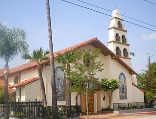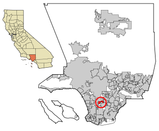
Northridge is a neighborhood in the San Fernando Valley region of the City of Los Angeles. The community is home to California State University, Northridge, and the Northridge Fashion Center.

Florence-Graham is a census-designated place in Los Angeles County, California. The population was 61,983 at the 2020 census, down from 63,387 at the 2010 census. The census area includes separate communities of Florence, Firestone Park, and Graham. It is located in the south central region of Los Angeles County. The neighboring communities are Central-Alameda, Florence, Green Meadows, Lynwood, Vernon, Walnut Park, Watts, and Compton.

San Fernando is a general-law city in the San Fernando Valley region of Los Angeles County, California, in the Los Angeles metropolitan area. It is an enclave in the City of Los Angeles. As of the 2020 census the population of San Fernando was 23,946.

West Athens is a census-designated place (CDP) in Los Angeles County, California. The population was 9,393 at the 2020 census. It is an unincorporated community within the 2nd Supervisorial District of Los Angeles County. West Athens is served by the Los Angeles County Sheriff's Department, operating out of the South Los Angeles Station. The approximate boundaries for West Athens are: 87th Street to the north, Vermont Avenue to the east, El Segundo Boulevard to the south, and approximately Western Avenue to Van Ness Avenue to the west. West Athens is predominantly residential, with commercial uses along its main corridors. Los Angeles Southwest Community College lies within the West Athens neighborhood and city limits.

Willowbrook, alternatively named Willow Brook, is an unincorporated community and census-designated place (CDP) in Los Angeles County, California. The population was 24,295 at the 2020 census, down from 35,983 at the 2010 census.

Mission Hills is a neighborhood in the City of Los Angeles, California, located in the San Fernando Valley.

Canoga Park is a neighborhood in the San Fernando Valley region of the City of Los Angeles, California. Before the Mexican–American War, the district was part of a rancho, and after the American victory it was converted into wheat farms and then subdivided, with part of it named Owensmouth as a town founded in 1912. It joined Los Angeles in 1917 and was renamed Canoga Park on March 1, 1931, after Canoga, New York.
The Santa Monica Mountains Conservancy is an agency of the state of California in the United States founded in 1980 and dedicated to the acquisition of land for preservation as open space, for wildlife and California native plants habitat Nature Preserves, and for public recreation activities.

The Simi Hills are a low rocky mountain range of the Transverse Ranges in eastern Ventura County and western Los Angeles County, of southern California, United States.

Castaic Dam is an embankment dam in northwestern Los Angeles County, California, in the unincorporated area of Castaic. Although located on Castaic Creek, a major tributary of the Santa Clara River, Castaic Creek provides little of its water. The lake is the terminus of the West Branch of the California Aqueduct, part of the State Water Project. The dam was built by the California Department of Water Resources and construction was completed in 1973. The lake has a capacity of 325,000 acre-feet (401,000,000 m3) and stores drinking water for the western portion of the Greater Los Angeles Area.

The Upper Las Virgenes Canyon Open Space Preserve is a large open space nature preserve owned and operated by the Santa Monica Mountains Conservancy spanning nearly 3,000 acres (1,200 ha) in the Simi Hills of western Los Angeles County and eastern Ventura County.
The United States Air Force's 614th Space Intelligence Squadron was a unit located at Vandenberg AFB, California. It was inactivated on 18 June 2007 when the 614th Space Operations Group was redesignated the 614 Air and Space Operations Center. The 614th Space Intelligence Squadron was formed on November 22, 2003 and assigned to Vandenberg Air Force Base. The purpose of this squadron was to defend navigation, weather, communications and missile warning satellites from enemy attacks in space and on the ground.

Founded in 1915, the Greater Los Angeles Area Council (GLAAC) (#033) served most of the City of Los Angeles as well as several other cities in the greater Los Angeles area. It was one of five Boy Scouts of America councils in Los Angeles County, California. Since its founding in 1915, the Los Angeles Area Council has brought its purpose and values to millions of youth. The Council served 54,567 youth in the Greater Los Angeles Area in 2008 alone.
Bell Canyon Park is a large open-space regional park located in the Simi Hills at the western end of the San Fernando Valley in West Hills, Los Angeles and Bell Canyon, California. Bell Creek, a primary tributary to the Los Angeles River, flows through the park with riparian zone vegetation along its natural banks. The geographic landmark Escorpión Peak is high above it to the south in adjacent El Escorpión Park.
Cheviot Hills is a neighborhood on the Westside of the city of Los Angeles, California.
Pueblo Del Rio is a public housing project located in the Central-Alameda neighborhood of South Los Angeles, California. The address of Pueblo Del Rio is 1801 East 53rd Street, which is near the intersection of 55th and Alameda streets.

The LA84 Foundation/John C. Argue Swim Stadium is an aquatics center that was originally constructed for the 1932 Summer Olympics in Los Angeles, California. Located near the Los Angeles Memorial Coliseum, the venue hosted the diving, swimming, water polo, and the swimming part of the modern pentathlon events.
The Department of Music at California State University is a conservatory in Los Angeles, California. There are more than 500 students pursuing undergraduate and graduate degrees in music.

Alliance Alice M. Baxter College-Ready High School is a public charter school located in San Pedro, California.

Paul Tzanetopoulos, is a Greek-American inter-media artist known for his work with digital, video, and electronic mediums. Moving to Los Angeles over 25 years ago, Tzanetopoulos has become a prominent figure in the city's art scene. He first gained attention in 1974 when he presented a video installation and computer-driven inter-media piece at the Ruth Schaffner Gallery in Los Angeles. Since then, his work has continued to focus on social and ecological issues, often incorporating interactive elements.


