McArthur Lake (Northwest Territories)

Last updated
McArthur Lake
Illustration of canoe building at Lake Clowey 1795.jpg
Illustration of canoe building at Lake Clowey (McArthur Lake), from Samuel Hearne's 1795 A Journey From Prince of Wales’s Fort in Hudson’s Bay to the Northern Ocean
Relief map of Canada.png
Red pog.svg
McArthur Lake
Location in Canada
Location Northwest Territories, Canada
Coordinates 61°34′02″N106°47′38″W / 61.567361°N 106.793764°W / 61.567361; -106.793764 Coordinates: 61°34′02″N106°47′38″W / 61.567361°N 106.793764°W / 61.567361; -106.793764
Basin  countriesCanada

McArthur Lake, formerly Clowey Lake, is a lake in the Northwest Territories, Canada. It is on the Taltson River to the east of Great Slave Lake, and is just south of the tree line. In the past it may have been a center for canoe building.

Northwest Territories Territory of Canada

The Northwest Territories is a federal territory of Canada. At a land area of approximately 1,144,000 km2 (442,000 sq mi) and a 2016 census population of 41,786, it is the second-largest and the most populous of the three territories in Northern Canada. Its estimated population as of 2019 is 44,826. Yellowknife became the territorial capital in 1967, following recommendations by the Carrothers Commission.

Taltson River river in Canada

The Taltson River is a roughly 500 km (310 mi) river in the Northwest Territories of Canada that drains into the Great Slave Lake. There are three hydroelectric power control structures on the river, and one power station.

Great Slave Lake Large lake in the Northwest Territories of Canada

The Great Slave Lake is the second-largest lake in the Northwest Territories of Canada, the deepest lake in North America at 614 metres, and the tenth-largest lake in the world. It is 469 km (291 mi) long and 20 to 203 km wide. It covers an area of 27,200 km2 (10,502 sq mi) in the southern part of the territory. Its given volume ranges from 1,070 km3 (260 cu mi) to 1,580 km3 (380 cu mi) and up to 2,088 km3 (501 cu mi) making it the 10th or 12th largest by volume.

Contents

Geography

McArthur Lake is about 250 kilometres (160 mi) north of Lake Athabasca and about 200 kilometres (120 mi) east of Great Slave Lake. [1] The lake is about 12 miles (19 km) long from east to west. The southern extension of the lake connects to Burpee Lake. [2] It lies just to the south of the tree line. [3] Annual average temperature is −8 °C (18 °F). The warmest month is July, when the average temperature is 16 °C (61 °F), and the coldest is December with −25 °C (−13 °F). [4] Campsites in the area typically have small groves of spruce and birch, and there are some jack pines. The lake is shallow, so a strong wind can whip up steep waves. Below the lake there is a series of complex rapids. [5]

Lake Athabasca lake in northern Alberta and Saskatchewan, Canada

Lake Athabasca is located in the northwest corner of Saskatchewan and the northeast corner of Alberta between 58° and 60° N. The lake is 26% in Alberta and 74% in Saskatchewan.

Spruce genus of plants

A spruce is a tree of the genus Picea, a genus of about 35 species of coniferous evergreen trees in the family Pinaceae, found in the northern temperate and boreal (taiga) regions of the Earth. Spruces are large trees, from about 20–60 m tall when mature, and have whorled branches and conical form. They can be distinguished from other members of the pine family by their needles (leaves), which are four-sided and attached singly to small persistent peg-like structures on the branches, and by their cones, which hang downwards after they are pollinated. The needles are shed when 4–10 years old, leaving the branches rough with the retained pegs. In other similar genera, the branches are fairly smooth.

Birch genus of plants

A birch is a thin-leaved deciduous hardwood tree of the genus Betula, in the family Betulaceae, which also includes alders, hazels, and hornbeams. It is closely related to the beech-oak family Fagaceae. The genus Betula contains 30 to 60 known taxa of which 11 are on the IUCN 2011 Red List of Threatened Species. They are a typically rather short-lived pioneer species widespread in the Northern Hemisphere, particularly in northern areas of temperate climates and in boreal climates.

History

McArthur Lake seems to be the lake that the explorer Samuel Hearne named "Clowey Lake". [3] The lake is within Chipewyan territory. [1] Hearne left Prince of Wales Fort on Hudson Bay on 7 December 1770 with a party of Chipewyan people, aiming to reach the Arctic Ocean by summer. He described Dene canoe building at Lake Clowey. [6] Based on Hearne's account, it seems possible that Slavey and Dogrib Dene people habitually gathered at the lake to build canoes. [1] It was given its present name on 6 June 1957 in honour of Warrant Officer Edwin Matthew McArthur, 405 Squadron of the Royal Canadian Air Force, who died in action during World War II on 1 September 1943. [7]

Samuel Hearne British explorer

Samuel Hearne was an English explorer, fur-trader, author, and naturalist. He was the first European to make an overland excursion across northern Canada to the Arctic Ocean, actually Coronation Gulf, via the Coppermine River. In 1774, Hearne built Cumberland House for the Hudson's Bay Company, its first interior trading post and the first permanent settlement in present Saskatchewan.

Chipewyan ethnic group

The Chipewyan are an aboriginal Dene ethnolinguistic group of the Athabaskan language family, whose ancestors are identified with the Taltheilei Shale archaeological tradition. They are part of the Northern Athabascan group of peoples, and come from what is now Western Canada.

Prince of Wales Fort fort

The Prince of Wales Fort is a historic Bastion fort on Hudson Bay across the Churchill River from Churchill, Manitoba, Canada.

River basin

The Taltson River basin has a subhumid, high boreal ecoclimate. Summers are typically cool and winters are very cold. It covers about 11,486 square kilometres (4,435 sq mi) upstream from Gray Lake, an arm of Nonacho Lake. The river rises near a series of lakes, including Coventry Lake and Dymond Lake in the northeast of the basin. It flows north to McArthur Lake, then west to Gray Lake. From there it flows to the southern shore of Great Slave Lake at the western end of the Simpson Island chain. [8]

Nonacho Lake Canadian lake

Nonacho Lake is the eighth largest lake in the Northwest Territories, Canada.

Geology

The McCann–McArthur Lake region is in the southwestern Rae Craton. [9] The lake lies in the McCann domain just southeast of the northeast-trending Penylan domain. [10]

Rae Craton An Archean craton in northern Canada north of the Superior Craton

The Rae Craton is an Archean craton located in northern Canada north of the Superior Craton.

Fish

A 2014 analysis of mercury in twenty specimens of lake trout found that 75% were over the commercial guideline and 100% over the frequent consumption guideline. Analysis of four specimens of lake whitefish found that all were within the guidelines. [11]

Lake trout Species of fish

Lake trout is a freshwater char living mainly in lakes in northern North America. Other names for it include mackinaw, namaycush,lake char (or charr), touladi, togue, and grey trout. In Lake Superior, it can also be variously known as siscowet, paperbelly and lean. The lake trout is prized both as a game fish and as a food fish. Those caught with dark coloration may be called mud hens.

Lake whitefish species of fish

The lake whitefish is a species of freshwater whitefish from North America. Lake whitefish are found throughout much of Canada and parts of the northern United States, including all of the Great Lakes. The lake whitefish is sometimes referred to as a "humpback" fish due to the small size of the head in relation to the length of the body. It is a valuable commercial fish, and also occasionally taken by sport fishermen. Smoked, refrigerated, vacuum-packed lake whitefish fillets are available in North American grocery stores. Other vernacular names used for this fish include Otsego bass, Sault whitefish, gizzard fish, common whitefish, eastern whitefish, Great Lakes whitefish, humpback whitefish, inland whitefish and whitefish.

Notes

    1. 1 2 3 Goldner 2016, p. 15.
    2. Fuller 1999, p. 262.
    3. 1 2 Fuller 1999, p. 261.
    4. Dataset Index – NEO.
    5. Morse 1987, p. 151.
    6. Goldner 2016, p. 13.
    7. A Place of Honour, p. 21.
    8. Taltson Hydroelectric Expansion Project, p. 9.3.1.
    9. Berman et al. 2013, p. 44.
    10. Percival et al. 2016, p. 7.
    11. MLT Aikins LLP 2017, p. 6.

    Sources

    Related Research Articles

    Tłı̨chǫ ethnic group

    The Tłı̨chǫ people, sometimes spelled Tlicho and also known as the Dogrib, are a Dene First Nations people of the Athabaskan-speaking ethnolinguistic group living in the Northwest Territories, Canada.

    Chipewyan language language spoken by the Chipewyan people of central Canada

    Chipewyan, ethnonym DënesųłinéIPA: [tènɛ̀sũ̀ɬìnɛ́], is the language spoken by the Chipewyan people of northwestern Canada. It is categorized as part of the Northern Athabaskan language family. Dënesųłiné has nearly 12,000 speakers in Canada, mostly in Saskatchewan, Alberta, Manitoba and the Northwest Territories. It has official status only in the Northwest Territories, alongside 8 other aboriginal languages: Cree, Dogrib, Gwich'in, Inuktitut, Inuinnaqtun, Inuvialuktun, North Slavey and South Slavey.

    The Dené people are an aboriginal group of First Nations who inhabit the northern boreal and Arctic regions of Canada. The Dené speak Northern Athabaskan languages. Dené is the common Athabaskan word for "people". The term "Dené" has two usages. More commonly, it is used narrowly to refer to the Athabaskan speakers of the Northwest Territories and Nunavut in Canada, especially including the Chipewyan (Denesuline), Tlicho (Dogrib), Yellowknives (T'atsaot'ine), Slavey, and Sahtu. But it is sometimes also used to refer to all Northern Athabaskan speakers, who are spread in a wide range all across Alaska and northern Canada. Note that Dené never includes the Pacific Coast Athabaskan or Southern Athabaskan speakers in the continental U.S., despite the fact that the term is used to denote the Athabaskan languages as a whole. The Southern Athabaskan speakers do, however, refer to themselves with similar words: Diné (Navajo) and Indé (Apache).

    Coppermine River River in Canada

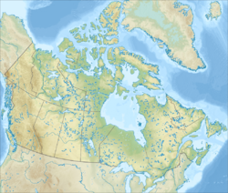
    The Coppermine River is a river in the North Slave and Kitikmeot regions of the Northwest Territories and Nunavut in Canada. It is 845 kilometres (525 mi) long. It rises in Lac de Gras, a small lake near Great Slave Lake, and flows generally north to Coronation Gulf, an arm of the Arctic Ocean. The river freezes in winter but may still flow under the ice.

    Yellowknives Aboriginal peoples of Canada

    The Yellowknives, Yellow Knives, Copper Indians, Red Knives or T'atsaot'ine are indigenous peoples of Canada, one of the five main groups of the First Nations Dene who live in the Northwest Territories of Canada. The name, which is also the source for the later community of Yellowknife, derives from the colour of the tools made from copper deposits.

    Colville Lake, Northwest Territories Settlement Corporation in Northwest Territories, Canada

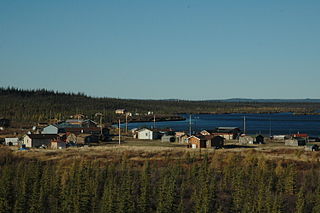
    Colville Lake is a settlement corporation located in the Sahtu Region of the Northwest Territories, Canada. The community is located 50 km (31 mi) north of the Arctic Circle, on a lake of the same name, and is northeast of Norman Wells. This settlement is the administrative office of the Behdzi Ahda band government.

    Behchokǫ̀ Tłı̨chǫ Community Government in Northwest Territories, Canada

    Behchokǫ̀, officially the Tłı̨chǫ Community Government of Behchokǫ̀, is a community in the North Slave Region of the Northwest Territories, Canada. Behchokǫ̀ is located on the Yellowknife Highway, on the northwest tip of Great Slave Lake, approximately 110 km (68 mi) northwest of Yellowknife.

    Łutselke First Nation - Designated Authority of Łutselkʼe in Northwest Territories, Canada

    Łutselkʼe, also spelt Łutsel Kʼe, is a "designated authority" in the North Slave Region of the Northwest Territories, Canada. The community is located on the south shore near the eastern end of Great Slave Lake and until 1 July 1992, it was known as Snowdrift, as the community lies near the mouth of the Snowdrift River.

    Slave Craton An Archaean craton in the north-western Canadian Shield, in Northwest Territories and Nunavut

    The Slave Craton is an Archaean craton in the north-western Canadian Shield, in Northwest Territories and Nunavut. The Slave Craton includes the 4.03 Ga-old Acasta Gneiss which is one of the oldest dated rocks on Earth. Covering about 300,000 km2 (120,000 sq mi), it is a relatively small but well-exposed craton dominated by ~2.73–2.63 Ga greenstones and turbidite sequences and ~2.72–2.58 Ga plutonic rocks, with large parts of the craton underlain by older gneiss and granitoid units. The Slave Craton is one of the blocks that compose the Precambrian core of North America, also known as the palaeocontinent Laurentia.

    Churchill Craton The northwest section of the Canadian Shield from southern Saskatchewan and Alberta to northern Nunavut

    The Churchill Craton is the northwest section of the Canadian Shield and stretches from southern Saskatchewan and Alberta to northern Nunavut. It has a very complex geological history punctuated by at least seven distinct regional tectonometamorphic intervals, including many discrete accretionary magmatic events. The Western Churchill province is the part of the Churchill Craton that is exposed north and west of the Hudson Bay. The Archean Western Churchill province contributes to the complicated and protracted tectonic history of the craton, and marks a major change in the behaviour of the Churchill Craton with many remnants of Archean supracrustal and granitoid rocks.

    The Bloody Falls massacre was an incident believed to have taken place during Hudson Bay Company employee Samuel Hearne's exploration of the Coppermine River for copper deposits near modern-day Kugluktuk, Nunavut, Canada on 17 July 1771. Hearne's original travelogue is now lost, and the narrative that became the famous story was published after Hearne's death with substantial editorializing.The narrative states that Chipewyan and "Copper Indian"Dene men led by Hearne's guide and companion Matonabbee attacked a group of Copper Inuit camped by rapids approximately 15 km (9.3 mi) upstream from the mouth of the Coppermine River.

    Taltson Magmatic Zone Archean to Proterozoic geologic belt in northern Canada

    The Taltson Magmatic Zone (TMZ) is a north-trending belt of Archean to Paleoproterozoic granitic basement gneiss, amphibolite supracrustal gneissic rock and Paleoproterozoic magmatic rocks in the Canadian Shield, extending from Northern Alberta to the southwestern Northwest Territories. The TMZ basement is 3.2–3.0 Ga and the Rutledge River supracrustal gneisses 2.13–2.09 Ga years old and were intruded by magmatic rocks around 1.99–1.92 Ga.

    Hearne Craton A craton in northern Canada which, together with the Rae Craton, forms the Western Churchill Province

    The Hearne Craton is a craton in northern Canada which, together with the Rae Craton, forms the Western Churchill Province. Hearne is one of the six Archaean cratons of the Canadian Shield that are bound together by Palaeoproterozoic orogenic belts. Before being merged these six cratons formed independent microcontinents.

    Snowbird Tectonic Zone

    The Snowbird Tectonic Zone (STZ) is a geological structure in the western Canadian Shield which forms a geophysical boundary between the Hearne Craton and the south-west arm of the Rae Craton. It is enigmatic and has been interpreted as a Proterozoic suture or escape structure, or an Archaean suture reactivated during either the Archaean or Palaeoproterozic. It stretches 2,800 km (1,700 mi) from the Canadian Cordillera north-east to Hudson Bay, diagonally crossing Alberta, Saskatchewan, the Northwest Territories, and Nunavut.

    The Thlewiaza River is a river in Canada. Although some sources define the river as originating out of Nueltin Lake, according to the Canadian Geographical Names Database the river begins at Snyder Lake in northwestern Manitoba. From there the river flows northeast through Kasmere Lake into the southwest end of Nueltin Lake. It exits Nueltin Lake at its northern end in Nunavut and flows 275 kilometres (171 mi) east through Edehon Lake and Ranger Seal Lake before emptying into Hudson Bay. Its drainage basin covers an area of 64,399.6 square kilometres (24,864.8 sq mi).