
St Ives is a village in the county of Dorset in the south of England. It lies close to the border between Dorset and Hampshire, near Ringwood, Verwood and Ferndown. The village is adjacent to St Leonards and Ashley Heath. The parish of St Leonards and St Ives has a population of 6,672 (2001); 41.6% are retired. The joint population including two electoral wards had risen to 6,859 at the 2011 Census.

Purbeck was a local government district in Dorset, England. The district was named after the Isle of Purbeck, a peninsula that forms a large proportion of the district's area. However, it extended significantly further north and west than the traditional boundary of the Isle of Purbeck which is the River Frome. The district council was based in the town of Wareham, which is itself north of the Frome.

The Forest of Bere is a mixed-use partially forested area in Hampshire immediately north of Fareham, Portsmouth and Roman Road, Havant and including a small part of the South Downs National Park.

Durlston Country Park is a 320-acre country park and nature reserve stretching along the coast of the Isle of Purbeck on the outskirts of Swanage in Dorset, England. The park is a popular destination for tourists to enjoy the walks, views, visitor centre, climbing, and wildlife, including Durlston Castle, the Great Globe, Tilly Whim Caves, and Anvil Point Lighthouse. It is a gateway to the Jurassic Coast World Heritage Site, forms part of the 630 mile South West Coast Path, and is owned by Dorset Council.

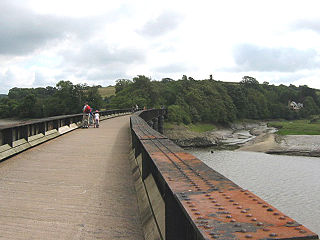
The Castleman Trailway is a footpath in Southern England. Portions of the trailway are also used as a cyclepath but the middle section from East Wimborne to the River Allen bridge is not cyclable.
The Tarka Trail is a series of footpaths and cyclepaths around north Devon, England that follow the route taken by the fictional Tarka the Otter in the book of that name. It covers a total of 180 miles (290 km) in a figure-of-eight route, centred on Barnstaple.

Combe Down Tunnel is on the now-closed Somerset and Dorset Joint Railway main line, between Midford and Bath Green Park railway station, below high ground and the southern suburbs of Bath, England, emerging below the southern slopes of Combe Down village.
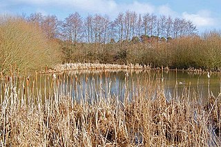
Ebblake Bog is a 11.3-hectare (28-acre) biological Site of Special Scientific Interest in Dorset and Hampshire, located west of Ringwood. It is part of Dorset Heathlands Ramsar site and Special Protection Area, and of Dorset Heaths Special Area of Conservation,

Fordingbridge was a railway station serving Fordingbridge, a small town in Hampshire. It was one of many casualties of the mass closure of British railway lines in the 1960s and 1970s. The line was officially closed on 4 May 1964, but as there was no Sunday service the last trains ran on the 2nd. It was served by the Salisbury and Dorset Junction Railway, a line running north–south, along the River Avon just to the west of the New Forest, connecting Salisbury to the North and Poole to the south, meeting the Southampton and Dorchester Railway at West Moors.

The Moors Valley Railway is a 7+1⁄4 in narrow gauge passenger railway, in the Moors Valley Country Park at Ashley Heath, Dorset, England near Ringwood in Hampshire. There are 20 steam engines and 2 diesel engines. The railway is fully signalled, with two signal boxes, one in a Great Western Railway style and one in a British Rail Southern Region style. The latter box also contains a mini lever frame and push button panel, for the control of the Lakeside area. The railway was constructed at its present location in 1985/86 and opened to the public in July 1986, after the closure in 1985 of its predecessor at Tucktonia in nearby Christchurch, which had run since 1979.
Tucktonia was a late 1970s theme park located on Stour Road, Christchurch, Dorset, England. It was officially opened on 23 May 1976 by Arthur Askey. It originally occupied 4 acres (1.6 ha) of the 21-acre (8.5 ha) Tuckton Park Leisure Complex. The park was closed down in 1986. The site has since been redeveloped for residential use.

The South Pennines is a region of moorland and hill country in northern England lying towards the southern end of the Pennines. In the west it includes the Rossendale Valley and the West Pennine Moors. It is bounded by the Greater Manchester conurbation in the west and the Bowland Fells and Yorkshire Dales to the north. To the east it is fringed by the towns of West Yorkshire whilst to the south it is bounded by the Peak District. The rural South Pennine Moors constitutes both a Site of Special Scientific Interest and Special Area of Conservation.

Breamore railway station was a railway station in the Avon Valley at the village of Breamore, Hampshire, England. The station was built for the Salisbury and Dorset Junction Railway and opened in 1866. It was served by trains between Salisbury in Wiltshire and West Moors in Hampshire. British Railways closed the station and the line on 2 May 1964.

Verwood railway station served the town of Verwood, Dorset, England from 1866 to 1964.
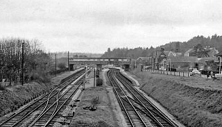
Broadstone was a railway station in the northern part of the Borough of Poole in the county of Dorset in England. It opened in 1872 under the name of New Poole Junction and closed to passengers in 1966. Between these dates there were several changes of name for a station which at its height provided a suburb of Poole with four substantial platforms and a goods yard. A prominent feature of the station was the large footbridge needed to span the four running lines.
National Cycle Network (NCN) Route 66 is a Sustrans National Route that runs from Kingston upon Hull to Manchester via Beverley, York and Leeds.

Turlin Moor is a suburb of Poole in Dorset, England, located between Hamworthy and Upton.

Stoney Down or Stony Down is both a hill and an area of forested countryside in the county of Dorset, England, that has been designated an "Area of Great Landscape Value" (AGLV) in the East Dorset Local Plan. The forest is known as the Stoney Down Plantation or Stony Down Plantation. It covers an area of 51.13 hectares. The area is popular with riders and walkers.

Tyersal Beck is a watercourse in West Yorkshire, England, named after the village of Tyersal in whose vicinity it runs.

