The Fosse Way was a Roman road built in Britain during the first and second centuries AD that linked Isca Dumnoniorum (Exeter) in the southwest and Lindum Colonia (Lincoln) to the northeast, via Lindinis (Ilchester), Aquae Sulis (Bath), Corinium (Cirencester), and Ratae Corieltauvorum (Leicester).

Icknield Street or Ryknild Street is a Roman road in England, with a route roughly south-west to north-east. It runs from the Fosse Way at Bourton on the Water in Gloucestershire to Templeborough in South Yorkshire. It passes through Alcester, Studley, Redditch, Metchley Fort, Birmingham, Sutton Coldfield, Lichfield, Burton upon Trent and Derby.

Hod Hill is a large hill fort in the Blackmore Vale, 3 miles (5 km) north-west of Blandford Forum, Dorset, England. The fort sits on a 143 m (469 ft) chalk hill of the same name that lies between the adjacent Dorset Downs and Cranborne Chase. The hill fort at Hambledon Hill is just to the north. The name probably comes from Old English "hod", meaning a shelter, though "hod" could also mean "hood", referring to the shape of the hill.

Housesteads Roman Fort is the remains of an auxiliary fort on Hadrian's Wall, at Housesteads, Northumberland, England, south of Broomlee Lough. The fort was built in stone around AD 124, soon after the construction of the wall began in AD 122 when the area was part of the Roman province of Britannia. Its name has been variously given as Vercovicium, Borcovicus, Borcovicium, and Velurtion. The 18th-century farmhouse Housesteads gives the modern name. The site is owned by the National Trust and is in the care of English Heritage. Finds can be seen at the site, in the museum at Chesters, and in the Great North Museum: Hancock in Newcastle upon Tyne.

Birdoswald Roman Fort was known as Banna in Roman times, reflecting the geography of the site on a triangular spur of land bounded by cliffs to the south and east commanding a broad meander of the River Irthing in Cumbria below.
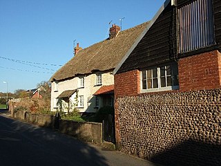
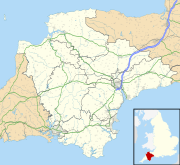
Woodbury is a village and civil parish in East Devon in the English county of Devon, 7 miles (11 km) south east of the city of Exeter. At the 2011 Census the village had a population of 1,605, and the parish had a population of 3,466. It lies on the east bank of the Exe Estuary, has borders – clockwise from the estuary – with the district of Exeter and then the parishes of Clyst St George, Clyst St Mary, Farringdon, Colaton Raleigh, Bicton and Lympstone. Woodbury is part of the electoral ward of Woodbury and Lympstone whose population at the 2011 Census was 5,260.
Kelly Rounds, or Castle Killibury is an Iron Age hill fort in Cornwall, England, United Kingdom. It is situated beside the A39 trunk road approximately two miles east of Wadebridge.

Poundbury Hill is the site of a scheduled Prehistoric and Roman archaeological remains and includes evidence of a Neolithic settlement, a substantial Bronze Age occupation site and an Iron Age hillfort. There are also late Iron Age burials and a section of Roman aqueduct. On the eastern side is an earlier Romano-British farmstead; and an extensive later cemetery, belonging to the Roman town Durnovaria.

Ravenglass Roman Bath House is a ruined ancient Roman bath house at Ravenglass, Cumbria, England. Belonging to a 2nd-century Roman fort and naval base, the bath house is described by Matthew Hyde in his update to the Pevsner Guide to Cumbria as "an astonishing survival". The still standing walls are 13 ft high, there are patches of the internal rendering, in dull red and white cement, and traces of the splayed window openings remain.
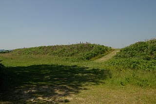
Waddon Hill is a hill and the site of an old Roman fort near Beaminster, in the English county of Dorset. The name Waddon is from the Old English meaning wheat hill.

Charterhouse was a town in the Roman province of Britannia. Its site is located just to the west of the village of Charterhouse-on-Mendip in the English county of Somerset.

The Caersws Roman Forts are two Roman military camps at Caersws, Powys in Mid Wales. They were garrisoned during the occupation of Great Britain between the 1st and 5th centuries when this part of Wales was part of the Roman province of Britannia Superior. A surviving section of Roman road lies to the west of the encampments.
The rectangular enclosure that defined this Roman fort was built in the 70s AD as part of the campaign to integrate southern Wales into the Roman province of Britannia Superior. It lay on a key road, now known as the Sarn Helen (RR69), from the legionary fortress of Isca Augusta (Caerleon) that ran north west across Wales to Bremia and on to North Wales. It also sat on a road running from Moridunum (Carmarthen) across to eastern Wales at Castell Collen. It thus held an important crossroads along with a bridging point over the River Towy, and the town that grew up near the fort retained its significance and became Llandovery.
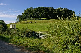
Boringdon Camp is an English Iron Age and Roman earthwork in Cann Woods, near Plympton, Plymouth, Devon. It is a scheduled ancient monument and owned by South Hams District Council.

Ambleston is a village, parish, and community in Pembrokeshire, Wales, lying seven miles (11 km) north-north-east of Haverfordwest. The parish includes the hamlets of Wallis and Woodstock.
Milecastle 18 (East Wallhouses) was a milecastle of the Roman Hadrian's Wall. It is located to the west of the settlement of East Wallhouses in Northumberland and is visible as a platform in the ground. The milecastle is of a unique construction, having a gateway associated with builders of the Legio II Augusta and a layout typical of the Legio VI Victrix or Legio XX Valeria Victrix. Historians have suggested that it may have been begun by men of one legion and finished by those of another. One of Milecastle 18's associated turrets shows evidence of being used as a workshop, possibly for the repair of shoes.

Milecastle 19 (Matfen Piers) was a milecastle of the Roman Hadrian's Wall. Sited just to the east of the hamlet of Matfen Piers, the milecastle is today covered by the B6318 Military Road. The milecastle is notable for the discovery of an altar by Eric Birley in the 1930s. An inscription on the altar is one of the few dedications to a mother goddess found in Roman Britain, and was made by members of the First Cohort of Varduli from northern Spain. The presence of the Vardulians at this milecastle has led to debate amongst archaeologists over the origins of troops used to garrison the wall. A smaller altar was found at one of the two associated turrets.

Milecastle 31 (Carrawburgh) was a milecastle of the Roman Hadrian's Wall. Its remains exist as a turf covered platform beside (and partially covered by) the B6318 Military Road, just to the east of Carrawburgh fort (adjoining the car park).
Whitley Castle (Epiacum) is a large, unusually shaped Roman fort north-west of the town of Alston, Cumbria, England. The castrum, which was first built by the Roman Army early in the 2nd century AD, was partly demolished and rebuilt around 200 AD. It appears to have been sited to protect lead mining in the area as well as to support the border defences of Hadrian's Wall.

Port Neville is a bay, port and locality on the north side of Johnstone Strait, south of Call Inlet, in the Central Coast region of British Columbia, Canada.