Krajina is a Slavic toponym, meaning 'frontier' or 'march'. The term is related with kraj or krai, originally meaning "edge" and today denoting a region or province, usually distant from the metropole.

Zagora is a village and a former municipality in Magnesia, Thessaly, Greece. Since the 2011 local government reform it is part of the municipality Zagora-Mouresi, of which it is the seat and a municipal unit. The municipal unit has an area of 96.101 km2.
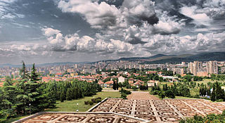
Stara Zagora is the sixth-largest city in Bulgaria, and the administrative capital of the homonymous Stara Zagora Province.

Sredna Gora is a mountain range in central Bulgaria, situated south of and parallel to the Balkan mountain range and extending from the Iskar River to the west and the elbow of Tundzha north of Yambol to the east. Sredna Gora is 285 km long, reaching 50 km at its greatest width. Its highest peak is Golyam Bogdan at 1,604 m (5,262 ft).

Nova Zagora is a town located in the southeastern plains of Bulgaria in Sliven Province. It is the administrative centre of Nova Zagora Municipality. As of December 2009, the town had a population of 23,625 inhabitants, while the entire municipality had a population of 45,111.

Chirpan is a town on the Tekirska River in Stara Zagora Province of south-central Bulgaria. It is the administrative centre of the homonymous Chirpan Municipality. As of December 2013, the town had a population of 15,109 down from 16,355 inhabitants in December 2009.

Mouresi is a village and a former municipality in Magnesia, Thessaly, Greece. It is situated in the northeastern part of the Pelion peninsula. Since the 2011 local government reform it is part of the municipality Zagora-Mouresi, of which it is a municipal unit. The municipal unit has an area of 54.214 km2. The seat of the municipality was in Tsagkarada. In 2011 the population of the village Mouresi was 485, that of the community Mouresi was 548, and of the municipal unit 2,475.
Shipka is a town in central Bulgaria, part of Kazanlak Municipality, Stara Zagora Province. It lies in the Central Balkan Mountains, at 42°42′N25°23′E, 650 metres above sea level. As of 2005, Shipka has a population of 1,398 and the mayor is Stoyan Ivanov.
Tsagkarada is a village and a community in the municipal unit of Mouresi in the eastern part of Magnesia, Greece. It was the seat of the former municipality Mouresi. It is situated at 408 m elevation, on the eastern slope of the forested Pelion mountains. Its population in 2011 was 525 for the village and 543 for the community which includes the village Mylopotamos. Tsagkarada is located 1.5 km southeast of Mouresi, 3 km north of Xorychti, 9 km southeast of Zagora and about 20 km east of the city of Volos.

Dalmatian Hinterland is the southern inland region of Croatia. The name zagora means "behind hills", which is a reference to the fact that it is the part of Dalmatia that is not coastal.

Maglizh is a town in Stara Zagora Province, South-central Bulgaria. It is the administrative centre of the homonymous Maglizh Municipality. As of December 2009, the town has a population of 3,426 inhabitants.
Zagore ; also Zagorie, Zagora, Zagoria) was a vaguely defined medieval region in what is now Bulgaria. Its name is of Slavic origin and means "beyond [i.e. south of] the [Balkan] mountains". The region was first mentioned as Ζαγόρια in Greek when it was ceded to the First Bulgarian Empire by the Byzantine Empire during the rule of Tervel of Bulgaria in the very beginning of the 8th century. From the context, Zagore can be defined as a region in northeastern Thrace.

Svilaja is a mountain range in Croatia, located in inland of Dalmatian Zagora.

Veliki Kozjak or just Kozjak is a mountain cliff in Croatia, located in inland of Dalmatian Zagora.

Kozjak, also known as Mali Kozjak or Primorski Kozjak is a mountain located above the town of Kaštela in Dalmatia, Croatia.
Kran is a town in central Bulgaria. It is located just south of the Balkan Mountains and is administratively part of Kazanlak Municipality, Stara Zagora Province. Kran was an important castle of the Second Bulgarian Empire in the 13th–14th century. Among the local sights are a conserved ancient Thracian tomb, a much older Thracian sanctuary and the ruins of the medieval fortress.
The 2012–13 Bulgarian Cup was the 31st official season of the Bulgarian annual football knockout tournament. The competition began on 13 October 2012 with the matches of the Preliminary Round and ended with the final on 15 May 2013. Ludogorets Razgrad were the defending champions, but were eliminated by CSKA Sofia in the second round. Beroe Stara Zagora won the title, their second overall, after defeating Levski Sofia in the final by penalties.

Starozagorski bani is a village and a mineral spring spa resort in central Bulgaria. It is located 15 km (9 mi) north-west of Stara Zagora, in the Sredna Gora mountain.