
Zambia, officially the Republic of Zambia, is a landlocked country at the crossroads of Central, Southern and East Africa. It is typically referred to being in South-Central Africa or Southern Africa. It is bordered to the north by the Democratic Republic of the Congo, Tanzania to the north-east, Malawi to the east, Mozambique to the southeast, Zimbabwe and Botswana to the south, Namibia to the southwest, and Angola to the west. The capital city of Zambia is Lusaka, located in the south-central part of Zambia. The population is concentrated mainly around Lusaka in the south and the Copperbelt Province to the north, the core economic hubs of the country.

Kitwe is the third largest city in terms of infrastructure development and second largest city in terms of size and population in Zambia. With a population of 517,543 Kitwe is one of the most developed commercial and industrial areas in the nation, alongside Ndola and Lusaka. It has a complex of mines on its north-western and western edges.

Livingstone is a city in Zambia. Until 1935, it served as the capital of Northern Rhodesia. Lying 10 km (6 mi) to the north of the Zambezi River, it is a tourism attraction center for the Victoria Falls and a border town with road and rail connections to Zimbabwe on the other side of the Victoria Falls. A historic British colonial city, its present population was enumerated at 177,393 inhabitants at the 2022 census. It is named after David Livingstone, the Scottish explorer and missionary who was the first European to explore the area. Until 2011, Livingstone was the provincial capital of Zambia's Southern Province.

Kabwe is the capital of the Zambian Central Province and the Kabwe District, with a population estimated at 202,914 at the 2010 census. Named Broken Hill until 1966, it was founded when lead and zinc deposits were discovered in 1902. Kabwe also has a claim to being the birthplace of Zambian politics as it was an important political centre during the colonial period.

Central Province is one of Zambia's ten provinces. The provincial capital is Kabwe, which is the home of the Mulungushi Rock of Authority. Central Province has an area of 94,394 km (58,654 mi). It borders eight other provinces and has eleven districts. The total area of forest in the province is 9,095,566 ha, and it has a national park and three game management areas. The first mine in the region was opened up in 1905 making the then Broken Hill town the first mining town. In 1966, the town's name was reverted to its indigenous name - Kabwe meaning 'ore' or 'smelting'.

The National Assembly is Zambia's unicameral legislative body. Between 1972 and 1990, Zambia was a one-party state with the United National Independence Party (UNIP) as the sole legal party.

The Mulungushi Dam located 50 kilometres (31 mi) southeast of Kabwe, Zambia, was constructed by the Broken Hill Development Company on the Mulungushi River and opened in 1925 by the Prince of Wales to provide hydroelectric power to the Broken Hill Mine in Kabwe. It is a sister facility to the Mita Hills Dam 60 km (37 mi) to its northeast. The Lunsemfwa Hydropower Company currently controls the power stations of both dams and the one at Lunsemfwa Falls.
This article gives lists of the National Monuments and other historic sites of Zambia, with a one- or two-line description providing links to details given on other pages.
The Kafue Flats are a vast area of swamp, open lagoon and seasonally inundated flood-plain on the Kafue River in the Southern, Central and Lusaka provinces of Zambia. They are a shallow flood plain 240 km (150 mi) long and about 50 km (31 mi) wide, flooded to a depth of less than a meter in the rainy season, and drying out to a clayey black soil in the dry season.
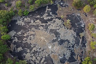
Mulungushi Rock of Authority, also known as Mulungushi Rock, is a kopje in the Central Province of Zambia associated with major political gatherings and speeches. Situated near the Mulungushi River north of Kabwe, it was first used in 1958 for a rally of the Zambian African National Congress and then in 1960 for the first conference of the newly-formed United National Independence Party. Since 1964, it has been regularly used by political parties for their annual conventions and meetings. A national symbol, the Rock of Authority is called "the birthplace of Zambian independence".
The following outline is provided as an overview of and topical guide to Zambia:
Zambia, officially known as the Republic of Zambia, is a landlocked country in Southern Africa. The neighbouring countries are the Democratic Republic of the Congo to the north, Tanzania to the north-east, Malawi to the east, Mozambique, Zimbabwe, Botswana, and Namibia to the south, and Angola to the west. The capital city is Lusaka, located in the southeast of the country. The population is concentrated mainly around the capital and the Copperbelt to the northwest.

Mulungushi University is one of the public universities of Zambia. Previously known as the National College of Management and Development Studies, it was turned into a university by the Zambian Government in a public-private partnership with Konkola Copper Mines in 2008. The university consists of three campuses: the Main Campus, or Great North Road Campus, located 26 kilometers North of Kabwe on the banks of the Mulungushi River; the Town Campus, located along Mubanga Road, off Munkoyo Street, near the center of Kabwe town; and the Livingstone Campus, located in Livingstone, which is home to the medical school. The university provides bachelor's degrees and master's degrees for full-time and distance education. In 2009, more than 500 distance education students enrolled. They were mainly former diploma students of the National College for Management and Development Studies.

Lusaka is the capital and largest city of Zambia. It is one of the fastest-developing cities in southern Africa. Lusaka is in the southern part of the central plateau at an elevation of about 1,279 metres (4,196 ft). As of 2019, the city's population was about 3.3 million, while the urban population is estimated at 2.5 million in 2018. Lusaka is the centre of both commerce and government in Zambia and connects to the country's four main highways heading north, south, east, and west. English is the official language of the city administration, while Bemba and Nyanja are the commonly spoken street languages.
Investrust Bank Plc., commonly known as Investrust Bank, is a commercial bank in Zambia. It is licensed by the Bank of Zambia, the central bank and national banking regulator.

Rufunsa District is a district in Zambia, located in Lusaka Province. The district capital is Rufunsa. The district was established by President Michael Sata in 2012 by splitting Chongwe District. It is estimated to have a population of about 45,000.
The Southern Africa Freedom Trail is a route running through Lusaka, Zambia that leads to a number of historic sites significant to the region's anti-colonial and anti-apartheid struggles.

Kwame Nkrumah University (KNU) is a public university in Zambia.

The T2 is a trunk road in Zambia. The road runs from the Tunduma border with Tanzania via Mpika, Kabwe and Lusaka to the Chirundu border with Zimbabwe. The road is the longest route of the country, as it is approximately 1,155 kilometres (718 mi). The route from Mpika to Kafue is a toll road. The route from Tanzania to Lusaka is Zambia's Great North Road and is part of the Tanzam Highway.

Chisamba District is a district of Central Province, Zambia. It covers a total surface area of 5,526 sq.km and is known for its agricultural activities with over 32,000 small scale farming families and 256 commercial farmers, the majority of whom are white Zambians. It shares borders with Lusaka, Chongwe, Chibombo, Kabwe, Kapiri Mposhi and Luano Districts. The District has a total population of 103,983 of which 51,955 are females and 52,028 are males.