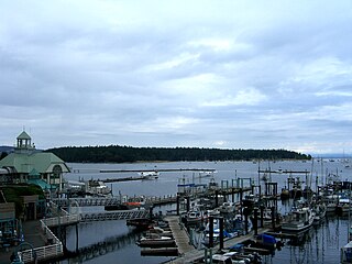
Nanaimo/Long Lake Water Airport | |||||||||||
|---|---|---|---|---|---|---|---|---|---|---|---|
| Summary | |||||||||||
| Airport type | Private | ||||||||||
| Operator | A. Laynard M. & L. Morrison | ||||||||||
| Location | Nanaimo | ||||||||||
| Time zone | PST (UTC−08:00) | ||||||||||
| • Summer (DST) | PDT (UTC−07:00) | ||||||||||
| Elevation AMSL | 390 ft / 119 m | ||||||||||
| Coordinates | 49°13′N124°01′W / 49.217°N 124.017°W Coordinates: 49°13′N124°01′W / 49.217°N 124.017°W | ||||||||||
| Map | |||||||||||
| Runways | |||||||||||
| |||||||||||
Source: Water Aerodrome Supplement [1] | |||||||||||
Nanaimo/Long Lake Water Airport( TC LID : CAT3) is located in the Wellington area of Nanaimo, British Columbia, Canada. It is classified as an airport by Nav Canada and is subject to regular inspections by Transport Canada. [1]


