National Road network (Netherlands)

Last updated

Nationale Wegen (National Highways) or simply N-wegen (N-roads), was a numbering system for a set of main highway routes in the Netherlands, used from 1957 through 1976.

Netherlands Constituent country of the Kingdom of the Netherlands in Europe

The Netherlands is a country located mainly in Northwestern Europe. The European portion of the Netherlands consists of twelve separate provinces that border Germany to the east, Belgium to the south, and the North Sea to the northwest, with maritime borders in the North Sea with Belgium, Germany and the United Kingdom. Together with three island territories in the Caribbean Sea—Bonaire, Sint Eustatius and Saba— it forms a constituent country of the Kingdom of the Netherlands. The official language is Dutch, but a secondary official language in the province of Friesland is West Frisian.

Contents

In 1957, signposted road numbering was introduced in the Netherlands and the governments Rijkswegen plan foresaw in an increasing number of highways, together forming a nationwide system. Alongside the pan-European E-road numbers, which were given to routes of international importance, a complementing series of N-road numbers was devised to designate those routes not included in the European system, but considered of national significance. [1]

A routenumber is an identifying numeric designation assigned by a highway authority to a particular stretch of roadway to distinguish it from other routes and, in many cases, also to indicate its classification, general geographical location and/or orientation. The numbers chosen may be used solely for internal administrative purposes; however, in most cases they are also displayed on roadside signage and indicated on maps.

International E-road network numbering system for roads in Europe

The international E-road network is a numbering system for roads in Europe developed by the United Nations Economic Commission for Europe (UNECE). The network is numbered from E 1 up and its roads cross national borders. It also reaches Central Asian countries like Kyrgyzstan, since they are members of the UNECE.

In 1976, the until then administrative only Rijksweg numbers were adopted as the new road denominations, along with a completely new series of N-numbers for Non motorway highways, in 1978. The original brown N-numbers on road-signs were since then replaced with red A-numbers, for Dutch motorways, and new yellow N-numbers for other highways.
The E-road system was significantly renumbered in 1985, but remains signposted everywhere in the Netherlands. [2]

For this road system the numbers 89 to 100 were used. This is because the numbers leading up to 85 were used for the original Rijksstraatwegen and later the modern rijkswegen count.
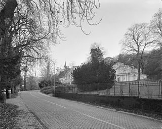
Rijksstraatweg

Rijksstraatweg or simply Straatweg was the term for paved roads of interregional significance in the Netherlands in the 19th and early 20th centuries. These roads were built by the national government, and formed the country's first centrally planned highway network. They received route numbers, eventually resulting in a nationwide network of 82 highways. It formed the basis for today's system of nationally controlled roads, the Netherlands' main highway grid.
Original N-highway routes [3]

N89"The Wadden Sea Route", length: 200 km
Amsterdam - Delfzijl (via Alkmaar, Leeuwarden and Groningen)

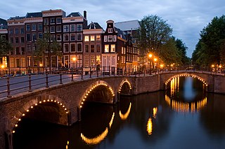
Amsterdam Capital city of the Netherlands and municipality

Amsterdam is the capital city and most populous municipality of the Netherlands. Its status as the capital is mandated by the Constitution of the Netherlands, although it is not the seat of the government, which is The Hague. Amsterdam has a population of 854,047 within the city proper, 1,357,675 in the urban area and 2,410,960 in the metropolitan area. The city is located in the province of North Holland in the west of the country but is not its capital, which is Haarlem. The Amsterdam metropolitan area comprises much of the northern part of the Randstad, one of the larger conurbations in Europe, which has a population of approximately 8.1 million.

Delfzijl City and municipality in Groningen, Netherlands

Delfzijl is a city and municipality with a population of 25,651 in the province of Groningen in the northeast of the Netherlands. Delfzijl was a sluice between the Delf and the Ems, which became fortified settlement in the 16th century. The fortifications were removed in the late 19th century. Delfzijl is the fifth largest seaport in the Netherlands, and the largest port in the North East of the country.

Alkmaar City and municipality in North Holland, Netherlands

Alkmaar[ˈɑl(ə)kmaːr](listen) is a city and municipality in the Netherlands, located in the province of North Holland. Alkmaar is well known for its traditional cheese market. For tourists, it is a popular cultural destination.

N90"The Frisia Route", length: 130 km
Leeuwarden - Almelo (via Heerenveen and Zwolle)

Leeuwarden City and municipality in Friesland, Netherlands

Leeuwarden, Stadsfries: Liwwadden) is a city and municipality in Friesland in the Netherlands. It is the provincial capital and seat of the States of Friesland. The municipality has a population of 122,293.

Almelo City and municipality in Overijssel, Netherlands

Almelo is a municipality and a city in the eastern Netherlands. The main population centres in the town are Aadorp, Almelo, Mariaparochie, and Bornerbroek.

Heerenveen Place in Friesland, Netherlands

Heerenveen is a town and municipality in the province of Friesland (Fryslan), in the north of the Netherlands. The town has gained international prominence in speed skating, for it has the fastest lowland speed skating rink in the world.

N91"The Zuyderzee Route", length: 145 km
Joure - Utrecht (via Lelystad and Hilversum)

N92"The Lower Saxony Route", length: 185 km
Eemshaven - Enschede (via Emmen and Hardenberg)

N93 "The Veluwe Route", length: 180 km
Emmeloord - Tilburg (via Apeldoorn, Arnhem, Nijmegen and 's-Hertogenbosch)

N94"The Central Route", length: 220 km
Hoorn - Valkenswaard (via Lelystad, Ede, Oss and Eindhoven)

N95"The Upper Meuse Route", length: 140 km
Nijmegen - Maastricht (via Venlo and Heerlen)

N96"The Rhine Route", 110 km
Maasvlakte - Enschede (two sections, separated by E31 )

N97"The Lower Meuse Route", length: 135 km
Renesse - 's-Hertogenbosch (via Zierikzee, Steenbergen and Moerdijk)

N98"The Delta Works Route", length: 160 km
Europoort - Sas van Gent (via Renesse and Flushing)

N99"The North Sea Route", length: 235 km
Wieringen - Antwerp (via Amsterdam, The Hague, Rotterdam and Bergen op Zoom)

N100"The IJ Route", length: 55 km (incomplete)[ citation needed ]
Greater beltway around Amsterdam

See also

Related Research Articles

Transport in the Netherlands

The Netherlands is both a very densely populated and a highly developed country, in which transport is a key factor of the economy. Correspondingly it has a very dense and modern infrastructure, facilitating transport with road, rail, air and water networks. In its Global Competitiveness Report for 2014-2015, the World Economic Forum ranked the Dutch transport infrastructure fourth in the world.

Zwolle City and municipality in Overijssel, Netherlands

Zwolle is a city and municipality in the northeastern Netherlands serving as Overijssel's capital. With a population of 125,806, it is the second-largest municipality of the province after Enschede.

Amsterdam Zuid station railway station in the Dutch city of Amsterdam

Amsterdam Zuid is a railway station situated in the borough of Amsterdam-Zuid in Amsterdam, Netherlands. For a number of years, it was named Amsterdam Zuid WTC, in reference to the neighbouring World Trade Center Amsterdam. During 2006, in conjunction with the rapid development of the area surrounding the station, the station was enlarged and the reference to the WTC was formally dropped from the name.

Directorate-General for Public Works and Water Management government agency

The Directorate-General for Public Works and Water Management, founded in 1798 as the Bureau voor den Waterstaat, is part of the Ministry of Infrastructure and Water Management of the Netherlands, the former Ministry of Transport, Public Works and Water Management. Its role is the practical execution of the public works and water management, including the construction and maintenance of waterways and roads, and flood protection and prevention. The agency was also involved in the construction of big railway projects such as the Betuweroute and the HSL-Zuid.

A2 motorway (Netherlands) highway in the Netherlands

The A2 motorway is a motorway in the Netherlands. It is one of the busiest highways in the Netherlands. The road connects the city of Amsterdam, near the Amstel interchange with the Belgian border, near Maastricht (NL) and Liège (B), and the Belgian A25 road.

Zwolle railway station railway station in the Dutch city of Zwolle

Zwolle is the main railway station of Zwolle, Netherlands. The station opened on 6 June 1864 and is on the Utrecht–Kampen railway, also known as the Centraalspoorweg, the Zwolle–Almelo railway, the Arnhem–Leeuwarden railway, the Zwolle–Stadskanaal railway and the Lelystad–Zwolle railway, also known as the Hanzelijn.

European route E232 road in Europe

The E 232 is a European B class road in the Netherlands, connecting the cities of Amersfoort and Groningen.

European route E311 road in Europe

E 311 is a European B class road in Netherlands, connecting the cities of Utrecht and Breda.

National Road 93 or simply N93, was a highway route in the Netherlands from 1957 through 1985. It formed part of the Dutch National highway network and connected Tilburg (E312) with Emmeloord (N91). A stretch of road between Tilburg and the Belgian border was also part of the initial route.

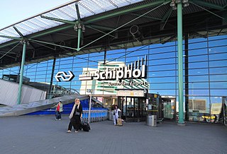
Schiphol Airport railway station railway station

Schiphol Airport railway station is a major passenger railway station in Haarlemmermeer, Netherlands. It is located directly beneath the terminal complex of Amsterdam Airport Schiphol and is operated by the Nederlandse Spoorwegen. The station's six platforms are accessible via twelve escalators and three elevators located in the main concourse of the airport. The original station was opened in 1978, and the current station was opened in 1995. It connects the airport to Amsterdam and to various other cities in the Netherlands, as well as to Belgium and France.

Road transport in the Netherlands

With 139,000 km of public roads, the Netherlands has one of the most dense road networks in the world – much denser than Germany and France, but still not as dense as Belgium. In 2013, 5,191 km were national roads, 7,778 km were provincial roads, and 125,230 km were municipality and other roads.
Dutch roads include 3,530 km of motorways and expressways, and with a motorway density of 64 kilometres per 1,000 km2, the country also has one of the densest motorway networks in the world. In Dutch a motorway is called "autosnelweg" or simply "snelweg"; other expressways are just called "autoweg". According to a 2004 estimate, some 12,500 km of road remain as yet unpaved.

Roads in the Netherlands

With 139,000 km of public roads, the Netherlands has one of the most dense road networks in the world – much denser than Germany and France, but still not as dense as Belgium. Dutch roads include at least 3,530 km of motorways and expressways, and with a motorway density of 64 kilometres per 1,000 km², the country also has one of the densest motorway networks in the world.
The Netherlands' main highway net (hoofdwegennet), comparable to Britains net of trunk roads, consists of most of its 5,200 km of national roads, supplemented with the most prominent provincial roads. Although only about 2,500 km of roads are fully constructed to motorway standards, much of the remainder are also expressways for fast motor vehicles only.

References

  1. Elsevier Atlas van Nederland, België en Luxemburg, samengesteld door de Winkler Prins redactie, Amsterdam/Brussel 1960.
  2. De Grote Shell Atlas: Benelux en Europa. Editie 1979.
  3. Shell Stratenboek van Nederland. Editie 55 (2008); the sections shared with E-roads have not been counted toward the total length of the N-roads.