
The Appalachian Trail, also called the A.T., is a hiking trail in the Eastern United States, extending almost 2,200 miles (3,540 km) between Springer Mountain in Georgia and Mount Katahdin in Maine, and passing through 14 states. The Appalachian Trail Conservancy claims the Appalachian Trail to be the longest hiking-only trail in the world. More than three million people hike segments of the trail each year.

Hiking is a long, vigorous walk, usually on trails or footpaths in the countryside. Walking for pleasure developed in Europe during the eighteenth century. Religious pilgrimages have existed much longer but they involve walking long distances for a spiritual purpose associated with specific religions.
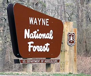
The Wayne National Forest is located in the south-eastern part of the US state of Ohio, in the Unglaciated Allegheny Plateau. It is the only national forest in Ohio. Forest headquarters are located between The Plains and Nelsonville, Ohio, on US Route 33 overlooking the Hocking River.
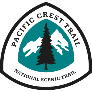
The Pacific Crest Trail (PCT), officially designated as the Pacific Crest National Scenic Trail, is a long-distance hiking and equestrian trail closely aligned with the highest portion of the Cascade and Sierra Nevada mountain ranges, which lie 100 to 150 miles east of the U.S. Pacific coast. The trail's southern terminus is next to the Mexico–United States border, just south of Campo, California, and its northern terminus is on the Canada–US border, upon which it continues unofficially to the Windy Joe Trail within Manning Park in British Columbia; it passes through the states of California, Oregon, and Washington.

The North Country Trail is a long-distance hiking trail in the Midwestern and Northeastern United States. The trail extends roughly 4,800 miles (7,700 km) from Lake Sakakawea State Park in North Dakota to the Appalachian Trail in Green Mountain National Forest in Vermont, passing through eight states along its route. As of 2023, most of the trail is in place, though about one-third of the distance consists of road walking; those segments are frequently evaluated for transfer to off-road segments on nearby public or private lands.

The Hoosier National Forest is a property managed by the United States Forest Service in the hills of southern Indiana. Composed of four separate sections, it has a total area of 202,814 acres. Hoosier National Forest's headquarters are located in Bedford, with a regional office in Tell City. Prominent places within the Forest include the Lick Creek Settlement, Potts Creek Rockshelter Archeological Site, and Jacob Rickenbaugh House.

Burr Oak State Park is a public recreation area located four miles (6.4 km) northeast of Glouster in the U.S. state of Ohio. The park sits mostly in Morgan County, with part extending into Athens County.

The American Discovery Trail is a system of recreational trails and roads that collectively form a coast-to-coast hiking and biking trail across the mid-tier of the United States. Horses can also be ridden on most of this trail. The coastal trailheads are the Delmarva Peninsula on the Atlantic Ocean and the northern California coast on the Pacific Ocean. The trail has northern and southern alternates for part of its distance, passing through Chicago and St. Louis respectively. The total length of the trail, including both the north and south routes, is 6,800 miles (10,900 km). The northern route covers 4,834 miles (7,780 km) with the southern route covering 5,057 miles (8,138 km). It is the only non-motorized coast-to-coast trail.

The Chesapeake and Ohio Canal National Historical Park is located in the District of Columbia and the state of Maryland. The park was established in 1961 as a National Monument by President Dwight D. Eisenhower to preserve the neglected remains of the Chesapeake and Ohio Canal and many of its original structures.
The Potomac Heritage Trail, also known as the Potomac Heritage National Scenic Trail or the PHT, is a designated National Scenic Trail corridor spanning parts of the mid-Atlantic region of the United States that will connect various trails and historic sites in Virginia, Maryland, Pennsylvania, and the District of Columbia. The trail network includes 710 miles (1,140 km) of existing and planned sections, tracing the natural, historical, and cultural features of the Potomac River corridor, the upper Ohio River watershed in Pennsylvania and western Maryland, and a portion of the Rappahannock River watershed in Virginia. The trail is managed by the National Park Service and is one of three National Trails that are official NPS units.

Emma Rowena (Caldwell) Gatewood, known as Grandma Gatewood,, was an American ultra-light hiking pioneer. After a difficult life as a farm wife, mother of eleven children, and survivor of domestic violence, she became famous as the first solo female thru-hiker of the 2,168-mile (3,489 km) Appalachian Trail (A.T.) in 1955 at the age of 67. She subsequently became the first person to hike the A.T. three times, after completing a second thru-hike two years later, followed by a section-hike in 1964. In the meantime, she hiked 2,000 miles (3,200 km) of the Oregon Trail in 1959. In her later years, she continued to travel and hike, and worked on a section of what would become the Buckeye Trail. The media coverage surrounding her feats was credited for generating interest in maintaining the A.T. and in hiking generally. Among many other honors, she was posthumously inducted into the Appalachian Trail Hall of Fame in 2012.

The Lewis and Clark National Historic Trail is a route across the United States commemorating the Lewis and Clark Expedition of 1804 to 1806. It is part of the National Trails System of the United States. It extends for some 4,900 miles (7,900 km) from Pittsburgh, Pennsylvania, to the mouth of the Columbia River in Oregon.

The Greenbrier River Trail (GRT), is a lineal state park comprising a 77.1-mile (124.1 km) rail trail between North Caldwell and Cass in eastern West Virginia, United States.

Nelson-Kennedy Ledges State Park is a 167-acre (68 ha) public recreation area offering trails and picnicking located in Nelson Township, Portage County, Ohio, United States. Within the park are angled rock formations 50 to 60 feet (18 m) high with ground fissures as deep as 60 feet (18 m). It is accessible from U.S. Route 422 and State Route 305 via State Route 282.
The ... rock formations at the Nelson-Kennedy Ledges have become trademarks of the park.... The ... sandstone cliff formations resulted from the forces of erosion—wind, water freezing and thawing—that wore away at the softer rock layers. As these soft layers eroded, large blocks of rock called slump blocks fell away leaving more resistant layers to form ledges above.

Mohican State Park is a 1,110-acre (450 ha) public recreation area located on the south shore of Pleasant Hill Lake, five miles (8.0 km) south of Loudonville in Ashland County, Ohio, United States. The state park is located along Ohio SR 3 and Ohio SR 97 and is surrounded by the 4,525-acre (1,831 ha) Mohican-Memorial State Forest. The Clear Fork of the Mohican River flows through the park carving a narrow gorge and joins the Black Fork about a half-mile east of the park to form the Mohican River. The park is open for year-round recreation including camping, hiking, boating, mountain biking, fishing, and picnicking.

The Ohio River Trail is composed of two trails: The Ohio Water Trail and the Ohio River Greenway Trail. The Ohio River Greenway Trail (ORGT) is a proposed route that would interconnect existing trails in Maryland, Pennsylvania, Ohio and West Virginia. The proposal is spearheaded by the Ohio River Trail Council (ORTC), a volunteer-led, non-profit organization. The ORTC is an Internal Revenue Service registered 501(c)(3) not-for-profit organization which relies on corporate, foundation, government, and private grants and donations to achieve its stated mission of creating a multi-use trail along the Ohio River and its tributaries. The Council is headquartered in Monaca, Pennsylvania.

Mount Rosa is a mountain summit of the Pikes Peak Massif in the southern Front Range of the Rocky Mountains of North America. The 11,504-foot (3,506 m) peak is located in Pike National Forest, 12.8 miles (20.6 km) southwest by west of downtown Colorado Springs in Teller County, Colorado, United States.
Buzzard Roost may refer to:

The Anthracite Range is a mountain range in the West Elk Mountains, a sub-range of the Rocky Mountains of North America. The range is located in Gunnison County of western Colorado and lies within the West Elk Wilderness of the Gunnison National Forest. The Anthracite Range is one of several prominent laccoliths found in the West Elk Mountains.