Nebraska Highway 21

Last updated

N-21.svg

Nebraska Highway 21

Nebraska Highway 21 map.png

Nebraska Highway 21 highlighted in red
Route information
Maintained by NDOT
Length 73.37 mi [1] (118.08 km)
Existed 1925 – present
Major junctions
South endN-23.svg N-23 near Eustis
 I-80.svg I-80 south of Cozad
US 30.svg US 30 in Cozad
North endN-2.svgN-92.svg N-2 / N-92 in Broken Bow
Location
Counties Frontier, Dawson, Custer
Highway system
US 20.svg US 20 N-22 N-22.svg

Nebraska Highway 21 is a highway in central Nebraska. Its southern terminus is at Nebraska Highway 23 east of Eustis. Its northern terminus is at an intersection with Nebraska Highway 2 and Nebraska Highway 92 in Broken Bow.

Nebraska State of the United States of America

Nebraska is a state that lies in both the Great Plains and the Midwestern United States. It is bordered by South Dakota to the north; Iowa to the east and Missouri to the southeast, both across the Missouri River; Kansas to the south; Colorado to the southwest; and Wyoming to the west. It is the only triply landlocked U.S. state.

Nebraska Highway 23 highway in Nebraska

Nebraska Highway 23 is a highway in southwestern Nebraska. Its western terminus is on the Colorado border at Venango, where the highway continues west as Colorado State Highway 23. Its eastern terminus is at Holdrege at an intersection with U.S. Highway 6 and U.S. Highway 34.

Eustis, Nebraska Village in Nebraska, United States

Eustis is a village in Frontier County, Nebraska, United States. The population was 401 at the 2010 census.

Contents

Route description

Nebraska Highway 21 begins a mile east of Eustis at an intersection with Nebraska Highway 23. It goes north through farmland and meets Interstate 80 shortly before Cozad. In Cozad, it meets U.S. Highway 30 and goes on a 13-mile (21 km) concurrency eastward to Lexington. At Lexington, it turns north into rural prairie areas and meets Nebraska Highway 40 in Oconto. After passing Oconto, it turns north-northeasterly and ends in Broken Bow when it meets Nebraska Highway 2 and Nebraska Highway 92. [1] [2]

Interstate 80 Interstate from California to New Jersey

Interstate 80 (I-80) is an east–west transcontinental freeway in the United States that runs from downtown San Francisco, California, to Teaneck, New Jersey, in the New York City Metropolitan Area. The highway was designated in 1956 as one of the original routes of the Interstate Highway System. Its final segment was opened to traffic in 1986. It is the second-longest Interstate Highway in the United States, following I-90. The Interstate runs through many major cities including Oakland, Sacramento, Reno, Salt Lake City, Omaha, Des Moines, and Toledo, and passes within 10 miles (16 km) of Chicago, Cleveland, and New York City.

Cozad, Nebraska City in Nebraska, United States

Cozad is a city in Dawson County, Nebraska, United States. The population was 3,977 at the 2010 census. The town is on the Great Plains of central Nebraska, along the Union Pacific Railroad and U.S. Highway 30, just north of the Platte River. The 100th meridian, which roughly marks the eastward boundary of the arid plains, passes just west of the town as is marked nearby on a prominent sign across U.S. Highway 30. In the early 1860s, it was a stop along the Pony Express.

Lexington, Nebraska City in Nebraska, United States

Lexington is a city in Dawson County, Nebraska, United States. The population was 10,230 at the 2010 census. It is the county seat of Dawson County. Lexington is located in southern Nebraska, on the Platte River, southeast of North Platte. It sits along the route of U.S. Route 30 and the Union Pacific Railroad. In the 1860s it was the location of a stop along the Pony Express.

History

The original version of Nebraska Highway 21 went south from Lexington and turned east to go through Beaver City and Alma. In the 1940s, U.S. Highway 283 was created and took over the segment of the highway south of Lexington, with the Beaver City-Alma segment becoming Nebraska Highway 89. In 1960, the current route was completed, as the Cozad-Eustis segment was completed, and the highway extended along US 30. [3]

Beaver City, Nebraska City in Nebraska, United States

Beaver City is a city in Furnas County, Nebraska, United States. The population was 609 at the 2010 census. It is the county seat of Furnas County.

Alma, Nebraska City in Nebraska, United States

Alma is a city in Harlan County, Nebraska, United States. The population was 1,133 at the 2010 census. It is the county seat of Harlan County.

Nebraska Highway 89 highway in Nebraska

Nebraska Highway 89 is a highway in southern Nebraska. Its western terminus is at U.S. Highway 83 west of Danbury. Its eastern terminus is at an intersection with U.S. Highway 183 south of Alma.

Major intersections

CountyLocationmi [1] kmDestinationsNotes
Frontier 0.000.00N-23.svg N-23  Elwood, Eustis Southern terminus
Dawson Cozad 12.6920.42I-80.svg I-80  Kearney, North Platte Exit 222 on I-80
14.0522.61US 30.svg US 30 west (Lincoln Highway) Gothenburg, North Platte Southern end of US-30 concurrency
22.2835.86N LINK 24A.svg L-24A south
Lexington 27.5144.27US 30.svg US 30 east (West Pacific Avenue) Overton, Kearney Northern end of US-30 concurrency
Custer Oconto 52.4684.43N-40.svg N-40  Eddyville, Callaway
Broken Bow 73.37118.08N-2.svgN-92.svg N-2 / N-92 (South E Street) Berwyn, Merna Northern terminus
1.000 mi = 1.609 km; 1.000 km = 0.621 mi

Related Research Articles

U.S. Route 275 (US 275) is a north–south United States highway. It is a branch of US 75, originally terminating at that route in Council Bluffs, Iowa. The highway's northern terminus is in O'Neill, Nebraska, at an intersection with U.S. Highway 20 and U.S. Highway 281. Its southern terminus is near Rock Port, Missouri, at an intersection with U.S. Highway 136.

Nebraska Highway 31 highway in Nebraska

Nebraska Highway 31 is a highway in Nebraska. The southern terminus is near Louisville at an intersection with Nebraska Highway 50. The northern terminus is near Kennard at an intersection with U.S. Highway 30. The highway serves as a main north–south highway in the western portion of the Omaha Metro Area.

Nebraska Highway 13 highway in Nebraska

Nebraska Highway 13 is a highway in the northeastern part of the U.S. state of Nebraska that runs predominantly northwest-southeast with a south terminus east of Hadar at an intersection with U.S. Highway 81 and a north terminus two miles (3 km) south of Center, Nebraska at an intersection with Nebraska Highway 84.

Nebraska Highway 4 highway in Nebraska

Nebraska Highway 4 is a highway in Nebraska. The entirety of the route is in Nebraska's southern tier of counties. Beatrice is the only city with over 1,000 in population on the highway. Its western terminus is at an intersection with US 6 and US 34 southwest of Atlanta. Its eastern terminus is at an intersection with US 75 north of Dawson.

Nebraska Highway 67 highway in Nebraska

Nebraska Highway 67 is a highway in southeastern Nebraska. Its southern terminus is at an intersection with U.S. Highway 73 near Verdon. Its northern terminus is at an intersection with U.S. Highway 34 near Nehawka. The segment between Nebraska Highway 2 and US 34 is one of four segments of road in the Nebraska highway system which is gravel.

Nebraska Highway 9 highway in Nebraska

Nebraska Highway 9 is a highway in northeastern Nebraska. The southern terminus is located just north of West Point at an intersection with U.S. Highway 275. Its northern terminus is at an intersection with Nebraska Highway 12 just south of Ponca.

Nebraska Highway 10 highway in Nebraska

Nebraska Highway 10 is a highway in Nebraska. Its southern terminus is at the Kansas border south of Franklin. Its northern terminus is at an intersection with Nebraska Highway 58, Nebraska Highway 92, and Recreation Road 82B in Loup City.

Nebraska Highway 109 highway in Nebraska

Nebraska Highway 109 is a highway in eastern Nebraska. Its southern terminus is at U.S. Highway 77 and Nebraska Highway 92 at Wahoo, Nebraska. Its northern terminus is at U.S. Highway 77 near Fremont, Nebraska.

Nebraska Highway 25 highway in Nebraska

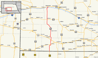
Nebraska Highway 25 is a highway in southwestern Nebraska. It runs for 87 miles (140 km). Its southern terminus is at the Kansas border south of Trenton. Its northern terminus is at U.S. Highway 30 in Sutherland.

Nebraska Highway 27 highway in Nebraska

Nebraska Highway 27 is a highway in Nebraska. It is divided into three segments. The southernmost segment begins at the Kansas border and goes north to Haigler. The middle segment begins at Interstate 80 near Chappell and goes north to Oshkosh. The northernmost segment begins at Ellsworth and goes north to the South Dakota border.

U.S. Route 26 in Nebraska highway in Nebraska

U.S. Highway 26 (US‑26) is an east–west highway in western Nebraska. It enters the state from Wyoming just west of Henry. The eastern terminus of US‑26 is in Ogallala at an interchange with Interstate 80 (Nebraska) (I-80). The highway largely parallels the North Platte River for the majority of its route in Nebraska and as such, runs at a northwest-southeast angle. The highway also parallels the original paths of the Oregon Trail, the California Trail and the Mormon Pioneer Trail.

Nebraska Highway 39 highway in Nebraska

Nebraska Highway 39 is a highway in central Nebraska. It runs for a length of 42.05 miles (67.67 km). It has a southern terminus west of Osceola at an intersection with Nebraska Highway 92. Its northern terminus is at an intersection with Nebraska Highway 14 southeast of Albion.

Nebraska Highway 40 highway in Nebraska

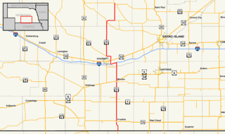
Nebraska Highway 40 is a highway in central Nebraska. It has a length of 85.73 miles (137.97 km). It has a western terminus at Nebraska Highway 92 in Arnold and an eastern terminus north of Kearney at an intersection with Nebraska Highway 10.

Nebraska Highway 57 highway in Nebraska

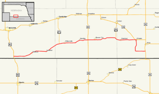
Nebraska Highway 57 (N-57) is a highway in northeastern Nebraska, United States. It is divided into two segments, which combine for a length of 58 miles (93 km). The southern segment begins northeast of Leigh at N-91 and ends at U.S. Highway 275 north of Stanton. The northern segment begins south of Carroll at N-98 and ends north of Hartington at an intersection with N-12.

U.S. Route 30 in Nebraska highway in Nebraska

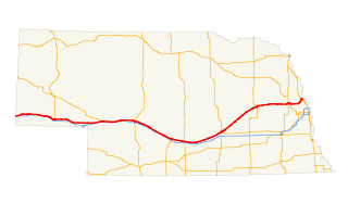
U.S. Highway 30 (US 30) is part of the United States Numbered Highway System that runs for 3,073 miles (4,946 km) from Astoria, Oregon to Atlantic City, New Jersey. Within the state of Nebraska it is a state highway that travels 451.74 miles (727.01 km) west to east across the state from the Wyoming state line west of Bushnell to the Missouri River in Blair on the Iowa state line. For much of its length it travels within the Platte River valley, adjacent or near the river between Brule and Fremont, a distance of just over 300 miles (480 km). This corridor was also highly traveled during Westward Expansion along the California and Oregon Trails, it was also used by the Pony Express and the Transcontinental Railroad. The landscape is dominated by vast agricultural fields within the fertile Platte River valley across the center of the state, while the western portion passes through higher plains and the eastern portion through the rolling hills adjacent to the Missouri River valley.

Nebraska Highway 70 highway in Nebraska

Nebraska Highway 70 is a highway in central Nebraska. Its western terminus is at an intersection with Nebraska Highway 2 and Nebraska Highway 92 east of Broken Bow. Its eastern terminus is at Nebraska Highway 14 in Elgin.

References

  1. 1 2 3 "Nebraska Highway Reference Log Book" (PDF). Nebraska Department of Roads. 2015. pp. 74–75. Retrieved January 7, 2017.
  2. Google (2010-11-03). "overview of Nebraska Highway 21" (Map). Google Maps . Google. Retrieved 2010-11-03.
  3. The Nebraska Highways Page: Highways 1 to 30 Archived 2011-06-29 at the Wayback Machine .

Route map: Google

KML file (edithelp)
KML is from Wikidata