Nedorazumeniya Island

Last updated
Location of Nedorazumeniya Island west of Magadan harbor Magadan 1978.jpg
Location of Nedorazumeniya Island west of Magadan harbor

Nedorazumeniya Island (Russian : Остров Недоразумения - Ostrov Nedorazumeniya; literally Island of misunderstanding) is an island on the north coast of the Sea of Okhotsk. It lies on the north side of Taui Bay, between Amakhton Bay to the west and Nagaev Bay to the east. It is about 20 kilometres (12 mi) west of the city of Magadan.

Russian language East Slavic language

Russian is an East Slavic language, which is official in the Russian Federation, Belarus, Kazakhstan and Kyrgyzstan, as well as being widely used throughout Eastern Europe, the Baltic states, the Caucasus and Central Asia. It was the de facto language of the Soviet Union until its dissolution on 25 December 1991. Although nearly three decades have passed since the breakup of the Soviet Union, Russian is used in official capacity or in public life in all the post-Soviet nation-states, as well as in Israel and Mongolia.

Sea of Okhotsk A marginal sea of the western Pacific Ocean, between the Kamchatka Peninsula, the Kuril Islands, the island of Hokkaido, the island of Sakhalin, and eastern Siberian coast

The Sea of Okhotsk is a marginal sea of the western Pacific Ocean, between the Kamchatka Peninsula on the east, the Kuril Islands on the southeast, the island of Hokkaido to the south, the island of Sakhalin along the west, and a long stretch of eastern Siberian coast along the west and north. The northeast corner is the Shelikhov Gulf. The sea is named after Okhotsk, the first Russian settlement in the Far East.

Taui Bay Bay in Far Eastern Federal District, Russian Federation

Taui Bay is a body of water in the Sea of Okhotsk off the coast of the Magadan Oblast in Russia. The bay opens to the south.

Contents

Nedorazumeniya Island lies 3 kilometres (1.9 mi) off the coast and is roughly triangular in shape. It is 3.5 kilometres (2.2 mi) long and has a maximum width of about 2 kilometres (1.2 mi).

On Nedorazumeniya's northeastern headland there is a settlement called Ribachiy.

Administratively Nedorazumeniya Island belongs to the Magadan Oblast of the Russian Federation.

Magadan Oblast First-level administrative division of Russia

Magadan Oblast is a federal subject of Russia. It is geographically located in the Far East region of the country, and is administratively part of the Far Eastern Federal District. Magadan Oblast has a population of 156,996, making it the least populated oblast and the third-least populated federal subject in Russia.

Etymology

The name of the island is remarkable. "Nedorazumeniye" in Russian means "misunderstanding", "error". The island got such a strange name because it was originally not mapped by a Russian expedition in the 1910s. Then the mistake was identified and corrected.

History

Between 1853 and 1885, [1] American and Russian whaleships anchored between Nedorazumeniya Island and the mainland to obtain shelter from storms, [2] procure wood and water from the island, [3] flense whales, [4] or boil oil. [5] They called the island Fabius Island, while the anchorage was called Fabius Harbor. Both features are named after the ship Fabius (432 tons), of New Bedford, [6] which frequented Taui Bay in the early 1850s. A graveyard existed on the north side of the island. [7] Boats also spent the night on the island after cruising for bowhead whales all day. [8]

United States Federal republic in North America

The United States of America (USA), commonly known as the United States or America, is a country comprising 50 states, a federal district, five major self-governing territories, and various possessions. At 3.8 million square miles, the United States is the world's third or fourth largest country by total area and is slightly smaller than the entire continent of Europe's 3.9 million square miles. With a population of over 327 million people, the U.S. is the third most populous country. The capital is Washington, D.C., and the largest city by population is New York City. Forty-eight states and the capital's federal district are contiguous in North America between Canada and Mexico. The State of Alaska is in the northwest corner of North America, bordered by Canada to the east and across the Bering Strait from Russia to the west. The State of Hawaii is an archipelago in the mid-Pacific Ocean. The U.S. territories are scattered about the Pacific Ocean and the Caribbean Sea, stretching across nine official time zones. The extremely diverse geography, climate, and wildlife of the United States make it one of the world's 17 megadiverse countries.

Whaler specialized ship designed for whaling

A whaler or whaling ship is a specialized ship, designed, or adapted, for whaling: the catching or processing of whales. The former includes the whale catcher – a steam or diesel-driven vessel with a harpoon gun mounted at its bow. The latter includes such vessels as the sail or steam-driven whaleship of the 16th to early 20th centuries and the floating factory or factory ship of the modern era. There have also been vessels which combined the two activities, such as the bottlenose whalers of the late 19th and early 20th century, and catcher/factory ships of the modern era.

Flensing

Flensing is the removing of the blubber or outer integument of whales, separating it from the animal's meat. Processing the blubber into whale oil was the key step that transformed a whale carcass into a stable, transportable commodity. It was an important part of the history of whaling. The whaling that still continues in the 21st century is both industrial and aboriginal. In aboriginal the blubber is rarely rendered into oil, although it may be eaten as muktuk.

A temporary whaling station was established on the island by two American vessels in the summer of 1858. It only consisted of a tent of sails, a thatched cook house, and a small tryworks. Sixteen men, eight from each ship, were given provisions for two months and worked on shares while the ships cruised to the south. [9] Among them were the second mates from both vessels, two boatsteerers (harpooners), a carpenter, a cook, and a steward. With two whaleboats they searched for bowhead and gray whales for as long as four days, ranging west to near the Taui River, east to Ola, and south to "Jeffrey's Point" (Mys Taran). They regularly cruised off "Jeanette Point" (Mys Chirikova) and often visited "Dobry Town" (probably Arman). Whales were also spotted by two men atop the island. They fished for salmon in the rivers at high water and dug for clams at low water. The men encountered bears on several occasions as well. They also traded meat and salmon for bread with other foreign whaleships. When they caught a whale, it was towed ashore, flensed at low tide, and the blubber rendered into oil using a single trypot. In the fall the men and their catch were picked up by their respective vessels. [10] [11]

Carpentry skilled trade

Carpentry is a skilled trade and a craft in which the primary work performed is the cutting, shaping and installation of building materials during the construction of buildings, ships, timber bridges, concrete formwork, etc. Carpenters traditionally worked with natural wood and did the rougher work such as framing, but today many other materials are also used and sometimes the finer trades of cabinetmaking and furniture building are considered carpentry. In the United States, 98.5% of carpenters are male, and it was the fourth most male-dominated occupation in the country in 1999. In 2006 in the United States, there were about 1.5 million carpentry positions. Carpenters are usually the first tradesmen on a job and the last to leave. Carpenters normally framed post-and-beam buildings until the end of the 19th century; now this old fashioned carpentry is called timber framing. Carpenters learn this trade by being employed through an apprenticeship training—normally 4 years—and qualify by successfully completing that country's competence test in places such as the United Kingdom, the United States, Australia and South Africa. It is also common that the skill can be learned by gaining work experience other than a formal training program, which may be the case in many places.

Gray whale species of mammal

The gray whale, also known as the grey whale, gray back whale, Pacific gray whale, or California gray whale, is a baleen whale that migrates between feeding and breeding grounds yearly. It reaches a length of 14.9 meters (49 ft), a weight of 36 tonnes, and lives between 55 and 70 years. The common name of the whale comes from the gray patches and white mottling on its dark skin. Gray whales were once called devil fish because of their fighting behavior when hunted. The gray whale is the sole living species in the genus Eschrichtius, which in turn is the sole living genus in the family Eschrichtiidae. This mammal descended from filter-feeding whales that appeared at the beginning of the Oligocene, over 30 million years ago.

Salmon Family of fish related to trout

Salmon is the common name for several species of ray-finned fish in the family Salmonidae. Other fish in the same family include trout, char, grayling and whitefish. Salmon are native to tributaries of the North Atlantic and Pacific Ocean. Many species of salmon have been introduced into non-native environments such as the Great Lakes of North America and Patagonia in South America. Salmon are intensively farmed in many parts of the world.

Related Research Articles

Shelikhov Gulf bay

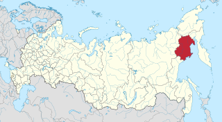
Shelikhov Gulf is a large gulf off the northwestern coast of Kamchatka, Russia. It is located in the northeastern corner of the Sea of Okhotsk and it branches into two main arms, Gizhigin Bay to the west and Penzhina Bay to the east. Its southwest corner is formed by the P'yagin Peninsula, Yam Gulf and the Yamsky Islands.

Shantar Islands Island group in Far Eastern Federal District, Russian Federation

The Shantar Islands are a group of fifteen islands located off the northwestern shore of the Sea of Okhotsk east of Uda Gulf and north of Academy Bay. Most of the islands have rugged cliffs, but they are of moderate height; the highest point in the island group is 720 metres. The name of the island group has its origins in the Nivkh language from the word ч’андь/č’and’’ meaning "to be white". The islands are currently uninhabited.

Feklistova Island Island in Far Eastern Federal District, Russian Federation

Feklistova or Feklistov Island is one of the Shantar Islands in Sea of Okhotsk. With an area of 372 km², it is the second largest in the archipelago.

Zavyalov Island island in Russia

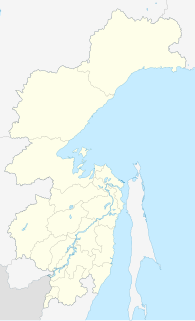
Zavyalov Island, formerly Ola Island, is a relatively large island in the Sea of Okhotsk, northwestern Pacific. It is located on the eastern side of Taui Bay, 20 km west of Cape Taran, Koni Peninsula, about 50 km south of the city of Magadan.

Iony Island Island in Khabarovsk Krai, Russian Federation

Iony Island, or Jonas' Island, formerly Ostrov Svyatogo Iony, is a small island in the Sea of Okhotsk.

Spafaryev Islands Island group in Far Eastern Federal District, Russian Federation

The Spafaryev Islands, or Spafaryev Island, a relatively large double island, are located in the Sea of Okhotsk. It was formerly known as Korovi Island. It lies 7 km east of the Antamlan Peninsula, the southernmost peninsula enclosing the Taui Bay from its western side.

Ulban Bay

Ulban Bay is a bay in the northwestern Sea of Okhotsk, just south of the Shantar Islands. It is a southern branch of Academy Bay to the north. The Syran and Ulban rivers flow into its head.

The Shantar Sea is a small coastal sea in the northwestern Sea of Okhotsk.

Maly Shantar Island Island in Far Eastern Federal District, Russian Federation

Maly Shantar Island is a small, narrow island in the northwestern Sea of Okhotsk, one of the Shantar Islands.

Medvezhy Island Island in Far Eastern Federal District, Russian Federation

Medvezhy Island is a long, narrow island in the northwestern Sea of Okhotsk, the westernmost of the Shantar Islands. It lies on the eastern side of Uda Gulf. It is 12.9 km long. It is separated from the mainland by Shevchenko Straight.

Nagaev Bay

Nagaev Bay or Nagayev Bay, also known as Nagayeva Bay, is a bay within Taui Bay in the northern part of the Sea of Okhotsk, Magadan Oblast, Russia.

Cape Alevina is a cape on the northern side of the Sea of Okhotsk. It is on the Koni Peninsula and forms the southeastern point of Taui Bay.

Sakharnaya Golova Island

Sakharnaya Golova is a small island in the northwestern Sea of Okhotsk. It is part of the Shantar Islands National Park.

Academy Bay (Sea of Okhotsk)

Academy Bay is a large bay in the Tuguro-Chumikansky District of Khabarovsk Krai, Russian Federation.

Bussol Strait is a wide strait that separates the islands of Broutona and Chirpoy to the west from Simushir to the east. It is nearly 58 km wide, making it the largest channel in the Kuril Islands.

Shelting Bay is a wide bay on the northern coast of the Sea of Okhotsk. It lies just west of Taui Bay. It is entered between Capes Moskvitin and Dal'ny and is about 32 km wide. Its shores are primarily high and rocky, with the exception of a sandy beach at its northwest end. Sheltered anchorages from southerly winds may be obtained in the northwestern and eastern parts of the bay.

Cape Bolshoy Dugandzha

Cape Bol'shoy Dugandzha is a headland in Khabarovsk Krai, Russia.

Yakshin Bay is a small bight in the western Sea of Okhotsk. It is 29 km wide and indents the southwest side of Bolshoy Shantar Island. The bay is entered between Capes Raduzhnyy to the west and Filippa to the east. The Yakshin River flows into the head of the bay. There is ice in the bay from December to July. Tides rise 4.9 m at springs, with the flood current flowing in a counterclockwise direction round the bay and the ebb in the reverse direction. These tidal currents may reach 3.5 to 4 knots near the entrance of the bay but are less than 2 knots at its head.

Commercial open-boat whaling by American and European ships occurred in the Sea of Okhotsk from the 1830s to the early 1900s. They primarily caught right and bowhead whales. Both populations of these species declined drastically, with the latter once thought to be extinct by western historians. Peak catches were made in the 1840s and 1850s. It's estimated that as many as 15,200 bowheads and 2,400 rights were taken in the sea.

References

  1. Lancaster, of New Bedford, Aug. 25, 1853, Old Dartmouth Historical Society (ODHS); Sea Breeze, of New Bedford, Sep. 20-26, 1868, ODHS; Mary and Helen II, of San Francisco, Sep. 20, 1885, Kendall Whaling Museum.
  2. Daniel Wood, of New Bedford, Aug. 13-18, 1855, Nicholson Whaling Collection (NWC).
  3. Pacific, of Fairhaven, Aug. 13, 1855, NWC.
  4. Onward, of New Bedford, June 9, 1856, NWC.
  5. Benjamin Tucker, of New Bedford, Sep. 5, 1853, ODHS.
  6. Starbuck, Alexander (1878). History of the American Whale Fishery from Its Earliest Inception to the year 1876. Castle. ISBN   1-55521-537-8.
  7. Lancaster, of New Bedford, Aug. 26, 1853, ODHS; Daniel Wood, of New Bedford, July 4, 1855, NWC.
  8. Daniel Wood, of New Bedford, Aug. 19, 1854, NWC.
  9. Sharon left the island on July 25 and returned on September 18, 1858, while Cicero left and returned on July 19 and October 1, 1858, respectively.
  10. Sharon, of Fairhaven, July 14-September 30, 1858, NWC.
  11. Cicero, of New Bedford, July 15-19, October 1, 1858, ODHS.

Coordinates: 59°35′N150°25′E / 59.583°N 150.417°E / 59.583; 150.417