Atlántico is a department of Colombia, located in northern Colombia with the Caribbean Sea to its north, the Bolívar Department to its west and south separated by the Canal del Dique, and the Magdalena Department to its east separated by the Magdalena River. Despite being the third smallest in the country, the department is among the most densely populated, with a population of 2,535,517.

The Archipelago of San Andrés, Providencia and Santa Catalina, or San Andrés and Providencia, is one of the departments of Colombia, and the only one located geographically in Central America. It consists of two island groups in the Caribbean Sea about 775 km northwest of mainland Colombia, and eight outlying banks and reefs. The largest island of the archipelago and Colombia is called San Andrés and its capital is San Andrés. The other large islands are Providencia and Santa Catalina Islands which lie to the north-east of San Andrés; their capital is Santa Isabel.

The Hoover Wilderness is a wilderness area in the Inyo and Humboldt-Toiyabe National Forests. It lies to the east of the crest of the central Sierra Nevada in California, to the north and east of Yosemite National Park - a long strip stretching nearly to Sonora Pass on the north and Tioga Pass on the south.
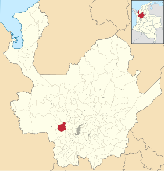
Anza is a town and municipality in Antioquia Department, Colombia. It spans an area of 256 km2.

Iza is a town and municipality in Boyacá Department, Colombia. Iza is located near the Tota Lake and part of the Sugamuxi Province, a subregion of Boyacá. Iza is located in the Eastern Ranges of the Colombian Andes on the Altiplano Cundiboyacense at a distance of 13 kilometres (8.1 mi) from Sogamoso and 90 kilometres (56 mi) from the department capital Tunja. The municipality borders Firavitoba and Sogamoso in the north, Sogamoso and Cuítiva in the east, in the west Pesca and Firavitoba, and in the south Cuítiva.

Santa Rosa de Viterbo is a town and municipality in Boyacá Department, Colombia, part of the Tundama Province, a subregion of Boyacá.

Tota is a town and municipality in the department of Boyacá, Colombia, part of the Sugamuxi Province. Tota is located approximately 40 km from Sogamoso and the municipality borders in the north Cuítiva, Aquitania in the east, Zetaquirá and San Eduardo in the south and westward of Tota the municipality of Pesca is located. Nearby and named after the village is Lake Tota, the largest lake of Colombia.
Usiacurí is a municipality and town in the Colombian department of Atlántico.

Cepitá is a town and municipality in the García Rovira Province, part of Santander Department in northeastern Colombia.
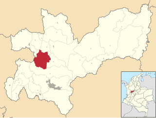
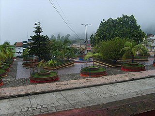
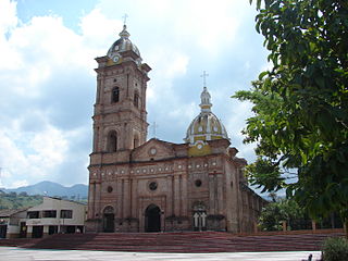
Aranzazu is a town and municipality in the Colombian Department of Caldas.
Filadelfia is a town and municipality in the Colombian Department of Caldas.

Marmato is a town and municipality in the Colombian Department of Caldas. Founded in 1540, Marmato has a population of 10,000 people. It is one of the historic gold-mining regions of the hemisphere.
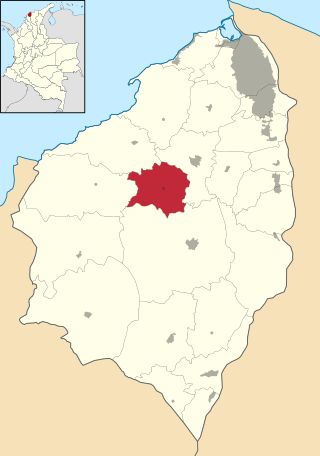
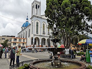
Pauna is a town and municipality in the Colombian Department of Boyacá, part of the subregion of the Western Boyacá Province.

Suaza is a town and municipality in the Huila Department, Colombia.
Timaná is a town and municipality in the Huila Department, Colombia. The municipality is located in the south of Huila at an altitude of 1,100 metres (3,600 ft) and 166 kilometres (103 mi) southwest of the capital Neiva.
Gran Colombia, or Greater Colombia, officially the Republic of Colombia, was a state that encompassed much of northern South America and part of southern North America from 1819 to 1831. It included present-day Colombia, mainland Ecuador, Panama, and Venezuela, along with parts of northern Peru, northwestern Brazil, and claimed the Essequibo region. The terms Gran Colombia and Greater Colombia are used historiographically to distinguish it from the current Republic of Colombia, which is also the official name of the former state.
Villamontán de la Valduerna is a municipality located in the province of León, Castile and León, Spain. According to the 2008 census (INE), the municipality has a population of 941 inhabitants. In addition to Villamontán, the municipality includes the villages of Fresno de la Valduerna, Miñambres de la Valduerna, Posada de la Valduerna, Redelga de la Valduerna, Valle de la Valduerna and Villalís de la Valduerna.

Iglesias is a municipality located in the province of Burgos, Castile and León, Spain.

The River Wards is a section of Philadelphia, Pennsylvania, United States located along the Delaware River to the northeast of Center City Philadelphia. 'River Wards' is the commonly used name for an area including several neighborhoods, such as Fishtown, Kensington, Port Richmond and Olde Richmond. The River Wards are located at the border of North Philadelphia and Northeast Philadelphia, and may be considered part of one or the other, or as a separate entity. The area is sometimes also known as 'Kensington-Richmond'.