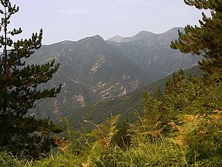
The Great St Bernard Pass is the third highest road pass in Switzerland, at an elevation of 2,469 m (8,100 ft). It connects Martigny in the canton of Valais in Switzerland with Aosta in the region Aosta Valley in Italy. It is the lowest pass lying on the ridge between the two highest mountains of the Alps, Mont Blanc and Monte Rosa. It is located on the main watershed that separates the basin of the Rhône from that of the Po.

The Little St Bernard Pass is a mountain pass in the Alps on the France–Italy border. Its saddle is at 2188 metres above sea level. It is located between Savoie, France, and Aosta Valley, Italy, to the south of the Mont Blanc Massif, exactly on the main alpine watershed. There is also a Great St. Bernard Pass, famous for giving the St Bernard breed its name, and a San Bernardino Pass.

Col Agnel is a mountain pass in the Cottian Alps, west of Monte Viso between France and Italy which links the Queyras valley (Hautes-Alpes) with Pontechianale in the province of Cuneo, Piedmont.

The Maddalena Pass is a high mountain pass between the Cottian Alps and the Maritime Alps, located on the border between Italy and France. It connects Barcelonnette in France with Cuneo in Italy. Its French name Col de Larche refers to the village Larche on its northwestern side.

The Ligurian Alps are a mountain range in northwestern Italy. A small part is located in France. They form the south-western extremity of the Alps, separated from the Apennines by the Colle di Cadibona. The Col de Tende and the Vermenagna valley separate them from the Maritime Alps. They form the border between Piedmont in the north and Liguria in the south.

The Alps form a large mountain range dominating Central Europe, including parts of Italy, France, Switzerland, Liechtenstein, Austria, Slovenia, Germany and Hungary.

Agnel Lake is a lake at Ceresole Reale in the Province of Turin, Piedmont, Italy, near the Nivolet Pass. The reservoir on the Orco river is located at an elevation of 2300 m, close to Serrù Lake.

Col de l'Échelle is a mountain pass in the Alps in the department of Hautes-Alpes in France. It is the lower mountain pass between France and Italy and connects Vallée de la Clarée and Vallée Étroite. The highest point between both valleys is actually at 1779 meter, some kilometers north of the official Col de l'Échelle at the Mauvais Pas. Between both cols, a small dry valley exists.

Herbétet is a mountain in the Gran Paradiso massif, a sub-group of the Graian Alps, with an elevation of 3,778 metres (12,395 ft). It is located between the Cogne Valley and the Valsavarenche Valley.

The Orco Valley is a valley in the Piedmont region of northern Italy located in the Graian Alps, in the territory of the Metropolitan City of Turin. The valley takes its name from the Orco river, which flows through the valley.

The Grande Aiguille Rousse is a mountain peak of the Graian Alps in Savoie, France, situated between the Maurienne and Tarentaise valleys near the Italian border. Reaching an altitude of 3,482 meters, it exceeds its junior to the west, the Petite Aiguille Rousse, by just 50 m (160 ft). Not far from Levanna, the Grande Aiguille Rousse overlooks Serrù Lake and the Gran Paradiso National Park in Italy.

The France–Italy border is 515 km long. It runs from the Alps in the north, a region in which it passes over Mont Blanc, down to the Mediterranean coast in the south. Three national parks are located along the border: Vanoise National Park and Mercantour National Park on the French side and Gran Paradiso National Park on the Italian side.

Corno Bussola is a 3,023 metres high peak on the Italian side of the Pennine Alps.

The Mont Tout Blanc is a 3,438.2 metres high mountain belonging to the Italian side of Graian Alps.

The Punta Leynir is a 3,238 metres high mountain belonging to the Italian side of Graian Alps.

The Punta Bes is a 3,177 metres high mountain belonging to the Italian side of Graian Alps.

The Colle della Rho or Col de la Roue is a mountain col at 2,541 metres (8,337 ft), at the border between the massif des Cerces and the Cottian Alps.

The Roc is a mountain of the Gran Paradiso massif, in the Graian Alps in Italy. It is located between the Aosta Valley and Piedmont regions and is the highest point in the Metropolitan City of Turin.


