
Alsace is a cultural region and a territorial collectivity in eastern France, on the west bank of the upper Rhine next to Germany and Switzerland. In January 2021, it had a population of 1,919,745. Alsatian culture is characterized by a blend of German and French influences.
Alsatian is the group of Alemannic German dialects spoken in most of Alsace, a formerly disputed region in eastern France that has passed between French and German control five times since 1681.

Alsace–Lorraine, officially the Imperial Territory of Alsace–Lorraine, was a former territory of the German Empire, located in modern day France. It was established in 1871 by the German Empire after it had occupied the region during the Franco-Prussian War. The region was officially ceded to the German Empire in the Treaty of Frankfurt. French resentment about the loss of the territory was one of the contributing factors to World War I. Alsace–Lorraine was ceded to France in 1920 as part of the Treaty of Versailles following Germany's defeat in the war, although already annexed in 1918.
The Vosges are a range of medium mountains in Eastern France, near its border with Germany. Together with the Palatine Forest to the north on the German side of the border, they form a single geomorphological unit and low mountain range of around 8,000 km2 (3,100 sq mi) in area. It runs in a north-northeast direction from the Burgundian Gate to the Börrstadt Basin, and forms the western boundary of the Upper Rhine Plain.

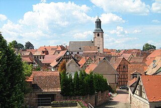
Sélestat is a commune in the Grand Est region of France. An administrative division (sous-préfecture) of the Bas-Rhin department, the town lies on the Ill river, 17 kilometres (11 mi) from the Rhine and the German border. Sélestat is located between the largest communes of Alsace, Strasbourg and Mulhouse.
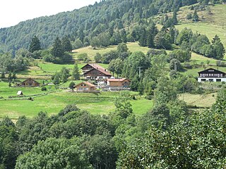
Sundgau is a geographical territory in the southern Alsace region, on the eastern edge of France. The name is derived from Alemannic German Sunt-gowe, denoting an Alemannic county in the Old High German period. The principal city and historical capital is Altkirch.

Jean-Jacques Waltz, also known as "Oncle Hansi", or simply "Hansi" was a French artist of Alsatian origin. He was a staunch pro-French activist, and is famous for his quaint drawings, some of which contain harsh critiques of the Germans of the time. He was also a French hero of both the First and the Second World Wars.

Unterelsaß was the northern part of the historical region Alsace or Elsass, inhabited originally by locals speaking Alemannic German. From 1871 to 1918, Bezirk Unterelsaß was the name for the central district (Bezirk) of the imperial territory of Elsaß-Lothringen (Alsace-Lorraine) in the German Empire.

The November 1918 insurgency in Alsace-Lorraine is a series of events which occurred when the region of Alsace–Lorraine passed from German to French sovereignty at the end of World War I. During this month, international events were linked to domestic troubles, particularly the German Revolution.

Saint-Hippolyte is a commune in the Haut-Rhin department in Grand Est in north-eastern France.
The Etichonids were an important noble family, probably of Frankish-Burgundian origin, who ruled the Duchy of Alsace in the Early Middle Ages. The dynasty is named for Eticho, who ruled from 673 to 690.

Rouffach is a commune in the Haut-Rhin department in Grand Est in north-eastern France.
Bouxwiller is a commune in the Bas-Rhin department, Alsace, Grand Est, northeastern France. Likely meaning "Bucco's land", Bouxwiller is the capital of the Bouxwiller canton and is located within the Saverne arrondissement about 34 kilometres (21 mi) northwest of Strasbourg.

Herrlisheim is a commune in the Bas-Rhin department in Grand Est in north-eastern France. The town dates from the 8th century. Herrlisheim was the scene of very heavy fighting during Operation Nordwind, an offensive launched by the German Army during World War II that inflicted considerable damage to the town.

The Taennchel is one of the summits of the Vosges Mountains, rising to 988 metres (3,241 ft). The Taennchel rises at the East of France, in the département of Haut-Rhin, halfway between Strasbourg to the North and Mulhouse to the South, around 60 km (40 mi) from both cities.

The history of the Jews in Alsace is one of the oldest in Europe. It was first attested to in 1165 by Benjamin of Tudela, who wrote about a "large number of learned men" in "Astransbourg"; and it is assumed that it dates back to around the year 1000. Although Jewish life in Alsace was often disrupted by outbreaks of pogroms, at least during the Middle Ages, and reined in by harsh restrictions on business and movement, it has had a continuous existence ever since it was first recorded. At its peak, in 1870, the Jewish community of Alsace numbered 35,000 people.

The Outre-Forêt is a natural region which is located in the very north of Alsace, bordering on Rhineland-Palatinate. Outre-Forêt means in French beyond the forest, beyond the Haguenau Forest. To the north, it is bounded by the Bienwald as well as by the Lauter. To the east, it is bounded by the Rhine and the Petit Ried. To the west, it is bounded by the Northern Vosges and the River Falkensteinerbach. As a frontier zone off the beaten tracks, the Outre-Forêt has managed to keep its traditions; numerous timbered houses can be admired, pottery is well developed. Far away from the traditional Alsatian vineyards, grapes are grown here.

Grand Est is an administrative region in northeastern France. It superseded three former administrative regions, Alsace, Champagne-Ardenne and Lorraine, on 1 January 2016 under the provisional name of Alsace-Champagne-Ardenne-Lorraine, as a result of territorial reform which had been passed by the French Parliament in 2014.

Gilles Pudlowski is a French journalist, writer, literary and gastronomic critic of Polish descent. He writes the blog les Pieds dans le Plat, writes for Saveurs, Cuisine et Vins de France and Les Dernières Nouvelles d'Alsace. He is also the author of the Pudlo guides.
Events from the year 1634 in France.