Definitions
The City of Austin has no official definition of "North Central Austin". The Planning and Development Review Department divides Austin's core into neighborhood planning areas, which mostly correspond to the boundaries of just one or two well-established neighborhood associations. The Austin Police Department has defined six area commands, among them "Central West", "Central East", "Northwest" and "Northeast", none of which are recognizable as "North Central". Austin's Parks and Recreation Department in its October 6, 2010, draft of its Long Range Plan appears to have revised its planning area definition, with Planning Area 9 corresponding to an area defined by Mopac on the west, 183 to the north, I-35 to the east and 2222 to the south, plus part of the North Lamar/Georgian Acres Combined NPA north of 183, and part of the North Loop NPA south of 2222. [1]
The Austin Board of Realtors in 2007 defined 25 "ACTRIS" regions to assist realtors and the public with identifying real estate. The North Central region runs from 2222 north all the way to 620 in Round Rock. [2]
The civic organization Sustainable Neighborhoods of North Central Austin, which uses the term in its name, defines its territorial scope based on the boundaries of six neighborhood associations: Allandale, Brentwood, Crestview, Highland, North Shoal Creek, and Wooten. [3] This definition mostly corresponds to a diamond of land bounded by the roads Mopac-183-I35-45th St. This part of Austin is undivided by highways, and shares a common architecture due to the prevalence of post-World War II single-family housing.
Sustainable Neighborhoods of North Central Austin is a civic organization based in the north central part of Austin, Texas. SN's mission is to ensure that redevelopment occurring on commercial arterials in North Central Austin is neighborhood-friendly.
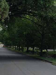
Allandale, Austin, Texas is a neighborhood in North Central Austin, in the U.S. State of Texas.The neighborhood is known for its large lots, mature trees and central location.
Brentwood is a neighborhood in central Austin, Texas.

West Los Angeles is an officially recognized Community Plan area in the city of Los Angeles, California. The residential and commercial neighborhood is divided by the Interstate 405 freeway, and each side is sometimes treated as a distinct neighborhood, mapped differently by different sources. Each of them lies within the larger Westside region of Los Angeles County and together they comprise most of the 90025 zip code.
Loop 360 is a 13.99-mile (22.51 km) loop route in Austin in the U.S. state of Texas. Loop 360 is a scenic highway winding through the hills of West Austin. The road is described by the Texas Department of Transportation (TxDOT) as "a 4-lane depressed median arterial with at-grade signalized intersections." In 2001, the average daily traffic was 55,000 vehicles at the most traveled point. The highway should not be confused with Texas State Highway 360 in the Dallas–Fort Worth metroplex.

The community areas in Chicago, as defined by the Social Science Research Committee at the University of Chicago beginning in the 1920s, are 77 geographical divisions of Chicago. They are now used by the City of Chicago for statistical and planning purposes. These areas are well-defined and static. Census data are tied to the community areas, and they serve as the basis for a variety of urban planning initiatives on both the local and regional levels.

Loop 1 is a freeway which provides access to the west side of Austin in the U.S. state of Texas. It is named Mopac Expressway after the Missouri Pacific Railroad. Local residents will invariably use the name "MoPac" rather than calling the road by its number which can cause much confusion as few signs along the road use this name. Adding to the confusion, the road goes in a mostly straight line rather than a loop.

TxTag, operated by the Texas Department of Transportation (TxDOT), is one of three interoperable electronic toll collection systems in Texas.

State Highway 45 is a highway loop around Austin, Texas, that exists in two open segments. The official designation of SH 45 is such to form a complete loop around Austin, a distance of roughly 80 miles (130 km).

The Old West Austin Historic District is a residential community in Austin, Texas, United States. It is composed of three neighborhoods located on a plateau just west of downtown Austin: Old Enfield, Pemberton Heights, and Bryker Woods. Developed between 1886 and 1953, the three historic neighborhoods stretch from Mopac Expressway east to Lamar Boulevard, and from 13th Street north to 35th Street. It borders Clarksville Historic District and the West Line Historic District to the south.

Tarrytown is a neighborhood located west of downtown Austin, Texas.

Oak Hill is an unincorporated community and collection of neighborhoods located in southwest Austin, Texas.
Ranch to Market Road 620, Ranch Road 620, or RM 620 is a Ranch to Market Road in the U.S. state of Texas maintained by the Texas Department of Transportation (TxDOT). The 27.1-mile (43.6 km) road begins at SH 71 in Bee Cave in Travis County west of Austin passing along southeastern Lake Travis, western Austin, and several suburban communities west and north of Austin before ending at Bus. I-35-L in Round Rock in Williamson County. The road has major intersections with I-35, US 183, and SH 45.
Farm to Market Road 1325 is a 7.2-mile (11.6 km) roadway located in Travis and Williamson counties of Texas. Along much of its length it is referred to as Burnet Road.

The Clarksville Historic District in Austin, Texas, is an area located west of downtown Austin near Lady Bird Lake and just northeast of the intersection of the Missouri Pacific Railroad and West Tenth Street. Many historic homes and structures are located within the Clarksville Historic District. While Clarksville is geographically part of the Old West Austin Historic District, it is distinct from the two historic neighborhoods of Old Enfield which lies immediately to the north on the eastern side of Texas State Highway Loop 1 and Tarrytown which is situated to the west and northwest on the western side of Mopac.

Loop 111 is a 4.219-mile (6.790 km) state-maintained roadway located in Austin, Texas. It is named Airport Boulevard.
Ranch to Market Road 2222 is a 10.8-mile (17.4 km) state-maintained roadway located in Travis County, Texas.
Canyon Creek is a residential neighborhood located in far northwest Austin, Texas. The neighborhood is located in ZIP Code 78726 and is bordered by Farm To Market 2222 (FM2222) on the south, Ranch Road 620 North (RR620) on the west, Anderson Mill Road on the north, and a major headwater tributary of Bull Creek to the east as well as the Balcones Canyonland Preserve. The preserve gives the neighborhood of over 1300 homes a semi-rural feeling despite being less than four miles to major shopping and employment centers. The major bisecting road is Boulder Lane, which winds its way through the picturesque, upper-middle-class neighborhood of single-family homes. Boulder Lane is a loop, and crosses RR620 in two places. The neighborhood is approximately 5 miles from Lake Travis and Lake Austin. Ranch Road 620 runs into the new toll roads of State Highway 45 at Lakeline Mall. Fast ways to get downtown is by taking 620 to 183 and going south. Another fast route is taking 620 to 2222 and then onto 360 to the left or the right. Left will take you to Gateway Theater on 183 and right will take you out to southern Austin and that is also a good route to the airport and San Antonio.

Northwest Hills, sometimes referred to as Far West after its main street, is a suburb in the northwestern part of Austin, Texas, United States. The neighborhood is home to the largest concentration of Jewish residents in Austin, and includes a 40-acre complex housing a number of Jewish community organizations, synagogues, and schools.
North Shoal Creek is a neighborhood in north central Austin, Texas established in the 1960s.
Montopolis is a neighborhood in Austin, Texas. Located southeast of the city's urban core, Montopolis encompasses part of ZIP code 78741.
