Oberloisdorf | ||
|---|---|---|
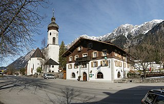
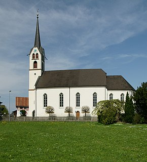
 Saint Roch Church | ||
| ||
 Oberloisdorf Location within Austria | ||
| Coordinates: 47°27′N16°30′E / 47.450°N 16.500°E Coordinates: 47°27′N16°30′E / 47.450°N 16.500°E | ||
| Country | Austria | |
| State | Burgenland | |
| District | Oberpullendorf | |
| Government | ||
| • Mayor | Manfred Jestl (ÖVP) | |
| Area | ||
| • Total | 10.65 km2 (4.11 sq mi) | |
| Elevation | 254 m (833 ft) | |
| Population (1 January 2016) [1] | ||
| • Total | 809 | |
| • Density | 76/km2 (200/sq mi) | |
| Time zone | UTC+1 (CET) | |
| • Summer (DST) | UTC+2 (CEST) | |
| Postal code | 7451 | |

Oberloisdorf (Croatian : Nadrloštrof, Hungarian : Felsőlászló) is a town in the district of Oberpullendorf in the Austrian state of Burgenland.

Croatian is the standardized variety of the Serbo-Croatian language used by Croats, principally in Croatia, Bosnia and Herzegovina, the Serbian province of Vojvodina, and other neighboring countries. It is the official and literary standard of Croatia and one of the official languages of the European Union. Croatian is also one of the official languages of Bosnia and Herzegovina and a recognized minority language in Serbia and neighboring countries.

Hungarian is a Finno-Ugric language spoken in Hungary and parts of several neighbouring countries. It is the official language of Hungary and one of the 24 official languages of the European Union. Outside Hungary it is also spoken by communities of Hungarians in the countries that today make up Slovakia, western Ukraine (Subcarpathia), central and western Romania (Transylvania), northern Serbia (Vojvodina), northern Croatia and northern Slovenia. It is also spoken by Hungarian diaspora communities worldwide, especially in North America and Israel. Like Finnish and Estonian, Hungarian belongs to the Uralic language family. With 13 million speakers, it is the family's largest member by number of speakers.

Austria, officially the Republic of Austria, is a country in Central Europe comprising 9 federated states. Its capital, largest city and one of nine states is Vienna. Austria has an area of 83,879 km2 (32,386 sq mi), a population of nearly 9 million people and a nominal GDP of $477 billion. It is bordered by the Czech Republic and Germany to the north, Hungary and Slovakia to the east, Slovenia and Italy to the south, and Switzerland and Liechtenstein to the west. The terrain is highly mountainous, lying within the Alps; only 32% of the country is below 500 m (1,640 ft), and its highest point is 3,798 m (12,461 ft). The majority of the population speaks local Bavarian dialects as their native language, and German in its standard form is the country's official language. Other regional languages are Hungarian, Burgenland Croatian, and Slovene.