It is situated on the outskirts of Nsukka city. Obimo shares common borders with Edem in the North; Lejja in the south; Agbani Nguru in the east and Nkpologu in the west.
Education in the community includes three secondary schools: Community Secondary School Obimo (formally Obimo Girls), Community high school Ajuona, Community Secondary School Akpotoro Obimo. And five primary school include Udoka primary school Akpotoro, Hilltop primary school i and ii Ajuona, Union primary school, Community primary school Agbo, Central primary school Akwutara.
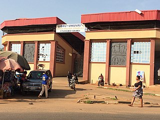
Igwe Spencer is the traditional ruler of Obimo and Igwe Moses Edoga is the traditional ruler of Ajuona Autonomous Community, who became the successor of the late chief Anthony Ani.
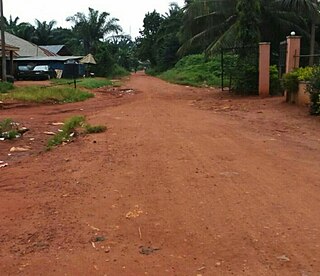
Driving down from Nsukka, Ikwoka Ezemba is the first village to be located at the bottom part of 'Ugwu odugudu hill before locating the first village after the hill. Amagu (Ama agu), which implies "the lion's den", is the first village to be sighted as soon as one sets their feet on Ajuona Obimo.
History
Good number of Obimo people have traced their ancestry to ancient Nri Kingdom in Anambra state. Although, most of the inhabitants believe that they didn't migrate from anywhere, but Nri influence on Obimo people can never be underrated. This point they back up with, the fact that they do not share any social affiliation with any village, in terms of giving them respect as their Ancestors or somewhere they migrated from. Old Obimo inhabitants were believed to be great sculptors; traces of this can be seen in one of the smallest villages in Obimo, (Ama-eha Agbo). They can be dug up from the compound of a man popularly referred to as Ugwuta Alaya Onyechi, but whose real name is Abel Ugwoke. Obimo people are Igbos by ethnicity.
Socio-cultural
These communities were traditional religionists. They attach most of their socio-cultural, political, and economic activities to traditional African religion – until the advent of the white man with his new religion.
Economy
They are subsistence agriculturalists depending more on their locally produced agricultural tools like hoes, axes and matchets. Their most staple food crop to present is yam (Dioscorea spp). They also engage in crafts and artistic works like blacksmithing, carving, basket making, weaving. Their women mostly cultivate gardens, egg, and fresh pepper. They also engage in activities with their neighbouring towns.
Nsukka is a town and a Local Government Area in Enugu State, Nigeria. Nsukka shares a common border as a town with Edem, Opi, Ede-Oballa, and Obimo.
Eze is an Igbo word which means King. Such words as Igwe and Obi, plus others, are used by Igbo people as titles of respect and homage to the Eze. Igwe is derived from the Igbo word Igwekala or Eluigwekala, "the sky or heaven above the sky is higher or bigger than land", implying that the Eze is a higher servant of the people. Obi usually refers to the centre building for receiving visitors within an Igbo leader's or man's homestead. When used as a title of respect for the Eze, Obi implies: "the one who sits in the throne house or heart of the Kingdom."
Enugu State is a state in the South-East geopolitical zone of Nigeria, bordered to the north by the states of Benue and Kogi, Ebonyi State to the east and southeast, Abia State to the south, and Anambra State to the west. The state takes its name from its capital and largest city, Enugu. The city acquired township status in 1917 and was called Enugwu-Ngwo. Due to the rapid expansion towards areas owned by other indigenous communities, it was renamed Enugu in 1928.
Nnewi is a commercial and industrial city in Anambra State, southeastern Nigeria. It is the second largest city in Anambra state after Onitsha. Nnewi as a metropolitan area has two local government area, which are Nnewi North and Nnewi South, all centred around the Nnewi town. Even Ekwusigo local government area is now part of Nnewi urban area, as urbanization continues to spread from Nnewi to neighbouring communities. The Nnewi town which is the only town in Nnewi North comprises four villages: Otolo, Uruagu, Umudim, and Nnewichi. Nnewi had been the centre of economics and commerce, being at a time the fastest growing industrial city east of the Niger, being the home of many industries such as The Ibeto Group, the Chicason Group, Cutix Cables, amongst others. The first indigenous car manufacturing plant in Nigeria is located in the city while the first wholly Made-in-Nigeria motorcycle, the 'NASENI M1' was manufactured in Nnewi.
Ngwo is a town located in the south-eastern state of Enugu, Nigeria, with a population of about 100,000 people. The town's native population are of Igbo ethnicity.
Abor is a town in southeastern Nigeria, located in Enugu State near the city of Enugu.
Nsugbe is a town in Anambra East Local Government Area, Anambra State, Nigeria.
Ohum,, is a valley town in Enugu State, in southeastern Nigeria.
The Umuoji people are those whose roots can be traced to the town of Umuoji in Idemili North, a local government area in Anambra State, Nigeria. These people are from Igbo-speaking ethnic group whose early history is adversely affected by a lack of, or non-existent, written records. Umuoji is bounded by Ogidi, Ojoto, Uke, Abatete and Nkpor and has an estimated population of 80,000 people which includes local residents in its 23 villages and citizens in diaspora.
Enugwu-Ukwu is a large town in Anambra State, Nigeria. Enugwu-Ukwu town is geographically situated on hilly terrain; thus it is named after its geographical topography. It is predominantly occupied by the Igbo people ethnic group of Anambra State. Most of its inhabitants are Christians. It is located in Njikoka Local Government Area of Anambra State. Major villages that make up the town include Uruokwe, Enu-Avomimi, Adagbe-Avomini, Umu-Atulu, Urualor, Akiyi, Avomimi, Awovu, Enuagu, Ire, Orji, Orofia, Osili, Umuakwu, Umuatulu, Umuatuora, Umuokpaleri, Uruekwo, Urukpaleke, Urunnebo, and Uruogbo.
Ogui is an autonomous community in Nike, in Enugu North Local Government Area of Enugu State in the southeastern geopolitical zone of Nigeria. It comprises Umunevo Village, Ihewuzi Village and Onuato Village. Ogui Nike, as it is usually called, is a major landlord to the administrative, political and economic hub of Enugu City, in that major public and private institutions, shopping malls, hotels, banks and so on are situated on Ogui land.
Unadu is a community in Igbo Eze South Local Government Area of Enugu State, Nigeria. It lies North West of Nsukka. Boundaries are formed by (Akpanya) Kogi state To the North, Enugu-Ezike, Itchi and Alor-Agu. Unadu plays host to Afor Market, popularly known as Afor Unadu and situated at the central area of the community. Unadu is made up of two autonomous communities: Ohomu Unadu and Obaka Unadu. Each of the autonomous communities is ruled by a traditional chief called the Igwe.
Lejja is a community comprising 33 villages in Enugu State of South-Eastern Nigeria. It is populated by the Igbo people and located about at 14 Kilometers from Nsukka. It is the location of a prehistoric archaeological site which contains iron smelting furnaces and slag that dates back to 2000 BC. The village square at Otobo ugwu is likely the first village square in Lejja contains over 800 blocks of slag weighs between 34 and 57 kg. Geophysical investigations have located buried iron slag in several other locations in the community.
Uvuru-Agada (Uvuru) is a community in Uzo Uwani, Enugu State, Nigeria. It is roughly 31 kilometres (19 mi) from Nsukka. Originally known as Ogbo-Uvuru, the community is commonly called Uvuru-Agada after Agada, the community's founder. The community is led by a committee of the oldest men in each clan, known as Ndi-Idi-Uvuru, which is responsible for administering justice and resolving disputes.
Nru Nsukka is a suburb located in Nsukka town. Nru Nsukka is one of the former old three autonomous communities: Mkpunanor, Nru and Ihe n'Owerre that made up the Nsukka urban area. Nru Nsukka having been upgraded to a suburban area was split into three newer autonomous communities with newly installed traditional rulers. Since 2018, the suburb is now made up of Iheagu Nru autonomous community with its traditional ruler as Sylvanus Arumah, Ezema ne Edem autonomous community with its traditional ruler as Linus.O. Atugwu and the youngest being Umuoyo Nru autonomous community with Paul Atanike as its traditional ruler elect.
Ezema is one of four sub-communities that made up Nru Nsukka town in Nsukka Local Government Area, Nigeria. It is adjacent to the three other sub-communities in Nru Nsukka: Edem Nru, Umuoyo Nru and Iheagu. It also shares common boundaries with Various communities such as Umuoyo, Iheagu, Agbamere/Amike and Umabor both in Eha Alumona.
Mmaku is a town in the Awgu local government area of Enugu State, Nigeria. The name Mmaku means "Welcomer" or "Embracer". Another derivation comes from the English language, and it means "beauty of wealth."
Neke is a town located in Isi-Uzo Local Government Area of Enugu State in South Eastern Nigeria. Bordered by towns such as Nike, Ikem, Mbu, Eha Amufu, Obollo and UmuAlor, Neke is a small town with a strong backbone. In the pre-colonial era, the people of Neke were known as fearsome warriors who had an economic stronghold on neighboring areas. In the present day, there are 5 main districts located in Neke namely; Ishienu, Akpani, ObeguAba, Umugwu and Umuegwu. These districts represent villages made up of clans and kindred prominent to the town's social structure.
Nawfia is a town in Njikoka Local Government Area of Anambra State, Nigeria. Nawfia is surrounded by neighbouring towns namely Enugwu Ukwu, Awka (Umuokpu), Nise, Amawbia and Enugwu Agidi. It is predominantly occupied by the Igbo ethnic group and is believed to be one of the towns that make up the ancestral home of Igbo people. Most of its inhabitants are Christians. Igbo and English are the predominant languages spoken in Nawfia.
Amaetiti is a town in Orumba North Local Government Area of Anambra State, located in the Southeast geopolitical zone of Nigeria.
This page is based on this Wikipedia article Text is available under the CC BY-SA 4.0 license; additional terms may apply. Images, videos and audio are available under their respective licenses.