Course
It is 29 km (18 mi) in length with its source in the northeast of Bernau bei Berlin. The headwaters were overbuilt with the construction of the railway from Berlin to Stettin in 1842, today the Panke waters leak beneath the railroad embankment. The river flows southwestwards parallel to the railway line through the Bernau town centre and reaches the municipal border with Panketal, underpassing the Bundesautobahn 11.
South of Panketal, the river crosses the border of Brandenburg with Berlin, where it traverses the Pankow borough from north to south, running through the locality of Buch, where it underpasses the Bundesautobahn 10 (Berliner Ring) and forms the border with the Berlin locality of Karow and the western border of Karow and Blankenburg with Französisch Buchholz. Joined by the Schmöckpfuhlgraben ditch the Panke runs between the Pankow and Niederschönhausen localities through the gardens of Schönhausen Palace and passes Majakowskiring.
The final stretches of the lower Panke run through Berlin's inner city districts of Gesundbrunnen and Wedding, where it is canalised and partly underground. Pedestrian walkways run alongside the river -or near it- for lengthy stretches. Nowadays it has two mouths, a northern one into the Nordhafen port of the Berlin-Spandau Ship Canal, and another, considerably smaller one directly into the Spree River in Mitte close to the Berliner Ensemble theater. The Mitte section behind the Bundesnachrichtendienst (BND) headquarters (the former site of the Stadion der Weltjugend ) is currently renaturated as an urban park component.

The Spree is, with a length of approximately 400 kilometres (250 mi), the main tributary of the River Havel, and at their confluence in Berlin-Spandau, is much longer than the Havel, which itself flows into the Elbe at Havelberg. The river rises in the Lusatian Highlands, that are part of the Sudetes, in the Lusatian part of Saxony, where it has three sources: the historical one called Spreeborn in the village of Spreedorf, the water-richest one in Neugersdorf, and the highest elevated one in Eibau. The Spree then flows northwards through Upper and Lower Lusatia, where it crosses the border between Saxony and Brandenburg. After passing through Cottbus, it forms the Spree Forest, a large inland delta and biosphere reserve. It then flows through Lake Schwielochsee before entering Berlin, as Müggelspree(listen ).

Mitte is the first and most central borough of Berlin. The borough consists of six sub-entities: Mitte proper, Gesundbrunnen, Hansaviertel, Moabit, Tiergarten and Wedding.

Pankow is the most populous and the second-largest borough by area of Berlin. In Berlin's 2001 administrative reform it was merged with the former boroughs of Prenzlauer Berg and Weißensee; the resulting borough retained the name Pankow. Pankow was sometimes claimed by the Western Allies to be the capital of the German Democratic Republic, while the German Democratic Republic itself considered East Berlin to be its capital.

Fürstenwalde/Spree is the most populous town in the Oder-Spree District of Brandenburg, Germany.

Berlin-Pankow is a station on the Berlin–Szczecin railway, situated in Berlin's Pankow district. It is served by the S-Bahn lines , and and is the northern terminus of the U-Bahn line .

Bernau bei Berlin is a German town in the Barnim district. The town is located about 10 km (6.2 mi) northeast of Berlin.
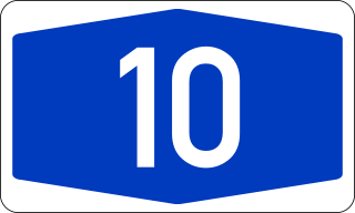
Bundesautobahn 10 is an orbital motorway around the German capital city of Berlin. Colloquially called Berliner Ring, it is predominantly located in the state of Brandenburg, with a short stretch of 5 km in Berlin itself. It should not be confused with the Berliner Stadtring around Berlin's inner city.

Wandlitz is a municipality in the district of Barnim, in Brandenburg, Germany. It is situated 25 km north of Berlin, and 15 km east of Oranienburg. The municipality was established in 2004 by merger of the nine villages Basdorf, Klosterfelde, Lanke, Prenden, Schönerlinde, Schönwalde, Stolzenhagen, Wandlitz and Zerpenschleuse.
Berlin has developed a highly complex transportation infrastructure providing very diverse modes of urban mobility. 979 bridges cross 197 kilometers of innercity waterways, 5,334 kilometres (3,314 mi) of roads run through Berlin, of which 73 kilometres (45 mi) are motorways. Long-distance rail lines connect Berlin with all of the major cities of Germany and with many cities in neighboring European countries. Regional rail lines provide access to the surrounding regions of Brandenburg and to the Baltic Sea.

Barnim Nature Park is a nature park and reserve in the state of Brandenburg, and partly in Berlin, Germany. It covers an area of 750 km2. It was established on September 24, 1998.

Mitte is a central locality (Ortsteil) of Berlin in the eponymous district (Bezirk) of Mitte. Until 2001, it was itself an autonomous district.
Pankow is a locality (Ortsteil) of Berlin in the district (Bezirk) of Pankow. Until 2001 it was an autonomous district with the localities of Karow, Niederschönhausen, Wilhelmsruh, Rosenthal, Blankenfelde, Buch and Französisch Buchholz.

Gesundbrunnen is a locality (Ortsteil) of Berlin in the borough (Bezirk) of Mitte. It was created as a separate entity by the 2001 administrative reform, formerly the eastern half of the former Wedding district and locality. Gesundbrunnen has the highest percentage of non-German residents of any Berlin locality, at 35.1% as of the end of 2008.

Malchow is a German locality (Ortsteil) in the borough (Bezirk) of Lichtenberg, Berlin. Until 2001 it was part of the former Hohenschönhausen borough. With a population of 450 (2008) it is the least-populated Berliner Ortsteil.

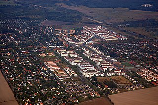
Buch is a German locality (Ortsteil) within the Berlin borough (Bezirk) of Pankow. Situated on the Panke river, it is the city's northernmost quarter, chiefly known for its historic village centre and extended hospital premises.

Französisch Buchholz, also known simply as Buchholz, is a German locality (Ortsteil) within the Berlin borough (Bezirk) of Pankow.

Stadtrandsiedlung Malchow is a German locality (Ortsteil) within the Berlin borough (Bezirk) of Pankow. Until 2001 it was part of the former Weißensee borough.
Karow is a German locality (Ortsteil) within the Berlin borough (Bezirk) of Pankow. Until 2001 it was part of the former Weißensee borough.

The Berlin/Brandenburg metropolitan region or capital region is one of eleven metropolitan regions of Germany, consisting of the entire territories of the state of Berlin and the surrounding state of Brandenburg. The region covers an area of 30,370 square kilometres (11,730 sq mi) with a total population of about 6 million.

The Berlin Inner Ring road is a beltway route of major roads around the historic city centre of Berlin encompassing the boroughs of Mitte, Pankow and Friedrichshain-Kreuzberg. It is named "Inner Ring" to distinguish it from both the wider City Ring (Stadtring) road including the Bundesautobahn 100 sections and the outer Berlin Ring orbital motorway.
