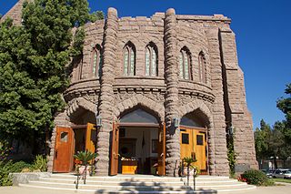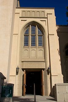
Fuller Theological Seminary is a multidenominational Christian evangelical seminary in Pasadena, California, with regional campuses in the western United States. The seminary has 2,897 students from 90 countries and 110 denominations.

Vroman's Bookstore an independent bookstore. It is the oldest and largest independent bookstore in Southern California. Founded in 1894 by Adam Clark Vroman, the original Vroman’s Book and Photographic Supply store was located at 60 E. Colorado St in Pasadena, California. Mr. Vroman loved books and loved giving back to his community. Mr. Vroman was also a passionate photographer, specializing in scenes of the American West and his portraits of Native Americans. When Mr. Vroman died in 1916, he left the bookstore to longtime employees.

Ambassador Auditorium is located on the historic Ambassador College campus in Pasadena, California, United States. Its architectural design has been noted to be somewhat similar to that of the Temple of ancient Israel. The auditorium's main hall has a capacity of 1262.

The Pasadena Convention Center is a convention center in Pasadena, California, near Los Angeles, owned by the City of Pasadena. It consists of three buildings.

KMRB is a radio station in Pasadena, California, United States that broadcasts completely in Cantonese 24 hours a day. It is the sister station to KAZN, which broadcasts in Mandarin. It is owned and operated by Multicultural Radio Broadcasting, Inc..
Highland College was a Christian liberal arts college in Pasadena, California, United States. It was located at 450 Avenue 64, Pasadena, California 91105.
Marceline is a neighborhood in Pasadena, California, whose central feature is Pasadena City College. It has an area of roughly half a square mile and is bordered by Walnut Street to the north, Orlando Road to the south, Hill Avenue to the west, and Allen Avenue to the east. The neighborhood is named for a short-lived railroad cutoff which ran through the center of the neighborhood at the turn of the 20th century.
Chapman, also known as Chapman Woods is a neighborhood in Pasadena, California. It is bordered by Del Mar Boulevard to the north, Huntington Drive to the south, the Eaton Wash to the west, and Highway 19 to the east. Chapman is an anomaly in that part of the neighborhood is in incorporated Pasadena while part is in unincorporated Los Angeles County. The region is named Chapman Woods because it is heavily wooded. It was Mr. Chapman's walnut grove.
Garfield Heights is a neighborhood in Pasadena, California. The original tract name registered with the city of Pasadena in 1904. In 1998, the area was designated a landmark district. It is bordered by Washington Boulevard to the north, Mountain Street to the south, North Marengo Avenue to the west, and Los Robles Avenue to the east.
Lower Arroyo is a neighborhood in Pasadena, California, centered on the Arroyo Seco south of Brookside Park. It is bordered by Holly Street to the north, Columbia Street to the south, San Rafael Avenue to the west, and Orange Grove Boulevard to the east.
Madison Heights is a neighborhood in Pasadena, California. It is bordered by California Boulevard to the north; Lake Avenue, Arden Road, Oak Knoll Avenue, Oak Knoll Circle, and El Molino Avenue to the east; Allendale, Los Robles Avenue, and South Pasadena to the south, and Marengo Avenue to the west.

Normandie Heights is a neighborhood in Pasadena, California. It is bordered by Woodbury Road to the north, Washington Boulevard to the south, Los Robles Avenue to the west, and Lake Avenue to the east. While the exterior of many older homes in Southern California have been coated with stucco, Normandie is distinguished by a high concentration of Craftsman homes with well-maintained wooden exteriors. Accordingly, the City of Pasadena has designated more than 50 homes in the neighborhood as architectural landmarks, many on Rio Grande Street, between Los Robles Avenue and El Molino Avenue, which was the site of the first residences in the neighborhood.
Olive Heights is the most densely populated neighborhood in Pasadena, California.It is bordered by Mountain Street to the north, Walnut Street to the south, El Molino Avenue to the west, and Lake Avenue to the east.
Orange Heights is a neighborhood in Pasadena, California, United States. It is bordered by Jackson Street to the north, Mountain Street to the south, Los Robles Avenue to the west, and El Molino Avenue to the east.
The Playhouse District is a neighborhood in Pasadena, California. It is Pasadena's premier entertainment and financial district; the headquarters of Community Bank are headquartered there. The Playhouse District is bordered by Interstate 210 to the north, California Boulevard to the south, Los Robles Avenue to the west, and Hudson Avenue to the east, with a panhandle-like extension to Wilson Avenue. The district is also notable for its manhattanization, the legacy of extensive urbanization from the 1960s to the 1980s.
Villa Parke is a neighborhood in Pasadena, California,bordered by Mountain Street to the north, Interstate 210 to the south, Fair Oaks Avenue to the west, and Los Robles Avenue to the east.
Academia Avance Charter (AA) is a public Charter middle and high school in the Highland Park neighborhood, approximately seven miles northeast of downtown Los Angeles, California. It is part of the Los Angeles County Board of Education.

Holliston Church is a church in Pasadena, California, United States. It is located at 1305 East Colorado Boulevard. It primarily serves the Korean community in Pasadena. The building was constructed in 1923.
California College of Music is a contemporary popular music school in Pasadena, in Los Angeles County, California. It opened its doors in 1998 as the Pasadena International Music Academy, and changed its name to California College of Music in 2008. It currently offers six-quarter Associate of Arts degrees in music performance as well as four-quarter Diploma and two-quarter Certificate programs.
The Pasadena Chalk Festival is an American cultural event of street painting. It was founded by the Light Bringer Project in 1993. During this festival, artists create temporary masterpieces in chalk on the streets, including original works, masterpiece recreations, movie posters and iconic scenes recreations, 3D realistic works, animation art, modern abstractions, and more. The festival is held annually in downtown Pasadena, California. In 2010, the Pasadena Chalk Festival was officially named the Largest Display of Chalk Pavement Art by Guinness World Records, and attracted more than 600 artists and 100,000 visitors in one weekend.


