Saunemin is a village in Livingston County, Illinois, United States. The population was 456 at the 2000 census. It was named after a Kickapoo chief.

Uniopolis is an unincorporated community and former village in Auglaize County, Ohio, United States. The population was 222 at the 2010 census. It is included in the Wapakoneta, Ohio Micropolitan Statistical Area. In 2013, voters chose to disincorporate Uniopolis into Union Township.

West Salem is a village in La Crosse County, Wisconsin, United States, along the La Crosse River. It is part of the La Crosse-Onalaska, WI-MN Metropolitan Statistical Area. The population was 4,799 as of the 2010 Census.

Lipníky is a village and municipality in Prešov District in the Prešov Region of eastern Slovakia.

Kandal Stueng District is a district (srok) of Kandal Province, Cambodia. The district is subdivided into 23 communes (khum) and 154 villages (phum).

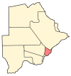
Nata is a village in Central District of Botswana. It is located in the northern part of the district, and is served by Nata Airport. The population was 4,150 at the 2001 census. The village of Nata lies along the Nata River, which carries its rainy season flow to the Makgadikgadi Pans, a seasonal hypersaline lake.
Malatswai is a village in Central District of Botswana. The village is located 110 km north-west of Serowe, and it has a primary school. The population was 872 in 2001 census.
Oodi or Odi is a village in Kgatleng District of Botswana. It is located 20 km north-east of Gaborone. The population was 3,440 in 2001 census.

Nor Armavir is a village in the Armavir Province of Armenia. The village was founded in 1923 by Armenian refugees from Turkey, who named the village after the ancient city of Armavir, which has its ruins nearby. However, The village is known first and foremost for the Battle of Sardarabad during the Caucasus Campaign, as the battle occurred on the modern site of the town in 1918.

Zbuczyn is a village in Siedlce County, Masovian Voivodeship, in east-central Poland. It is the seat of the gmina called Gmina Zbuczyn. It lies approximately 15 kilometres (9 mi) south-east of Siedlce and 100 km (62 mi) east of Warsaw.

Rudziniec is a village in Gliwice County, Silesian Voivodeship, in southern Poland. It is the seat of the gmina called Gmina Rudziniec. It lies approximately 21 kilometres (13 mi) north-west of Gliwice and 44 km (27 mi) west of the regional capital Katowice.

Lipnica is a village in Gmina Lipnica, Bytów County, Pomeranian Voivodeship, in northern Poland. It lies approximately 20 kilometres (12 mi) south-west of Bytów and 90 km (56 mi) south-west of Gdańsk.

Fuleda is a village in the administrative district of Gmina Giżycko, within Giżycko County, Warmian-Masurian Voivodeship, in northern Poland. It lies approximately 9 kilometres (6 mi) north-west of Giżycko and 83 km (52 mi) north-east of the regional capital Olsztyn.
Rychnowo is a village in the administrative district of Gmina Grunwald, within Ostróda County, Warmian-Masurian Voivodeship, in northern Poland. It lies approximately 15 kilometres (9 mi) south-east of Ostróda and 35 km (22 mi) south-west of the regional capital Olsztyn.
Unieście is a coastal village in the administrative district of Gmina Mielno, within Koszalin County, West Pomeranian Voivodeship, in north-western Poland. It lies approximately 12 kilometres (7 mi) north-west of Koszalin and 137 km (85 mi) north-east of the regional capital Szczecin.

Santo Domingo Tlatayápam is a village and small municipality in Oaxaca in south-western Mexico. The municipality covers an area of 12 km². It is part of the Teposcolula District in the center of the Mixteca Region

Lafayette is a census-designated place in the center of Deer Creek Township, Madison County, Ohio, United States. It is located at 39°56′15″N83°24′24″W, along U.S. Route 40, just west of its intersection with U.S. Route 42.

Venčane is a village in the municipality of Aranđelovac, Serbia. According to the 2002 census, the village has a population of 1576 people.
Tidriku is an uninhabited village in Haljala Parish, Lääne-Viru County, in northern Estonia.
Cross Creek is a census-designated place located in Cross Creek Township, Washington County in the state of Pennsylvania. The community is located in northern Washington County about 2 miles southwest of the community of Atlasburg. As of the 2010 census the population was 137 residents.