The Transverse Ranges are a group of mountain ranges of southern California, in the Pacific Coast Ranges physiographic region in North America. The Transverse Ranges begin at the southern end of the California Coast Ranges and lie within Santa Barbara, Ventura, Los Angeles, San Bernardino and Riverside counties. The Peninsular Ranges lie to the south. The name Transverse Ranges is due to their east–west orientation, making them transverse to the general northwest–southeast orientation of most of California's coastal mountains.

The Angeles National Forest (ANF) of the U.S. Forest Service is located in the San Gabriel Mountains and Sierra Pelona Mountains, primarily within Los Angeles County in southern California. The ANF manages a majority of the San Gabriel Mountains National Monument.

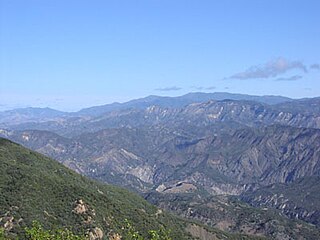
The Sierra Madre Mountains are a mountain range primarily in northern Santa Barbara County and extending into northwestern Ventura County in Southern California, western United States. It is a range of the Inner South Coast Ranges group, and is the southernmost reach of the California Coast Ranges, which are themselves part of the Pacific Coast Ranges of western North America.
The Coronado National Forest is a United States National Forest that includes an area of about 1.78 million acres (7,200 km2) spread throughout mountain ranges in southeastern Arizona and southwestern New Mexico.

The Modoc National Forest is a 1,654,392-acre (6,695 km2) national forest in northeastern California.

Plumas National Forest is a 1,146,000-acre (4,638 km2) United States National Forest located at the northern terminus of the Sierra Nevada, in northern California. The Forest was named after its primary watershed, the Rio de las Plumas, which was later anglicized to "Feather River".

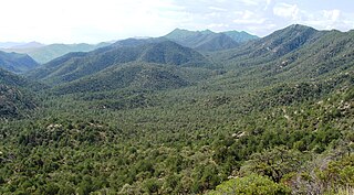
The San Rafael Wilderness is a wilderness area in the mountains of north central Santa Barbara County, California, United States. It is completely contained within the Los Padres National Forest, and is north of the city of Santa Barbara and east of Santa Maria. Formed in 1968, it was the first wilderness area to be created from a previously designated Primitive Area after the passage of the 1964 Wilderness Act. It also includes the Sisquoc Condor Sanctuary, created in 1937, which is the oldest designated sanctuary for the large endangered birds.

The Dick Smith Wilderness is a wilderness area in the mountains of eastern Santa Barbara County, California, United States, with a portion in Ventura County. It is completely contained within the Los Padres National Forest, and is northeast of the city of Santa Barbara and north of the city of Ojai. It is most easily accessible from two trailheads off State Route 33, which runs north from Ojai. It is adjacent to the large San Rafael Wilderness on the west and the Matilija Wilderness on the south. Across Highway 33 to the east, and also in the Los Padres National Forest, is the large Sespe Wilderness.
Monterey National Forest was established as the Monterey Forest Reserve by the U.S. Forest Service in California on June 25, 1906 with 335,195 acres (1,356.49 km2). It became a National Forest on March 4, 1907. On July 1, 1908 Pinnacles National Forest and San Benito National Forest were added. On August 8, 1919 the entire forest was transferred to Santa Barbara National Forest and the name was discontinued. The lands presently exist in Los Padres National Forest.
Santa Barbara National Forest was established as the Santa Barbara Forest Reserve by the General Land Office in California on December 22, 1903 with 1,838,323 acres (7,439.43 km2) by consolidation of Pine Mountain and Zaka Lake and Santa Ynez Forest Reserves. It included areas of the San Rafael Mountains and Santa Ynez Mountains.
San Luis National Forest was established by the U.S. Forest Service in California on July 1, 1908 from part of San Luis Obispo National Forest with 355,990 acres (1,440.6 km2). On July 1, 1910 the entire forest was combined with Santa Barbara National Forest and the name was discontinued.
San Luis Obispo National Forest was established as the San Luis Obispo Forest Reserve by the U.S. Forest Service in California on June 25, 1906 with 363,350 acres (1,470.4 km2). It became a National Forest on March 4, 1907. On July 1, 1908 part of the forest was combined with Santa Barbara National Forest, the remainder was used to establish San Luis National Forest, and the name was discontinued.
San Gabriel National Forest was established as the San Gabriel Forest Reserve by the General Land Office in California on December 20, 1892 with 555,520 acres (2,248.1 km2). After the transfer of federal forests to the U.S. Forest Service in 1905, it became a National Forest on March 4, 1907.
Trabuco Cañon National Forest was established as the Trabuco Cañon Forest Reserve by the General Land Office in California on February 25, 1893 with 49,920 acres (202.0 km2). In 1905 all federal forests were transferred to the U.S. Forest Service. On July 6, 1907 the name was changed to Trabuco Canyon National Forest and lands were added.
The San Bernardino Forest Reserve was established by the General Land Office in California on February 25, 1893 with 737,280 acres (2,983.7 km2) in the San Bernardino Mountains. After the transfer of federal forests to the U.S. Forest Service in 1905, it became a National Forest on March 4, 1907. On July 1, 1908 the entire forest was combined with San Gabriel National Forest and Santa Barbara National Forest to create Angeles National Forest, and the name was discontinued. On September 30, 1925 San Bernardino National Forest was re-established from parts of Angeles and Cleveland National Forest.
The Santa Cruz Trail is a trail in the Los Padres National Forest, in Santa Barbara County, California. It is the primary footpath from the Santa Ynez Recreation Area into the San Rafael and Dick Smith Wilderness areas. The section from the southern trailhead up to Santa Cruz Camp is designated as the Santa Cruz - Aliso National Recreation Trail.