San Giovanni | |
---|---|
Comune | |
Comune di Fabriano | |
Coordinates: 43°23′N13°5′E / 43.383°N 13.083°E Coordinates: 43°23′N13°5′E / 43.383°N 13.083°E | |
Country | Italy |
Region | Marche |
Province | Province of Macerata (MC) |
Area | |
• Total | 12.9 km2 (5.0 sq mi) |
Population (Dec. 2004) | |
• Total | 299 |
• Density | 23/km2 (60/sq mi) |
Time zone | CET (UTC+1) |
• Summer (DST) | CEST (UTC+2) |
Postal code | 62020 |
Dialing code | 0733 |
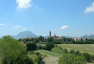
Poggio San Vicino is a comune (municipality) in the Province of Macerata in the Italian region Marche, located about 45 kilometres (28 mi) southwest of Ancona and about 30 kilometres (19 mi) northwest of Macerata. As of 31 December 2004, it had a population of 299 and an area of 12.9 square kilometres (5.0 sq mi). [1]
The comune is a basic administrative division in Italy, roughly equivalent to a township or municipality.
The province of Macerata is a province in the Marche region of Italy. Its capital is the city of Macerata. The province includes 55 comunes in the province, see Comunes of the Province of Macerata. Located between the rivers Potenza (Flosis) and Chienti, both of which originate in the province, the city of Macerata is located on a hill.
Italy, officially the Italian Republic, is a European country consisting of a peninsula delimited by the Italian Alps and surrounded by several islands. Located in the middle of the Mediterranean sea and traversed along its length by the Apennines, Italy has a largely temperate seasonal climate. The country covers an area of 301,340 km2 (116,350 sq mi) and shares open land borders with France, Slovenia, Austria, Switzerland and the enclaved microstates of Vatican City and San Marino. Italy has a territorial exclave in Switzerland (Campione) and a maritime exclave in the Tunisian sea (Lampedusa). With around 60 million inhabitants, Italy is the fourth-most populous member state of the European Union.
Poggio San Vicino borders the following municipalities: Apiro, Cerreto d'Esi, Fabriano, Matelica, Serra San Quirico.
Apiro is a comune (municipality) in the Province of Macerata in the Italian region Marche, located about 40 kilometres (25 mi) southwest of Ancona and about 25 kilometres (16 mi) northwest of Macerata.
Cerreto d'Esi is a comune (municipality) in the Province of Ancona in the Italian region Marche, located about 50 kilometres (31 mi) southwest of Ancona.
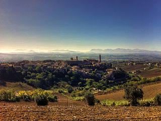
Fabriano is a town and comune of Ancona province in the Italian region of the Marche, at 325 metres (1,066 ft) above sea level. It lies in the Esino valley 44 kilometres (27 mi) upstream and southwest of Jesi; and 15 kilometres (9 mi) east-northeast of Fossato di Vico and 36 kilometres (22 mi) east of Gubbio. Its location on the main highway and rail line from Umbria to the Adriatic make it a mid-sized regional center in the Apennines. Fabriano is the headquarters of the giant appliance maker Indesit.
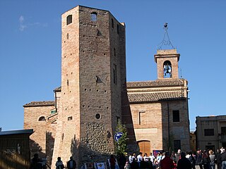
Among the churches is Santa Maria Assunta.
Poggio San Marcello is a comune (municipality) in the Province of Ancona in the Italian region Marche, located about 35 kilometres (22 mi) southwest of Ancona.
Appignano is a comune (municipality) in the Province of Macerata in the Italian region Marche, located about 35 kilometres (22 mi) southwest of Ancona and about 20 kilometres (12 mi) northwest of Macerata.
Belforte del Chienti is a comune (municipality) in the province of Macerata in the Italian region Marche, located about 80 kilometres (50 mi) south of Ancona and about 50 kilometres (31 mi) southeast of Macerata.
Bolognola is a comune (municipality) in the Province of Macerata in the Italian region Marche, located about 70 kilometres (43 mi) southwest of Ancona and about 40 kilometres (25 mi) southwest of Macerata.
Camporotondo di Fiastrone is a comune (municipality) of about 580 inhabitants in the Province of Macerata in the Italian region Marche, located about 60 kilometres (37 mi) southwest of Ancona and about 25 kilometres (16 mi) southwest of Macerata.
Colmurano is a comune (municipality) in the Province of Macerata in the Italian region of Marche, located about 50 kilometres (31 mi) southwest of Ancona and about 15 kilometres (9 mi) southwest of Macerata.
Fiastra is a comune (municipality) in the Province of Macerata in the Italian region Marche, located about 70 kilometres (43 mi) southwest of Ancona and about 40 kilometres (25 mi) southwest of Macerata.
Fiuminata is a comune (municipality) in the Province of Macerata in the Italian region Marche, located about 70 kilometres (43 mi) southwest of Ancona and about 45 kilometres (28 mi) southwest of Macerata. The municipal seat is in the frazione of Massa.
Gagliole is a comune (municipality) in the Province of Macerata in the Italian region Marche, located about 60 kilometres (37 mi) southwest of Ancona and about 30 kilometres (19 mi) west of Macerata.
Matelica is a comune (municipality) of the Province of Macerata in the Italian region of Marche. Located about 60 kilometres (37 mi) southwest of Ancona and 35 kilometres (22 mi) west of Macerata, it extends over an area of 81.04 square kilometres (31.29 sq mi).
Montecassiano is a comune (municipality) in the Province of Macerata in the Italian region Marche, located about 30 kilometres (19 mi) south of Ancona and about 8 kilometres (5 mi) north of Macerata.
Monte San Giusto is a comune (municipality) in the Province of Macerata in the Italian region Marche, located about 45 kilometres (28 mi) south of Ancona and about 14 kilometres (9 mi) southeast of Macerata.
Morrovalle is a comune (municipality) in the Province of Macerata in the Italian region Marche, located about 35 kilometres (22 mi) south of Ancona and about 11 kilometres (7 mi) east of Macerata.
Pollenza is a comune (municipality) in the Province of Macerata in the Italian region Marche, located about 40 kilometres (25 mi) southwest of Ancona and about 9 kilometres (6 mi) southwest of Macerata. As of 31 December 2004, it had a population of 6,086 and an area of 39.5 square kilometres (15.3 sq mi).
Ripe San Ginesio is a comune (municipality) in the Province of Macerata in the Italian region Marche, located about 50 kilometres (31 mi) south of Ancona and about 20 kilometres (12 mi) southwest of Macerata.
San Ginesio is a comune (municipality) in the Province of Macerata in the Italian region Marche, located about 60 kilometres (37 mi) southwest of Ancona and about 25 kilometres (16 mi) southwest of Macerata. As of 31 December 2004, it had a population of 3,872 and an area of 77.7 square kilometres (30.0 sq mi).
Sefro is a comune (municipality) in the Province of Macerata in the Italian region Marche, located about 70 kilometres (43 mi) southwest of Ancona and about 45 kilometres (28 mi) southwest of Macerata. As of 31 December 2004, it had a population of 453 and an area of 42.5 square kilometres (16.4 sq mi).
Poggio San Lorenzo is a comune (municipality) in the Province of Rieti in the Italian region Latium, located about 50 kilometres (31 mi) northeast of Rome and about 15 kilometres (9 mi) south of Rieti.
Torricella in Sabina is a comune (municipality) in the Province of Rieti in the Italian region Latium, located about 50 kilometres (31 mi) northeast of Rome and about 15 kilometres (9 mi) south of Rieti.
This Marche location article is a stub. You can help Wikipedia by expanding it. |