
The Nez Perce are an Indigenous people of the Plateau who still live on a fraction of the lands on the southeastern Columbia River Plateau in the Pacific Northwest. This region has been occupied for at least 11,500 years.

Latah County is a county located in the north central region of the U.S. state of Idaho. As of the 2020 census, the population was 39,517. The county seat and largest city is Moscow, the home of the University of Idaho, the state's flagship university.

Potlatch is a city in the northwest United States, located in north central Idaho in Latah County, about six miles (10 km) east of the border with Washington. On the Palouse north of Moscow, it is served by State Highway 6, and bordered on the northeast by the small community of Onaway. The population of Potlatch was 804 at the 2010 census.
PotlatchDeltic Corporation is an American diversified forest products company based in Spokane, Washington.
The Territory of Washington was an organized incorporated territory of the United States that existed from March 2, 1853, until November 11, 1889, when the territory was admitted to the Union as the State of Washington. It was created from the portion of the Oregon Territory north of the lower Columbia River and north of the 46th parallel east of the Columbia. At its largest extent, it also included the entirety of modern Idaho and parts of Montana and Wyoming, before attaining its final boundaries in 1863.

The Olympic Peninsula is a large arm of land in Western Washington that lies across Puget Sound from Seattle, and contains Olympic National Park. It is bounded on the west by the Pacific Ocean, the north by the Strait of Juan de Fuca, and the east by Hood Canal. Cape Alava, the westernmost point in the contiguous United States, and Cape Flattery, the northwesternmost point, are on the peninsula. Comprising about 3,600 square miles (9,300 km2), the Olympic Peninsula contained many of the last unexplored places in the contiguous United States. It remained largely unmapped until Arthur Dodwell and Theodore Rixon mapped most of its topography and timber resources between 1898 and 1900.

The Coeur d'Alene Resort is a resort hotel in the northwest United States, located in Coeur d’Alene, Idaho. Seated on the north shore of Lake Coeur d'Alene by Tubbs Hill, the resort features a marina, convention facilities, spa, as well as a notable 18-hole golf course.

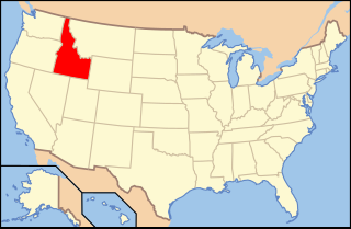
McCroskey State Park—officially Mary Minerva McCroskey State Park—is a public recreation area in the Pacific Northwest of the United States, located in the Palouse region of northern Idaho. The park's 5,300 acres stretch along a ridge in Latah and Benewah Counties, along the border with Washington.

State Route 272 (SR 272) is a 19.22-mile (30.93 km) long state highway serving Whitman County in the U.S. state of Washington. The highway travels from U.S. Route 195 (US 195) in Colfax to a short concurrency with parent route SR 27 in Palouse before ending at the Idaho state line and becoming Idaho State Highway 6 (SH-6). Prior to 1964, the highway was split between Secondary State Highway 3F (SSH 3F) from Colfax to Palouse and a branch of Primary State Highway 3 (PSH 3) from Palouse to the Idaho state line.
The following is an alphabetical list of articles related to the U.S. state of Idaho.

State Highway 6 (SH-6) is a state highway in northern Idaho running from the Washington state line near Potlatch to Santa. It is 40.645 miles (65.41 km) in length and generally runs southwest to northeast

State Highway 9 (SH-9) is a 13.522-mile (21.762 km) state highway in Latah County, Idaho, United States. It connects SH-8 just west of Deary with SH-6 near Harvard.

The economy of the Spokane metropolitan area plays a vital role as the hub for the commercial, manufacturing, and transportation center as well as the medical, shopping, and entertainment hub of the 80,000 square miles (210,000 km2) Inland Northwest region. Although the two have opted not to merge into a single Metropolitan Statistical Area (MSA) yet, the Coeur d'Alene MSA has been combined by the Census Bureau into the Spokane–Coeur d'Alene combined statistical area (CSA). The CSA comprises the Spokane metropolitan area and the Coeur d'Alene metropolitan area anchored by Coeur d'Alene, Idaho. According to the U.S. Bureau of Labor Statistics, the Spokane metropolitan area has a workforce of about 287,000 people and an unemployment rate of 5.3 percent as of February 2020; the largest sectors for non–farm employment are education and health services, trade, transportation, and utilities, and government. The Coeur d'Alene metropolitan area has a workforce of 80,000 people and an unemployment rate of 6.8% as of June 2020; the largest sectors for non-farm employment are trade, transportation, and utilities, government, and education and health services as well as leisure and hospitality. In 2017, the Spokane–Spokane Valley metropolitan area had a gross metropolitan product of $25.5 billion while the Coeur d'Alene metropolitan area was $5.93 billion.

Potlatch State Park is a 57-acre (23 ha) Washington state park located on Hood Canal near the town of Potlatch in Mason County. The park offers camping, hiking, boating, fishing, shellfish harvesting, beachcombing, and sailboarding.

The Clearwater River is in the northwestern United States, in north central Idaho. Its length is 74.8 miles (120.4 km), it flows westward from the Bitterroot Mountains along the Idaho-Montana border, and joins the Snake River at Lewiston. In October 1805, the Lewis and Clark Expedition descended the Clearwater River in dugout canoes, putting in at "Canoe Camp," five miles (8 km) downstream from Orofino; they reached the Columbia Bar and the Pacific Ocean about six weeks later.

The Potlatch River is in the state of Idaho in the United States. About 56 miles (90 km) long, it is the lowermost major tributary to the Clearwater River, a tributary of the Snake River that is in turn a tributary of the Columbia River. Once surrounded by arid grasslands of the Columbia Plateau adjacent to the western foothills of the Rocky Mountains, the Potlatch today is used mainly for agriculture and irrigation purposes.
The Hoodoo Mountains are a mountain range in the northwest United States, in north central Idaho. They are part of the Clearwater Mountains and are the source of the Potlatch and Palouse rivers. Located in northeastern Latah County and southeastern Benewah County, the high point is Bald Mountain at 5,334 feet (1,626 m) above sea level. On the west slope of the northern Rocky Mountains, the Hoodoos transition into the adjoining Palouse region, to the southwest.
North–South Ski Bowl was a modest ski area in the western United States, located in northern Idaho in the Hoodoo Mountains of southern Benewah County.
Clarence Ferris White was a prolific architect in the Pacific Northwest. He designed more than 1,100 buildings, including 63 schools, in the State of Washington. His largest project was the design of the company town of Potlatch, Idaho in 1905. Several of his works are listed on the United States National Register of Historic Places.

The Washington, Idaho and Montana Railway is a short-line railroad in the northwest United States, described as "a single-track standard gauge steam railroad" that runs between Bovill, Idaho and Palouse, Washington. Construction began 120 years ago in May 1905 by the Potlatch Lumber Company as a logging railroad, but it also carried other freight, passengers, and mail. By the end of that year, twenty miles (32 km) of track had been laid, and by the end of 1906, the track reached Bovill.