Vladikavkaz, formerly known as Ordzhonikidze (Орджоники́дзе) and Dzaudzhikau (Дзауджика́у), is the capital city of the Republic of North Ossetia-Alania, Russia. It is located in the southeast of the republic at the foothills of the Caucasus Mountains, situated on the Terek River. Population: 311,693 (2010 Census); 315,068 (2002 Census); 300,198 (1989 Census). Vladikavkaz is one of the most populous cities in the North Caucasus.
Kirovsky District is the name of several administrative and municipal divisions in Russia. The districts are generally named for Sergey Kirov, a Soviet statesman.

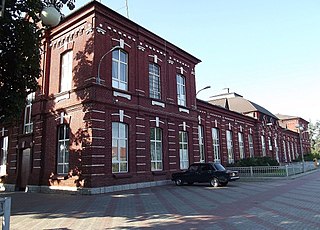
Mozdok is a town and the administrative center of Mozdoksky District of North Ossetia – Alania, Russia, located on the left shore of the Terek River, 92 kilometers (57 mi) north of the republic's capital Vladikavkaz. As of the 2010 Census, its population was 38,768.
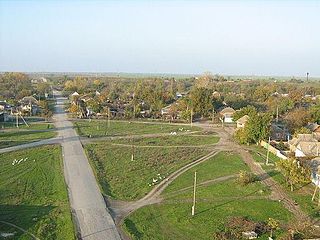
Beslan is a town and the administrative center of Pravoberezhny District of the Republic of North Ossetia-Alania, Russia, located about 29 kilometers (18 mi) north of the republic's capital Vladikavkaz, close to the border with the Republic of Ingushetia. As of the 2010 Census, its population was 36,728, making it the third largest town in the republic behind Vladikavkaz and Mozdok.

Ardon is a town and the administrative center of Ardonsky District in the Republic of North Ossetia-Alania, Russia, located in the center of the republic on the west bank of the Ardon River, 39 kilometers (24 mi) northwest of the republic's capital Vladikavkaz. As of the 2010 Census, its population was 18,774.

Prigorodny District is an administrative and municipal district (raion), one of the eight in the Republic of North Ossetia–Alania, Russia. It is located in the east of the republic. The area of the district is 1,460 square kilometers (560 sq mi). Its administrative center is the rural locality of Oktyabrskoye. Population: 108,665 (2010 Census); 102,990 ; 75,017 (1989 Census). The population of Oktyabrskoye accounts for 9.6% of the district's total population.
Alagir is an industrial town and the administrative center of Alagirsky District in the Republic of North Ossetia-Alania, Russia, located on the west bank of the Ardon River, 54 kilometers (34 mi) west of the republic's capital Vladikavkaz. As of the 2010 Census, its population was 20,949.
Pravoberezhny District is the name of several administrative and municipal districts in Russia. The name literally means "located on the right bank".

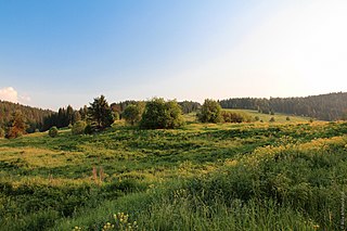
Alagirsky District is an administrative and municipal district (raion), one of the eight in the Republic of North Ossetia–Alania, Russia. It is located in the central and southern parts of the republic along the Russian border with South Ossetia/Georgia. The area of the district is 2,135 square kilometers (824 sq mi). Its administrative center is the town of Alagir. Population: 38,830 (2010 Census); 38,581 ; 39,048 (1989 Census). The population of Alagir accounts for 54.0% of the district's total population.
Mozdoksky District is an administrative and municipal district (raion), one of the eight in the Republic of North Ossetia–Alania, Russia. It is located in the north of the republic. The area of the district is 1,080 square kilometers (420 sq mi). Its administrative center is the town of Mozdok. Population: 84,682 (2010 Census); 88,634 ; 77,063 (1989 Census). The population of Mozdok accounts for 45.8% of the district's total population.
Ardonsky District is an administrative and municipal district (raion), one of the eight in the Republic of North Ossetia–Alania, Russia. It is located in the center of the republic. The area of the district is 376.5 square kilometers (145.4 sq mi). Its administrative center is the town of Ardon. Population: 30,685 (2010 Census); 28,831 ; 22,725 (1989 Census). The population of Ardon accounts for 61.2% of the district's total population.

Digorsky District is an administrative and municipal district (raion), one of the eight in the Republic of North Ossetia–Alania, Russia. It is located in the west of the republic. The area of the district is 640 square kilometers (250 sq mi). Its administrative center is the town of Digora. Population: 19,334 (2010 Census); 20,625 ; 19,328 (1989 Census). The population of Digora accounts for 56.1% of the district's total population.

Irafsky District is an administrative and municipal district (raion), one of the eight in the Republic of North Ossetia–Alania, Russia. It is located in the west of the republic. The area of the district is 1,376 square kilometers (531 sq mi). Its administrative center is the rural locality of Chikola. Population: 15,766 (2010 Census); 15,708 ; 15,732 (1989 Census). The population of Chikola accounts for 44.5% of the district's total population.

Kirovsky District is an administrative and municipal district (raion), one of the eight in the Republic of North Ossetia–Alania, Russia. It is located in the north of the republic. The area of the district is 411 square kilometers (159 sq mi). Its administrative center is the rural locality of Elkhotovo. Population: 27,807 (2010 Census); 26,571 ; 19,954 (1989 Census). The population of Elkhotovo accounts for 45.4% of the district's total population.

Pravoberezhny District is an administrative and municipal district (raion), one of the eight in the Republic of North Ossetia–Alania, Russia. It is located in the north of the republic. The area of the district is 441.29 square kilometers (170.38 sq mi). Its administrative center is the town of Beslan. Population: 57,063 (2010 Census); 55,685 ; 49,314 (1989 Census). The population of Beslan accounts for 64.4% of the district's total population.
Digora is a town and the administrative center of Digorsky District of the Republic of North Ossetia–Alania, Russia, located on the Ursdon River, 49 kilometers (30 mi) northwest of the republic's capital Vladikavkaz. As of the 2010 Census, its population was 10,856.
Zavodskoy is an urban locality under the administrative jurisdiction of Promyshlenny City District of the town of republican significance of Vladikavkaz, the Republic of North Ossetia-Alania, Russia. Population: 16,792 (2010 Census); 14,574 (2002 Census); 11,260 (1989 Census).
Chikola is a rural locality and the administrative center of Irafsky District of the Republic of North Ossetia–Alania, Russia. Population: 7,017 (2010 Census); 7,017 (2002 Census); 6,723 (1989 Census).
Elkhotovo is a rural locality and the administrative center of Kirovsky District of the Republic of North Ossetia–Alania, Russia. Population: 12,626 (2010 Census); 12,208 (2002 Census); 8,574 (1989 Census).
Oktyabrskoye is a rural locality and the administrative center of Prigorodny District of the Republic of North Ossetia–Alania, Russia. Population: 10,436 (2010 Census); 10,575 (2002 Census); 10,171 (1989 Census).