Related Research Articles

Pulau Tekong, also known colloquially as Tekong or Tekong Island, is the second-largest of Singapore's outlying islands after Jurong Island. Tekong is located off Singapore's northeastern coast, east of Pulau Ubin. Since the 1990s, the island has been used by the Singapore Armed Forces (SAF) and is generally restricted from public access. Transport to the island for permitted persons is via the SAF Changi Ferry Terminal at Changi Beach.

The Central Region is one of the five regions in the city-state of Singapore and the main metropolitan region surrounding the Central Area. Comprising 13,150 hectares of land area, it includes 11 planning areas within the Central Area, as well as another 11 more outside it. The region is home to many of Singapore's national monuments as it was historically the site where the city was first founded and the country's only UNESCO World Heritage Site, the Singapore Botanic Gardens, a 165-year-old tropical garden is also located in the region.

Pulau Ubin, also simply known as Ubin, is an island situated in the north east of Singapore, to the west of Pulau Tekong. The granite quarry used to be supported by a few thousand settlers on Pulau Ubin in the 1960s, but only about 40 villagers remained as of 2012. It is one of the last rural areas to be found in Singapore, with an abundance of natural flora and fauna. The island forms part of the Ubin–Khatib Important Bird Area (IBA), identified as such by BirdLife International because it supports significant numbers of visiting and resident birds, some of which are threatened. Today, the island is managed by the National Parks Board, compared to 12 agencies managing different areas of the island previously.
Seletar is an area located in the north-east of Singapore. Its name can also refer to the Seletar Planning Area, situated in the North-East Region of Singapore. The place name was derived from the Malay subgroup who were indigenous to the area, the Orang Seletar. It shares boundaries with the planning areas of Sengkang to the south, Punggol to the east, Yishun and Simpang to the west, as well as the Straits of Johor to the north.

Tanjong Chek Jawa is a cape and the name of its 100-hectare wetlands located on the south-eastern tip of Pulau Ubin, an island off the north-eastern coast of the main island of Singapore. Chek Jawa is among the last few places left in Singapore with a natural rocky shore.
The Nature Society (Singapore) (NSS) is a non-government, non-profit organisation centered towards the preservation and appreciation of Singapore's natural heritage, as well as that of the surrounding region. Run by volunteers, the NSS depends financially on its members' contributions as well as companies, institutions and individuals.

Changi Village is a modern village situated at the northern tip of Changi which is at the eastern end of Singapore. It is the usual connecting point for travellers heading to Pulau Ubin or Malaysia by ferry. Fishermen in the kelongs located in the Serangoon Harbour offshore also use this jetty as a drop off point to come onto mainland. Changi Village also has many resorts and leisure facilities to cater for a weekend getaway for many Singaporeans. The area is classified by Urban Redevelopment Authorities as under the planning area of Changi and in the subzone of Changi Point. It is also classified under District 17 for property indexing.

Urban planning in Singapore is the direction of infrastructure development in Singapore. It is done through a three-tiered planning framework, consisting of a long-term plan to plot out Singapore's development over at least 50 years, a Master Plan for the medium term, and short-term plans, the first two of which are prepared by the Urban Redevelopment Authority (URA) and the last by multiple agencies.

The Singapore Green Plan (SGP) was created in 1992 to ensure that the economic growth model of Singapore does not compromise the environment. The SGP sets out the strategies, programs and targets for Singapore to maintain a quality living environment while pursuing economic prosperity. The focus areas in the SGP are led by a main coordinating committee and respective action program committees. Since 1992, the SGP has been continuously updated to ensure its relevance, releasing SGP 2012 in 2002 and SGP 2030 in 2021. The United Nations (UN) Sustainable Development Goals (SDG) are correlated or mapped to the SGP.

The Southern Islands is a planning area consisting of a collection of islets located within the Central Region of Singapore, once home to the native Malay islanders and sea nomads before they were relocated to the mainland for urban redevelopment and future use. The islands that form the planning area are Kusu Island, Lazarus Island, Pulau Seringat, Pulau Tekukor, Saint John's Island, Sentosa and the two Sisters' Islands. The islands encompass a total land area of about 5.58 square kilometres (2.15 sq mi). The Sentosa Development Corporation oversaw the development and maintenance of these offshore islands south of Singapore from 1976 to March 2017, when it handed it back to the Singapore Land Authority.

This article shows the notable future developments in Singapore. Most of them are currently under construction with most to be completed within the next five years.

The North-East Region of Singapore is one of the five regions in the country. The region is the most densely populated and has the highest population among the five, with Sengkang being its most populous town as of 2020 and Seletar as the regional centre. Comprising 13,810 hectares, it includes seven planning areas and is largely a residential region with 217,120 homes. Housing largely consists of high-density HDB public housing estates, however private housing is also present in the region. As its name implies, it is located in the north-eastern part of Singapore.
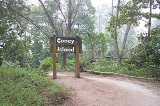
Coney Island, alternatively known as Pulau Serangoon, is a 133-hectare island located off the northeastern coast of Singapore within the town of Punggol, between Pulau Ubin to its northeast and the mainland to its southwest.
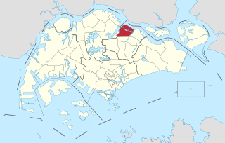
The North-Eastern Islands is a planning area and a group of islands located within the North-East Region of Singapore. The cluster is made up of three islands, namely Pulau Tekong, Pulau Tekong Kechil and Pulau Ubin. Pulau Tekong and Pulau Tekong Kechil was formerly home to 10 villages while Pulau Ubin was home to a number of granite quarries. At present, Pulau Tekong houses the Singapore Armed Forces Basic Military Training Centre while Pulau Ubin is one of the last areas in Singapore that has been preserved from urban development, concrete buildings and tarmac roads.

Serangoon Harbour is a harbour in Singapore located between the mainland island of Singapore and Pulau Ubin.

The Southern Ridges comprise 10 kilometres (6.2 mi) of trails connecting three parks along the southern ridge of Singapore. Some of the attractions along these trails include its greenery and the connecting bridges. This project linked up the parks between the Kent Ridge Park and HarbourFront. The idea to link these parks was coined in 2002 by Urban Redevelopment Authority (URA) and it took 2 years to complete and cost S$25.5 million.

Jurong Lake District (JLD) is a district of Singapore, planned as part of Urban Redevelopment Authority (URA)’s decentralisation efforts to bring more quality jobs, amenities, and recreational options closer to homes. The plans for the district have continued to evolve since the blueprint was first unveiled in the URA Master Plan 2008. It consists of three precincts, namely Jurong Gateway, Lakeside and Lakeside Gateway. It is 472 hectares (4,720,000 m2) in size and served by two major expressways and three MRT stations. It is planned to be Singapore's next central business district. In June 2023, a white site 6.5 hectares (ha) in size was released for sale to kick-start development of the largest commercial district outside Singapore’s city centre.
Ketam Mountain Bike Park is a mountain bike trail located in Pulau Ubin, Singapore.

The German Girl Shrine is a shrine on the island of Pulau Ubin in Singapore. It marks the site of the burial of an unknown 18-year-old girl who died on the island in 1914 after falling from a cliff while fleeing from British forces who sought to detain a number of German nationals then resident on the island. Her body was recovered and interred in an urn on the site by Chinese workers, and a makeshift shrine structure was built. The site was visited frequently by gamblers who thought the spirit of the girl would bring them good luck. A permanent structure was erected in 1974 by a company carrying out quarrying on the island. Quarrying has since ceased, and the shrine is now within Ketam Mountain Bike Park. Visitors often leave offerings, including makeup and Barbie dolls, at the site.

The Chek Jawa Visitor Centre, also known as House No. 1, is a visitor centre and former holiday home on Pulau Ubin, Singapore. It is believed to be the last remaining authentic Tudor-style building in the country.
References
- ↑ Pulau Ubin Archived 2012-03-02 at the Wayback Machine , National Parks Board Factsheet, 10 July 2008. Retrieved 3 June 2009.
- ↑ Concept Plan 2001, Urban Redevelopment Authority. Retrieved 3 June 2009.