Chhattisgarhi is an Indo-Aryan language spoken by 18 million people in the Indian state of Chhattisgarh. It is an Eastern Hindi language and is closely related to Awadhi and Bagheli.
The Rakasganda Fall is a tourist spot situated in Balrampur district, Chhattisgarh, India. This fall is on Rihand River, and it is around 150.0 km (93.2 mi) from Ambikapur and around 60.0 km (37.3 mi) from Wadraf Nagar, which is a small city and tehsil located amidst dense forest. Many transport buses are available, from Ambikapur and Wadraf Nagar, to reach Balangi, the last village before Rakasganda. From Balangi four-wheelers or two-wheelers can be hired to reach Rakasganda. The best time to see Rakasganda is around April – June.
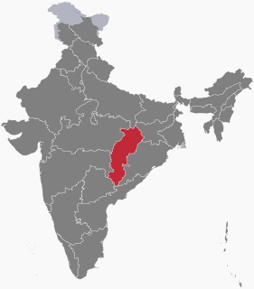
Balarampur or Balrampur may refer to the following places:
Surguja Lok Sabha constituency is one of the eleven Lok Sabha (parliamentary) constituencies in Chhattisgarh state in central India.
The Kanhar River is a tributary of the Son River and flows through the India states of Chhattisgarh, Jharkhand and Uttar Pradesh.

Sarguja University is a state university located in Ambikapur, Chhattisgarh, India. It is a teaching-cum-affiliating university which affiliates 75 college and has 7 departments and 1 constituent college. It was established and incorporated by Chhattisgarh Vishwavidyalaya Adhiniyam No. 18 of 2008 on September 2, 2008. The territorial jurisdiction of the University extends to the entire Sarguja division comprising five revenue districts: Korea, Sarguja, Jashpur, Surajpur and Balrampur. The University was established to serve the society through dissemination of knowledge in all the disciplines.

Vinod Kumar Choubey, KC was an Indian Police Service officer of 1998 batch who was killed in an encounter with naxalites in the Rajnandgaon ambush on July 2009. Choubey was posthumously awarded with peacetime gallantry award Kirti Chakra.

Bemetara district is a new district in the state of Chhattisgarh, India.

Surajpur is a district of the State of Chhattisgarh in central India, with its administrative headquarters at Surajpur. National Highway 43 passes through Surajpur district. Surajpur was declared a district on 15 August 2011 by the state Chief Minister Dr. Raman Singh along with eight other new districts. Surajpur is the first district to receive National Satyan Maitra Literacy Award. The district is known for its market and other major tourist places of Chhattisgarh with Tamor Pingla Wildlife Sanctuary.

Shankargarh is one of the administrative blocks of Balrampur district, Chhattisgarh state, India.
Ramchandrapur is an administrative block/Tehsil/Taluka of Balrampur district, in the Indian state of Chhattisgarh.
Wadrafnagar is one of the administrative blocks of Balrampur district, Chhattisgarh, India. It borders the states Uttar Pradesh and Madhya Pradesh.
Tourism in Chhattisgarh refers to tourism in Indian state of Chhattisgarh. It is India's 10th largest state and situated in the heart of India, is endowed with a rich cultural heritage and attractive natural diversity. The state has many ancient monuments, rare wildlife, exquisitely carved temples, Buddhist sites, palaces, water falls, caves, rock paintings and hill plateaus. Most of these sites are untouched and unexplored and offer a unique and alternate experience to tourists, compared to traditional destinations which have become overcrowded. For tourists who are tired of the crowds at major destinations will like the Bastar district, with its unique cultural and ecological identity. The green state of Chhattisgarh has 41.33% of its area under forests and is one of the richest bio-diversity areas in the country.
The following outline is provided as an overview of and topical guide to Chhattisgarh:
Ramanujganj Vidhan Sabha constituency is one of the 90 Vidhan Sabha constituencies of Chhattisgarh state in central India.
Samri Vidhan Sabha constituency is one of the 90 Vidhan Sabha constituencies of Chhattisgarh state in central India.


