
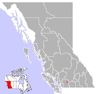
Pender Island is one of the Southern Gulf Islands located in the Gulf of Georgia, British Columbia, Canada. Pender Island is approximately 34 km2 (13 sq mi) in area and is home to about 2,250 permanent residents, as well as a large seasonal population. Like most of the rest of the Southern Gulf Islands, Pender Island enjoys a sub-Mediterranean climate and features open farmland, rolling forested hills, several lakes and small mountains, as well as many coves and beaches.
Spuzzum is an unincorporated settlement in British Columbia, Canada. Because it is on the Trans-Canada Highway, approximately 50 kilometres (31 mi) north of the community of Hope, it is often referred to as being "beyond Hope". Spuzzum was immortalized in the early 1980s by the band "Six Cylinder" in a song with the refrain "If you haven't been to Spuzzum, you ain't been anywhere."
The Cariboo Regional District spans the Cities and Districts of Quesnel, Williams Lake, 100 Mile House, and Wells in the Central Interior of British Columbia.

The Musqueam Indian Band is a First Nations band government in the Canadian province of British Columbia and is the only First Nations band whose reserve community lies within the boundaries of the City of Vancouver.

Keremeos is a village in the Southern Interior of British Columbia, Canada. The name originated from the Similkameen dialect of the Okanagan language word "Keremeyeus" meaning "creek which cuts its way through the flats" referring to Keremeos Creek which flows down from the Upper Benchlands to the Similkameen River that runs by the village. Local legend claims the name means "the meeting of the winds" and joke that the only time it's calm is when the wind blows equally from all four directions. Residents often abbreviate Keremeos as 'K Town', though this nickname is also commonly used to refer to nearby Kelowna and sometimes Kamloops as well.
The Williams Lake Indian Band is a First Nations government of the Secwepemc (Shuswap) Nation, located in the Cariboo region of the Central Interior region of the Canadian province of British Columbia, at the city of Williams Lake. It was created when the government of the then-Colony of British Columbia established an Indian Reserve system in the 1860s. It is a member government of the Northern Shuswap Tribal Council. Its main Indian Reserve is Williams Lake Indian Reserve No. 1, a.k.a. "Sugarcane" or "The Cane" or "SCB".
The High Bar First Nation is a First Nations government of the Secwepemc (Shuswap) Nation, located in the Fraser Canyon-Cariboo region of the Central Interior of the Canadian province of British Columbia. It was created when the government of the then-Colony of British Columbia established an Indian Reserve system in the 1860s. It is one of three Secwepemc bands that is not a member of either the Shuswap Nation Tribal Council or the Northern Shuswap Tribal Council. The High Bar people are also partly Tsilhqot'in and have links with some Chilcotin First Nations.
The Kluskus First Nation is the band government of the Lhoosk’uz, a Dakelh people whose main reserve located on the Chilcotin Plateau 130 km west of the city of Quesnel, British Columbia, Canada. The First Nation is a member of the Carrier-Chilcotin Tribal Council, which includes both Tsilhqot'in and Carrier (Dakelh) communities.
The Red Bluff First Nation is a Dakelh First Nations government located in the northern Fraser Canyon region of the Canadian province of British Columbia. It is a member of the Carrier-Chilcotin Tribal Council, which includes both Tsilhqot'in and Carrier (Dakelh) communities.

The Seton Lake First Nation, a.k.a. the Seton Lake Indian Band, is a First Nations government located in the Central Interior-Fraser Canyon region of the Canadian province of British Columbia. It is a member of the Lillooet Tribal Council, which is the largest grouping of band governments of the St'at'imc people. Other St'at'imc governments include the smaller In-SHUCK-ch Nation on the lower Lillooet River to the southwest, and the independent N'quatqua First Nation at the farther end of Anderson Lake from Seton Portage, which is the location of three of the band's reserve communities.

The Lil'wat First Nation, a.k.a. the Lil'wat Nation or the Mount Currie Indian Band, is a First Nation band government located in the southern Coast Mountains region of the Interior of the Canadian province of British Columbia. It is a member of the Lillooet Tribal Council, which is the largest grouping of band governments of the St'at'imc or Stl'atl'imx people. Other St'at'imc governments include the smaller In-SHUCK-ch Nation on the lower Lillooet River to the southwest, and the independent N'quatqua First Nation at the near end of Anderson Lake from Mount Currie, which is the main reserve of the Lil'wat First Nation, and also one of the largest Indian reserves by population in Canada.
Kanaka Bar is an unincorporated community and locality in the Fraser Canyon region of British Columbia, Canada, located near the town of Lytton. Named for a gold-bearing bar on the Fraser River below, which was mined by Hawaiians, Kanaka Bar is the home of the office and main rancherie of the Kanaka Bar Indian Band of the Nlaka'pamux peoples, and is also the source of the name of Kanaka Bar Indian Reserve No. 1A and Kanaka Bar Indian Reserve No. 2 which are governed by the band.

Tahltan, or Goon-da-chagga or Goon-tdar-shaga is an unincorporated locality and Indian Reserve community of the Tahltan people located west of Telegraph Creek in northern British Columbia, Canada, near the confluence of the Stikine and Tahltan Rivers. The local First Nations government is the Tahltan Band Council. The specific name of the Indian Reserve is Tahltan Indian Reserve No. 1. Other reserves in the immediate vicinity, also governed by this band, are Tahltan Forks Indian Reserve No. 5, Upper Tahltan Indian Reserve No. 4 and Hiusta's Meadow Indian Reserve No. 2.

Fountain Valley, officially named Three Lake Valley and also known as the Fountain Lakes Valley, is a valley and rural community located on the east flank of Fountain Ridge, just east of the town of Lillooet, British Columbia, Canada and immediately south of the Indian Reserve community of Fountain. The valley is historically significant as part of the River Trail, which ran up the length of the Fraser River from Yale to Big Bar and beyond, diverging at various points to connect to trails farther east and with the Old Cariboo Road at Fountain, then known as the Upper Fountains and an important junction and staging-ground for freight wagons and travellers bound northwards to the Cariboo goldfields. The trail through the valley, which developed into a wagon road whose roadgrade is largely used by today's road through the valley, climbs a steep grade from its southern end, near Fountainview Farms on the Fraser, and descends relatively gently towards Fountain. The three lakes in the valley, which give it its official name, are Cinquefoil Lake, Kwotlenemo Lake, and Chilhil Lake, the three of them collectively being known as the Fountain Lakes There are many recreational dwellings and small ranches forming a community in the valley, which is something of a rural "suburb" of Lillooet.
Kyuquot is an unincorporated settlement and First Nations Indian reserve community located on Kyuquot Sound on northwestern Vancouver Island, British Columbia, Canada. Meaning people of Kayukw in the Nuu-chah-nulth language, it is partly the community of the Kyuquot and Cheklesahht peoples, whose band government is the Kyuquot/Cheklesahht First Nation. The site of Kayukw, the original village of the Kyuquot people, is nearby in the form of Kayouk Indian Reserve No. 8, adjacent to which are Kayouk Bluff and Kayouk Creek. The original village site of the Cheklesahht people is the Checkaklis Island Indian Reserve 9 on the island of the same name in the Bunsby Islands in Checleset Bay, which is named for the people, whose name means "people of Checkaklis".
The Simpcw First Nation, formerly known as the North Thompson Indian Band, is a First Nations band government based in the Thompson Country of British Columbia, Canada. It is a member of the Shuswap Nation Tribal Council. It is a First Nations government of the Secwepemc (Shuswap) Nation, located in the Central Interior region of the Canadian province of British Columbia. The band's main community is at Chu Chua, British Columbia. Four of the five First Nation Reserves in Simpcw territory were designated on July 5, 1877 and the fifth was designated on February 24, 1916. The Shuswap language name for North Thompson Band's community and reserve is 'Simpcw'.
Takla Landing, also known as McLaing Landing is an unincorporated locality and former steamboat landing on the east side of Takla Lake in the Omineca Country of the Central Interior of British Columbia, Canada. In the days of the Omineca Gold Rush, Takla Landing was a port for steamboats connecting trails from Hazelton, British Columbia via Babine Lake to trails leading from Takla Landing eastwards to the area of the gold strikes in the lower Omineca River.
Red Bluff is an unincorporated settlement and adjoining Indian Reserve community located just south of Quesnel, British Columbia, Canada. The community includes Quesnel Indian Reserve No. 1, one of the reserves of the Red Bluff First Nation and is generally also referred to as Red Bluff.
Dragon Lake is an unincorporated community just south of Quesnel named after the lake of the same name nearby. It is one of the main commercial areas of Greater Quesnel, including a number of large shopping plazas and major supermarkets and big box stores. The locality includes Dragon Lake Indian Reserve No. 3, one of the Indian Reserves of the Red Bluff First Nation.

The Nlaka'pamux or Nlakapamuk, also previously known as the Thompson, Thompson River Salish, Thompson Salish, Thompson River Indians or Thompson River people, and historically as the Klackarpun, Haukamaugh, Knife Indians and Couteau Indians, are an Indigenous First Nations people of the Interior Salish language group in southern British Columbia. Their traditional territory includes parts of the North Cascades region of Washington.
