
Ruthin is a market town and community in Denbighshire, Wales, in the south of the Vale of Clwyd. It is Denbighshire's county town. The town, castle and St Peter's Square lie on a hill, skirted by villages such as Pwllglas and Rhewl. The name comes from the Welsh rhudd (red) and din (fort), after the colour of sandstone bedrock, from which the castle was built in 1277–1284. The Old Mill, Ruthin, is nearby. Maen Huail, a registered ancient monument associated with King Arthur and with Hueil mab Caw, the brother of the historian Gildas, stands in St Peter's Square.

Denbighshire is a county in the north-east of Wales. It borders the Irish Sea to the north, Flintshire to the east, Wrexham to the southeast, Powys to the south, and Gwynedd and Conwy to the west. Rhyl is the largest town, and Ruthin is the administrative centre. Its borders differ from the historic county of the same name.

Denbighshire, or the County of Denbigh, was one of the thirteen historic counties of Wales, in the north of Wales. It was a maritime county, that was bounded to the north by the Irish Sea, to the east by Flintshire, Cheshire and Shropshire, to the south by Montgomeryshire and Merionethshire, and to the west by Caernarfonshire.

Wrexham Maelor was a local government district with borough status, being one of six districts in the county of Clwyd, north-east Wales, from 1974 to 1996.
Glyndŵr was one of six local government districts in the county of Clwyd in Wales from 1974 to 1996.

The Diocese of Saint Asaph is a diocese of the Church in Wales in north-east Wales, named after Saint Asaph, its second bishop.

Clwyd West was a constituency of the House of Commons of the Parliament of the United Kingdom. It elected one Member of Parliament (MP) by the first past the post method of election. Its last MP was David Jones of the Conservative Party, first elected at the 2005 general election and who also served as Secretary of State for Wales from 4 September 2012 until 14 July 2014.

Llandyrnog is a large village and community in Denbighshire, Wales lying in the valley of the River Clwyd, about 3 miles (4.8 km) from Denbigh and 5 miles (8.0 km) from Ruthin. The village has good road links to Denbigh and the main A541 road at Bodfari, and is served by buses number 76 and 53. The village contains the Church of St. Tyrnog's is a Grade II* listed building, and has a notable creamery on the outskirts and former hospital. The community includes the settlements of Waen, Ffordd-las and Llangwyfan.

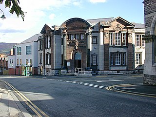
Denbighshire County Council is the unitary local authority for the county of Denbighshire, one of the principal areas of Wales. The council is based at County Hall in Ruthin.
Ceiriog was a rural district in the administrative county of Denbighshire from 1935 to 1974.
Aled was a rural district in the administrative county of Denbighshire, Wales, from 1935 to 1974.

Llanarmon Dyffryn Ceiriog is a village in Wrexham County Borough, Wales. It lies on the River Ceiriog and is at the end of the B4500 road, five miles (8 km) south-west of Glyn Ceiriog and ten miles (16 km) north-west of Oswestry. It is within the Ceiriog Valley ward, Clwyd South Senedd constituency and Clwyd South UK parliamentary constituency. It is in the community of Ceiriog Ucha.

Ceiriog Ucha, also spelled as Ceiriog Uchaf, is a community in Wrexham County Borough, Wales. The community lies in the Ceiriog Valley and comprises the villages of Llanarmon Dyffryn Ceiriog and Tregeiriog as well as surrounding farmland and grouse and pheasant moors. It is a rural district set in low hills. The area is governed by Ceiriog Uchaf Community Council, and had a total population of 346, in 129 households, at the 2001 census. reducing to 317 in 2011.
Hiraethog was a rural district of the administrative county of Denbighshire, Wales, from 1935 to 1974. The district took its name from the historic district of Mynydd Hiraethog.

Llanbedr Dyffryn Clwyd is a small village and community in Denbighshire in Wales, approximately 2 miles north-east of the town of Ruthin on the main A494 road towards Chester.

Llanychan is a parish near Llandyrnog, Denbighshire, Wales. Covering 567 acres (2.29 km2), it is the smallest parish in the diocese of St Asaph. It is approximately three miles north of Ruthin and is bounded to the west by the Afon Clwyd.
The office of High Sheriff of Clwyd was established in 1974 as part of the creation of the county of Clwyd in Wales following the Local Government Act 1972, and effectively replaced the shrievalties of the amalgamated counties of Flintshire and Denbighshire.
Llannerch was a commote in the cantref of Dyffryn Clwyd which later became the Marcher Lordship of Ruthin. Situated in an area south of Ruthin the commote covered an area of 9,000 acres which included the parishes of Llanfair Dyffryn Clwyd and Llanelidan and 19 townships. Much of the land within the commote was owned by the Bishopric of Bangor.

Clwyd East is a constituency of the House of Commons in the UK Parliament, first contested at the 2024 United Kingdom general election, following the 2023 Periodic Review of Westminster constituencies.