Transport in French Guiana consists of transport by road, boat, bus, and airplane. There is a railway line within the Guiana Space Centre to transport spacecraft. The road network is mainly concentrated in the coastal region. The interior of Guiana is accessed by plane or boat. There is one main airport, however there are several smaller airstrips in the interior.

The Oyapock or Oiapoque is a 403-kilometre (250 mi) long river in South America that forms most of the border between the French overseas department of French Guiana and the Brazilian state of Amapá.

Saint-Georges is a commune of French Guiana, an overseas region and department of France located in South America. It lies on the Oyapock River, opposite the Brazilian town of Oiapoque. The town contains a town hall, a French Foreign Legion detachment, and some hotels. Saint-Georges has been one of the three sub-prefectures of French Guiana and the seat of the Arrondissement of Saint-Georges since October 2022.

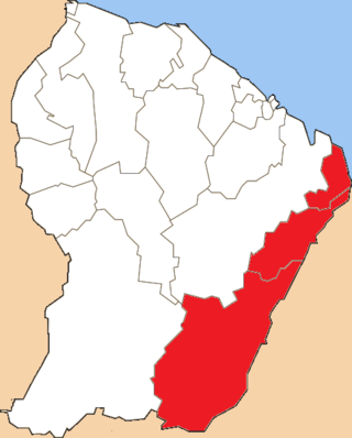
The arrondissement of Cayenne is an arrondissement of France in French Guiana department in French Guiana region. It has 10 communes. Its population is 181,520 (2020), and its area is 17,029 km2 (6,575 sq mi). It is the smallest of the three arrondissements in French Guiana, but also it's most populated.
The following is a list of the 19 former cantons of the French Guiana department, an overseas department of France, sorted by arrondissement. The cantons were abolished in 2015, when the Assembly of French Guiana replaced the General Council of French Guiana and the Regional Council of French Guiana.

Cayenne – Félix Eboué Airport is French Guiana's main international airport. It is located near the commune of Matoury, 13 kilometres (8 mi) southwest of French Guiana's capital city of Cayenne. It is managed by the Chamber of Commerce and Industry of French Guiana.

Articles related to the French overseas department of Guiana(Région Guyane) include:

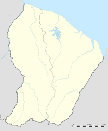
French Guiana is an overseas department/region and single territorial collectivity of France on the northern Atlantic coast of South America in the Guianas. It borders Brazil to the east and south and Suriname to the west.

The Franco-Brazilian Binational Bridge spans the Oyapock River, linking the cities of Oiapoque in Amapá, Brazil and Saint-Georges-de-l'Oyapock in French Guiana, France. The bridge is cable-stayed, with two towers rising to a height of 83 metres (272 ft) and a length of 378 metres (1,240 ft). There are two lanes for vehicles with a total width of 9 metres (30 ft) and a pedestrian sidewalk with a width of 2.50 metres. The vertical clearance under the bridge is 15 metres (49 ft).

Maripasoula Airport is an airport 3.5 km (1.9 NM) north of Maripasoula, a commune in the arrondissement of Saint-Laurent-du-Maroni in French Guiana. It is near the Lawa River, which forms the border between French Guiana and Suriname.

Saint-Yan Airport, also known as Charolais Bourgogne Sud Airport, is an airport in Saint-Yan, a commune of the Saône-et-Loire department in the Burgundy (Bourgogne) region of France. A campus of the École nationale de l'aviation civile is located on the airport.

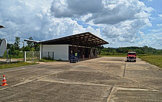
Saül Airport is an airstrip serving Saül, a commune of French Guiana.
Saint-Laurent-du-Maroni Airport is an airport serving Saint-Laurent-du-Maroni, a commune of French Guiana. The city is on the Maroni River, the border with Suriname.
Grand-Santi Airport is an airport serving the Lawa River port of Grand-Santi, a commune of French Guiana. The airport is 1 kilometre (0.62 mi) east of the river, which forms the border with Suriname.
Régina Airport is an airport serving Régina, a commune of French Guiana on the Approuague River. The runway lies along the west side of the village.

BR-156 is a federal highway of Brazil.
Camopi Airport is an airport serving the Oyapock river village of Camopi, French Guiana near the border with Brazil.
The canton of Saint-Georges-de-l'Oyapock is one of the former cantons of the Guyane department in French Guiana. It was located in the arrondissement of Cayenne, and consisted of three communes. Its administrative seat was located in Saint-Georges. Its population was 5,644 in 2012.

Route nationale 2 (RN2) is a highway in French Guiana, an overseas region and department of France in South America. The highway connects Cayenne with Saint-Georges and measures 185 kilometres (115 mi). The highway provides a direct connection to Brazil.