
Salmon River Road in Nova Scotia
Salmon River Road is a community in the Canadian province of Nova Scotia, located in the Cape Breton Regional Municipality on Cape Breton Island.
Salmon River Road is a community in the Canadian province of Nova Scotia, located in the Cape Breton Regional Municipality on Cape Breton Island.

The Gulf of St. Lawrence is the outlet of the North American Great Lakes via the St. Lawrence River into the Atlantic Ocean. The gulf is a semi-enclosed sea, covering an area of about 226,000 square kilometres (87,000 sq mi) and containing about 34,500 cubic kilometres (8,300 cu mi) of water, at an average depth of 152 metres (500 ft).
The Cabot Trail is a scenic highway on Cape Breton Island in Nova Scotia, Canada. It is a 298 km (185 mi) loop around the northern tip of the island, passing along and through the Cape Breton Highlands and the Cape Breton Highlands National Park.

The Chéticamp River is a river on Cape Breton Island, Nova Scotia, located at the western entrance to Cape Breton Highlands National Park which includes Acadian Trail. According to estimates by the Province of Nova Scotia, there are 2,650 people resident within the Chéticamp watershed in 2011.
The Aspy River is a river on northeastern Cape Breton Island which rises in the Cape Breton Highlands and empties into Aspy Bay. The North Aspy follows the ancient Aspy Fault which extends for 40 km inland from the coast and extends along the upper section of the northeast Margaree River. This geological fault is thought to be a part of the Cabot Fault (Newfoundland)/ Great Glen Fault (Scotland) system of Avalonia.
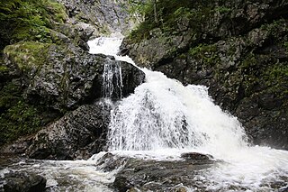
The Baddeck River is a minor river on Cape Breton Island, Nova Scotia, Canada. It empties into the Bras d'Or Lake several kilometres west of the village of Baddeck.
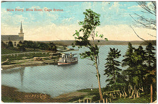
The Mira River is a Canadian river located in eastern Cape Breton Island, Nova Scotia.
The Fleur-de-lis Trail is a scenic roadway located on Nova Scotia's Cape Breton Island. It is approximately 182 km (113 mi) long and runs along the southeastern part of the island through an Acadian region, with a 35 km (22 mi) spur route to and encircling Isle Madame, for a total distance of 217 km (135 mi).
Albert Bridge is a Canadian rural community in Nova Scotia's Cape Breton Regional Municipality.
Coxheath is a community in the Canadian province of Nova Scotia, located north of the Sydney River in the Cape Breton Regional Municipality on Cape Breton Island. The community is home to Riverview Rural High School, a secondary school with approximately 900 students in Grades 10-12 and Coxheath Elementary.
Grand Lake Road is a community in the Canadian province of Nova Scotia, located in the Cape Breton Regional Municipality. The community is a retail service area of Cape Breton hosting the Mayflower Mall and several other outlets. Cape Breton University is also located in the community. The community was also home to 2 schools Lakevale and St. Augustine's Elementary which closed years ago.
Howie Centre is a community in the Canadian province of Nova Scotia, located in the Cape Breton Regional Municipality on Cape Breton Island. The community has a school, Mountainview Elementary, which is a complex with East Bay Elementary.
Enon is a community in the Canadian province of Nova Scotia, located in the Cape Breton Regional Municipality on Cape Breton Island.
Middle Cape is a community in the Canadian province of Nova Scotia, located in the Cape Breton Regional Municipality on Cape Breton Island.
Georges River is a community in the Canadian province of Nova Scotia, located in the Cape Breton Regional Municipality on Cape Breton Island.
Victoria Bridge is a community in the Canadian province of Nova Scotia, located in the Cape Breton Regional Municipality on Cape Breton Island.
Salem Road is a community in the Canadian province of Nova Scotia, located in the Cape Breton Regional Municipality on Cape Breton Island.
French Road is a community in the Canadian province of Nova Scotia, located in the Cape Breton Regional Municipality on Cape Breton Island.
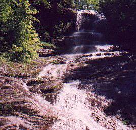
Barra Head is a small community in the Canadian province of Nova Scotia, located in Richmond County on Cape Breton Island. Barra Head surrounds a small inlet called Salmon River, which was the old name for Barra Head being salmon river had to be changed because it was far too common and the post office had trouble locating people.
Framboise River is an estuarine river in Cape Breton Island, Nova Scotia, Canada.
Coordinates: 45°53′52.42″N60°20′7.95″W / 45.8978944°N 60.3355417°W
| | This Cape Breton County, Nova Scotia location article is a stub. You can help Wikipedia by expanding it. |