Belmopan is the capital city of Belize. Its population in 2010 was 16,451. Although the smallest capital city in the continental Americas by population, Belmopan is the third-largest settlement in Belize, behind Belize City and San Ignacio. Founded as a planned community in 1970, Belmopan is one of the newest national capital cities in the world. Since 2000 Belmopan has been one of two settlements in Belize to hold official city status, along with Belize City.

This article is about the demographic features of the population of Belize, including population density, ethnicity, education level, health of the populace, economic status, religious affiliations and other aspects of the population.

Belize City is the largest city in Belize and was once the capital of the former British Honduras. According to the 2010 census, Belize City has a population of 57,169 people in 16,162 households. It is at the mouth of the Haulover Creek, which is a tributary of the Belize River. The Belize River empties into the Caribbean Sea five miles from Belize City on the Philip Goldson Highway on the coast of the Caribbean. The city is the country's principal port and its financial and industrial hub. Cruise ships drop anchor outside the port and are tendered by local citizens. The city was almost entirely destroyed in 1961 when Hurricane Hattie swept ashore on October 31. It was the capital of British Honduras until the government was moved to the new capital of Belmopan in 1970.

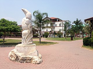
Punta Gorda, known locally as P.G., is the capital and largest town of Toledo District in southern Belize. Punta Gorda is the southernmost sizable town in the nation, with a population of about 5,000 people. Although the town bears a Spanish name, its inhabitants are mostly Kriol/English-speaking, and are primarily of Garifuna, East Indian, Kriol, and Maya descent.

Corozal Town is a town in Belize, capital of Corozal District. Corozal Town is located about 84 miles north of Belize City, and 9 miles from the border with Mexico. The population of Corozal Town, according to the main results of the 2010 census, is 9,871. Corozal was a private estate before becoming a town in the 1840s, mostly settled by Maya Mestizo refugees from the Caste War of Yucatán. Much of the town was built over an ancient Maya city, sometimes known as Santa Rita; this may have been the original Pre-Columbian town called Chetumal. Corozal Town was badly damaged by Hurricane Janet in 1955, and was substantially rebuilt afterwards.

Orange Walk Town is the fourth largest town in Belize, with a population of about 13,400. It is the capital of the Orange Walk District. Orange Walk Town is located on the left bank of the New River, 53 miles (85 km) north of Belize City and 30 miles (48 km) south of Corozal Town.
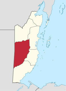
Stann Creek District is a district in the south east region of Belize. According to the 2010 census, the district had a population of 32,166 people. Its capital is the city of Dangriga, formerly known as "Stann Creek Town." Stann comes from "stanns," or safe havens used by colonialists coming from the "old world" to the "new world."

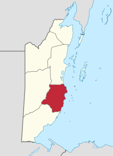
Toledo District is the southernmost district in Belize, and Punta Gorda is the District capital. It is the least developed region in the country, and it features some of the most pristine rainforests, extensive cave networks, coastal lowland plains, and offshore cays. Toledo is home to a wide range of cultures: Mopan and Kekchi Maya, Creole, the Garifuna, East Indians, Mennonites, Mestizos, and descendants of US Confederate settlers.
San Ignacio and Santa Elena are towns in western Belize. San Ignacio serves as the cultural-economic hub of Cayo District. It got its start from mahogany and chicle production during British colonialism. Over time it attracted people from the surrounding areas, which led to the diverse population of the town today. San Ignacio is the largest settlement in Cayo District and the second largest in the country, after Belize City.
Carmelita is a rapidly-expanding village in the Orange Walk District of the nation of Belize. According to the 2010 census, it had a population of 1,474 people. It lies along the New River. Carmelita has the country's only toll booth at the New River bridge on the Northern Highway where the village begins. Beside the bridge lies an access point for boat tours to the Maya historic site, Lamanai.

Chetumal is a city on the east coast of the Yucatán Peninsula in Mexico. It is the capital of the state of Quintana Roo and the municipal seat of the Municipality of Othón P. Blanco. In 2010 it had a population of 151,243 people.

The Maya peoples are an ethnolinguistic group of indigenous peoples of Mesoamerica. They inhabit southern Mexico, Guatemala, Belize, El Salvador and Honduras. The overarching term "Maya" is a collective designation that includes the peoples of the region which share some degree of cultural and linguistic heritage; however, the term embraces many distinct populations, societies and ethnic groups that each have their own particular traditions, cultures and historical identity.
According to the 2010 census, the major languages spoken in Belize include English, Spanish and Kriol, all three spoken by more than 40% of the population. Mayan languages are also spoken in certain areas.
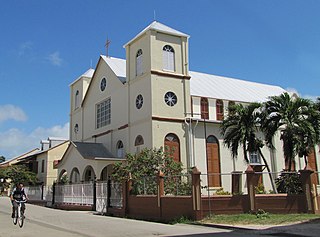
Christianity is the dominant religion in Belize. The single largest denomination is the Roman Catholic Church with about 40.1% of the population, a reduction from 49.6% of the population in 2000, 57.7% in 1991 and 61.9% in 1980, although absolute numbers have still risen. Other major groups include Pentecostal with 8.4% of the population up from 7.4% in 2000 and 6.3% in 1991, Seventh-day Adventists with 5.4% of the population up from 5.2% in 2000 and 4.1% in 1991. The following of the Anglican Church has been steadily declining, with only 4.7% of the population in 2010 compared to 6.95% in 1991. About 12,000 Mennonites live mostly in the rural districts of Cayo and Orange Walk. People who declared they belong to no religion make up 15.5% of the population in 2010, more than double their 2000 census numbers. 11.2% adhere to other religions which include the Maya religion, Afro-American religions, Mormons, Hindus, Buddhists, Muslims, Bahá'ís, Rastafarians and others.
The Mopan people are an indigenous, sub-ethnic group of the Maya peoples. They are native to regions of Belize and Guatemala.

Belizeans are people associated with the country of Belize through citizenship or descent. Belize is a multiethnic country with residents of African, Amerindian, European and Asian descent or any combination of those groups.
The Chinese community in Belize consists of descendants of Chinese immigrants who were brought to British Honduras as indentured laborers as well as recent immigrants from China and Taiwan.

Bullet Tree Falls is a village located along the Mopan River in Cayo District, Belize. It lies approximately five kilometers northwest of San Ignacio. According to the 2010 census, Bullet Tree Falls has a population of 2,124 people in 426 households. The population consists mainly of Spanish-speaking mestizos, Yucatec Maya and some Creoles.
Hispanic Belizeans or Belizean Mestizos are Belizeans of Hispanic and mestizo descent. Currently, they comprise around 52.9% of Belize's population.