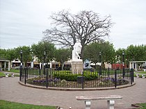
The City of Monte Vista is the home rule municipality that is the most populous municipality in Rio Grande County, Colorado, United States. The city population was 4,247 at the 2020 Census.

San Fernando de la Buena Vista is a city in the Gran Buenos Aires area, in Argentina, and capital of the San Fernando Partido, 20 km (12 mi) north of the city of Buenos Aires.
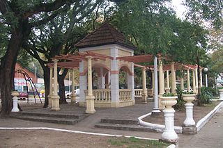
Santos Lugares is a town in the southeast of the partido of Tres de Febrero. It is part of the urban agglomeration of Greater Buenos Aires in Buenos Aires Province, northeast of the Buenos Aires city proper. According to the 2001 census [INDEC], Santos Lugares had 17,023 inhabitants.

La Falda is a town in the province of Córdoba, Argentina, located 79 km (49 mi) from Córdoba and 800 km from Buenos Aires. It had about 15,000 inhabitants at the 2001 census [INDEC].
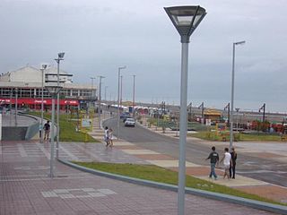
Monte Hermoso is a town located on the Atlantic coast of Argentina, some 100 km (62 mi) east of the city of Bahía Blanca, in the south of the Province of Buenos Aires. It is the administrative seat of the partido of Monte Hermoso.

Famaillá is a city in the province of Tucumán, Argentina, located 30 km south from the provincial capital San Miguel de Tucumán. It has 22,924 inhabitants as per the 2010 census [INDEC], and is the head town of the Famaillá Department.
Monte Caseros is a city in the south-east of the province of Corrientes in the Argentine Mesopotamia. It has about 37,000 inhabitants as of the 2010 census [INDEC]. It is the head town of the department of the same name, which comprises also the municipalities of Colonia Libertad, Juan Pujol and Mocoretá.
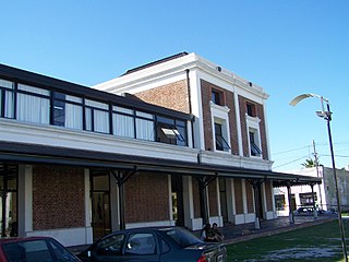
Ensenada is a city and port in Buenos Aires Province, Argentina, located around the Ensenada de Barragán. It has 31,031 inhabitants as per the 2001 census [INDEC]. It is the capital of Ensenada Partido, and together with Berisso Partido they are the main suburbs of the Gran La Plata conurbation around the provincial capital of La Plata.

Monte Grande is a city which forms part of the urban agglomeration of Greater Buenos Aires. It is the administrative seat of Esteban Echeverría Partido in Buenos Aires Province, Argentina.

Olavarría is a city in the province of Buenos Aires, Argentina. It is the administrative seat of the Olavarría Partido and has over 111,320 inhabitants, per the 2010 census [INDEC].

The Punilla Department is an administrative division of the province of Córdoba, Argentina. It has over 155,000 inhabitants, with a population density of almost 60 inhabitants/km2.
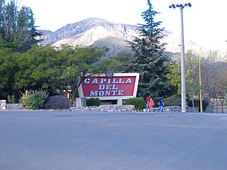
Capilla del Monte is a small city in the northeastern part of the province of Córdoba, Argentina, located by the Sierras Chicas mountain chain, in the northern end of the Punilla Valley. It has about 11,281 inhabitants as per the 2010 census [INDEC].

Burzaco is a city in Almirante Brown Partido, Buenos Aires Province, Argentina. It has an area of 22.77 km2, holds a population of 98,859. It is 27 kilometres from Buenos Aires city, to which it is linked by the Ferrocarril General Roca South. Although there were some farms in the area since at least since the end of the 18th century, Burzaco was first established as a town soon after the arrival of the railway in 1865. The current city is the site of the country's first ever National Flag monument, in Burzaco's main square.
José C. Paz is a city, the capital of José C. Paz Partido, Buenos Aires Province, Argentina. It forms part of the Greater Buenos Aires urban area and is located around 35 km north-west of the Capital federal. It was named after José C. Paz, an Argentine journalist and diplomat.

Belén is a small town in the province of Catamarca, Argentina. It has about 12,000 inhabitants according to the 2001 census [INDEC], and it is the head town of the department of the same name. Belén is the birthplace of Luis Franco.
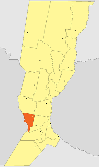
The Belgrano Department is an administrative subdivision (departamento) of the province of Santa Fe, Argentina. It is located in the southwest of the province. It limits with the departments of San Martín (north), San Jerónimo (northeast), Iriondo (east), and Caseros (south); to the west it limits with the province of Córdoba.
Berazategui is a city in Buenos Aires Province, Argentina, located to the south-east of Quilmes. It is the head town of the Berazategui Partido. It is part of the Gran Buenos Aires metropolitan area.

Florencio Varela is a city in Buenos Aires Province, Argentina. It is the administrative centre for Florencio Varela Partido. It forms part of the urban agglomeration of Greater Buenos Aires.
Monte Chingolo is a town in Buenos Aires Province, Argentina. Located in Lanús Partido in the south of the Greater Buenos Aires metropolitan area.
