Prince Edward County is a county located in the Commonwealth of Virginia. As of the 2010 census, the population was 23,368. Its county seat is Farmville.

Appomattox County is a United States county located in the Piedmont region and near the center of the Commonwealth of Virginia. The county is part of the Lynchburg, VA Metropolitan Statistical Area, and its county seat is the town of Appomattox.
Bailey Creek is an 8.6-mile-long (13.8 km) stream in the U.S. state of Virginia. It is a tributary of the James River, rising in Fort Lee east of Petersburg and flowing northeast past the city of Hopewell to reach the James River 2 miles (3 km) southeast of the mouth of the Appomattox River.
Buffalo Creek is a 21.1-mile-long (34.0 km) tributary of the Appomattox River in the U.S. state of Virginia. Flowing entirely through Prince Edward County, it joins the Appomattox River at Farmville.
Cabin Creek is a 4.8-mile-long (7.7 km) stream in the U.S. state of Virginia. It is a tributary of the Appomattox River. It rises in Fort Lee and flows north into the western side of the city of Hopewell, reaching the Appomattox River 3 miles (5 km) upstream of that river's confluence with the James River.
The Conway River is a 14.4-mile-long (23.2 km) river in the U.S. state of Virginia. Rising near the triple junction of Madison, Greene and Page counties at the crest of Shenandoah National Park, the river flows south, then southeast to the Rapidan River northwest of Burtonville. The river is part of the Rappahannock River watershed.
Deep Creek is a 30.1-mile-long (48.4 km) tributary of the Appomattox River in the U.S. state of Virginia. It rises in Nottoway County northwest of Crewe and flows northeast into Amelia County, joining the Appomattox River 23 miles (37 km) west of Petersburg.
Flat Creek is a 34.0-mile-long (54.7 km) tributary of the Appomattox River in the U.S. state of Virginia. It rises just east of the town of Burkeville in Nottoway County and flows north into Amelia County, then northeast to join the Appomattox River 28 miles (45 km) northwest of Petersburg.
The Little Willis River is a 15.5-mile-long (24.9 km) tributary of the Willis River in the U.S. state of Virginia. It is part of the James River watershed. It rises in Buckingham County and flows east into Cumberland County, joining the Willis River 9 miles (14 km) north of Farmville.
The McClure River is a 17.9-mile-long (28.8 km) tributary of the Russell Fork in the U.S. state of Virginia. It is located in Dickenson County in the southwestern part of the state. Via the Russell Fork, the Levisa Fork, the Big Sandy River, and the Ohio River, it is part of the Mississippi River watershed.
The Middle River is a 70.6-mile-long (113.6 km) river in the U.S. state of Virginia. Flowing entirely within Augusta County, the Middle River joins the North River, which in turn meets the South River at Port Republic to form the South Fork Shenandoah River.
Namozine Creek is a 23.6-mile-long (38.0 km) stream in the U.S. state of Virginia. It is a tributary of the Appomattox River. Rising in Nottoway County 6 miles (10 km) northeast of the town of Blackstone, Namozine Creek forms the boundary between Dinwiddie County to the south and Nottoway and Amelia counties to the north for nearly its entire length. It joins the Appomattox River 13 miles (21 km) west of Petersburg.
The North River is a 7.6-mile-long (12.2 km) tidal river in the U.S. state of Virginia. It is an arm of Mobjack Bay, itself part of Chesapeake Bay. The North River forms the boundary between Mathews and Gloucester counties.
The North River is a 9.3-mile-long (15.0 km) tributary of the Slate River in Buckingham County in the U.S. state of Virginia. It is part of the James River watershed.
The Piney River is a 16.5-mile-long (26.6 km) tributary of the Tye River in the U.S. state of Virginia. It is part of the James River watershed.
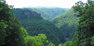
The Russell Fork is a 51.9-mile-long (83.5 km) tributary of the Levisa Fork in southwestern Virginia and southeastern Kentucky in the United States. Known for its whitewater, it rises in the Appalachian Mountains of southwest Virginia, in southern Dickenson County, and flows north through the town of Haysi, Virginia, the Breaks Interstate Park, and the town of Elkhorn City, Kentucky, in Pike County, where it flows into the Levisa Fork which, together with the Tug Fork, form the Big Sandy River.
The Slate River is a 48.8-mile-long (78.5 km) tributary of the James River in the U.S. state of Virginia. It rises about 10 miles (16 km) northeast of Appomattox and flows northeast past Buckingham, eventually reaching the James River near Bremo Bluff. The river's course is entirely within Buckingham County.
The Staunton River is a 4.1-mile-long (6.6 km) stream in the U.S. state of Virginia. Flowing entirely within Shenandoah National Park, it is a tributary of the Rapidan River and part of the Rappahannock River watershed.
Swift Creek is a 44.9-mile-long (72.3 km) river in the U.S. state of Virginia. It rises west of Richmond in Powhatan County and flows southeast, eventually forming the northern boundary of Colonial Heights, where it joins the Appomattox River.


