Sankt Michael im Lungau | |
|---|---|
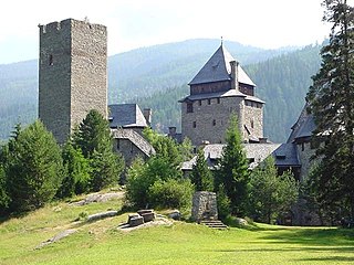
 | |
 Coat of arms | |
 Sankt Michael im Lungau Location within Austria | |
| Coordinates: 47°06′00″N13°38′00″E / 47.10000°N 13.63333°E Coordinates: 47°06′00″N13°38′00″E / 47.10000°N 13.63333°E | |
| Country | Austria |
| State | Salzburg |
| District | Tamsweg |
| Government | |
| • Mayor | Manfred Sampl (ÖVP) |
| Area | |
| • Total | 68.80 km2 (26.56 sq mi) |
| Elevation | 1,075 m (3,527 ft) |
| Population (2018-01-01) [2] | |
| • Total | 3,520 |
| • Density | 51/km2 (130/sq mi) |
| Time zone | UTC+1 (CET) |
| • Summer (DST) | UTC+2 (CEST) |
| Postal code | 5582 |
| Area code | 06477 |
| Vehicle registration | TA |
| Website | www.sankt-michael.at |
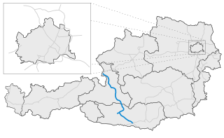
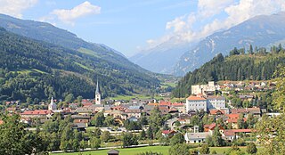
Sankt Michael im Lungau is a market town in the district of Tamsweg in the Austrian state of Salzburg.

Market town or market right is a legal term, originating in the Middle Ages, for a European settlement that has the right to host markets, distinguishing it from a village and city. On the European continent, a town may be correctly described as a "market town" or as having "market rights", even if it no longer holds a market, provided the legal right to do so still exists.
Bezirk Tamsweg is an administrative district (Bezirk) in the federal state of Salzburg, Austria. It is congruent with the Lungau region. The administrative centre of the district is Tamsweg.

Austria, officially the Republic of Austria, is a country in Central Europe comprising 9 federated states. Its capital, largest city and one of nine states is Vienna. Austria has an area of 83,879 km2 (32,386 sq mi), a population of nearly 9 million people and a nominal GDP of $477 billion. It is bordered by the Czech Republic and Germany to the north, Hungary and Slovakia to the east, Slovenia and Italy to the south, and Switzerland and Liechtenstein to the west. The terrain is highly mountainous, lying within the Alps; only 32% of the country is below 500 m (1,640 ft), and its highest point is 3,798 m (12,461 ft). The majority of the population speaks local Bavarian dialects as their native language, and German in its standard form is the country's official language. Other regional languages are Hungarian, Burgenland Croatian, and Slovene.