Sankt Thomas, Austria

Last updated

Sankt Thomas
Wappen at st thomas.png
Coat of arms
Sankt Thomas im Bezirk GR.png
Location in the district
Austria adm location map.svg
Red pog.svg
Sankt Thomas
Location within Austria
Coordinates: 48°17′09″N13°52′55″E / 48.28583°N 13.88194°E / 48.28583; 13.88194 Coordinates: 48°17′09″N13°52′55″E / 48.28583°N 13.88194°E / 48.28583; 13.88194
Country Austria
State Upper Austria
District Grieskirchen
Government
   Mayor Josef Lehner (ÖVP)
Area
[1]
  Total6.08 km2 (2.35 sq mi)
Population
 (2018-01-01) [2]
  Total545
  Density90/km2 (230/sq mi)
Time zone UTC+1 (CET)
  Summer (DST) UTC+2 (CEST)
Postal code
4732
Area code 07277
Vehicle registration GR
Website www.sankt-thomas.at

Sankt Thomas is a municipality in the de:Brunn im Gries district of Upper Austria.

Upper Austria State of Austria

Upper Austria is one of the nine states or Bundesländer of Austria. Its capital is Linz. Upper Austria borders on Germany and the Czech Republic, as well as on the other Austrian states of Lower Austria, Styria, and Salzburg. With an area of 11,982 km2 (4,626 sq mi) and 1.437 million inhabitants, Upper Austria is the fourth-largest Austrian state by land area and the third-largest by population.

Geography

Sankt Thomas lies in the Hausruckviertel. About 10 percent of the municipality is forest, and 82 percent is farmland.

Hausruckviertel geographic region

The Hausruckviertel is an Austrian region belonging to the state of Upper Austria: it is one of four "quarters" of Upper Austria the others being Traunviertel, Mühlviertel, and Innviertel. It is so-called because of the range of hills, the Hausruck, that pass through the region.

Related Research Articles

Sankt Georgen am Fillmannsbach Place in Upper Austria, Austria

St. Georgen am Fillmannsbach, also Sankt Georgen am Fillmannsbach is a municipality in the district of Braunau am Inn in the Austrian state of Upper Austria.

Sankt Johann am Walde Place in Upper Austria, Austria

St. Johann am Walde, also Sankt Johann am Walde is a municipality in the district of Braunau am Inn in the Austrian state of Upper Austria.

Sankt Pantaleon Place in Upper Austria, Austria

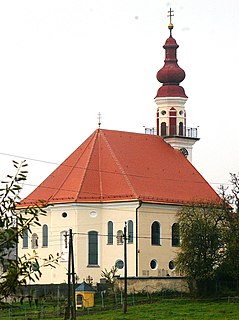
St. Pantaleon, also Sankt Pantaleon is a municipality in the district Braunau am Inn in Upper Austria, Austria. A monument was erected by the riverlet Moosach in memory of the slave workers engaged there in 1940/41 at the Weyer concentration camp.

Sankt Radegund Place in Upper Austria, Austria

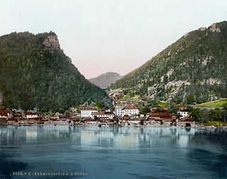
St. Radegund, also Sankt Radegund is a municipality in the district of Braunau am Inn in the Austrian state of Upper Austria, named after Saint Radegund. It is situated at the western rim of the Innviertel region, where the Salzach river forms the border to the German state of Bavaria.

Sankt Veit im Innkreis Place in Upper Austria, Austria

St. Veit im Innkreis, also Sankt Veit im Innkreis is a municipality in the district of Braunau am Inn in the Austrian state of Upper Austria.

Sankt Agatha Place in Upper Austria, Austria

Sankt Agatha is a municipality in the district of Grieskirchen in the Austrian state of Upper Austria.

Sankt Georgen bei Grieskirchen Place in Upper Austria, Austria

Sankt Georgen bei Grieskirchen is a municipality in the district of Grieskirchen in the Austrian state of Upper Austria.

Sankt Pankraz Place in Upper Austria, Austria

Sankt Pankraz is a municipality in the district of Kirchdorf an der Krems in the Austrian state of Upper Austria.

Sankt Georgen am Walde Place in Upper Austria, Austria

Sankt Georgen am Walde is a municipality in the district of Perg in the Austrian state of Upper Austria.

Sankt Nikola an der Donau Place in Upper Austria, Austria

Sankt Nikola an der Donau is a municipality in the district of Perg in the Austrian state of Upper Austria.

Sankt Georgen bei Obernberg am Inn Place in Upper Austria, Austria

Sankt Georgen bei Obernberg am Inn is a municipality in the district of Ried im Innkreis in the Austrian state of Upper Austria.

Sankt Marienkirchen am Hausruck Place in Upper Austria, Austria

Sankt Marienkirchen am Hausruck is a municipality in the district of Ried im Innkreis in the Austrian state of Upper Austria.

Sankt Veit im Mühlkreis Place in Upper Austria, Austria

Sankt Veit im Mühlkreis is a municipality in the district of Rohrbach in the Austrian state of Upper Austria.

Sankt Ulrich im Mühlkreis Place in Upper Austria, Austria

Sankt Ulrich im Mühlkreis is a municipality in the district of Rohrbach in the Austrian state of Upper Austria.

Sankt Peter am Wimberg Place in Upper Austria, Austria

Sankt Peter am Wimberg is a municipality in the district of Rohrbach in the Austrian state of Upper Austria. It is located 173 km from Austria's capital city, Vienna. The municipality also observes Daylight saving time (DST).

Sankt Florian am Inn Place in Upper Austria, Austria

Sankt Florian am Inn is a municipality in the district of Schärding in the Austrian state of Upper Austria.

Sankt Marienkirchen bei Schärding Place in Upper Austria, Austria

Sankt Marienkirchen bei Schärding is a municipality in the district of Schärding in the Austrian state of Upper Austria.

Sankt Roman Place in Upper Austria, Austria

Sankt Roman, officially St. Roman, is a municipality in the district of Schärding in the Austrian state of Upper Austria.

Sankt Willibald Place in Upper Austria, Austria

Sankt Willibald, officially St. Willibald, is a municipality in the district of Schärding in the Austrian state of Upper Austria.

Sankt Lorenz Place in Upper Austria, Austria

Sankt Lorenz is a municipality in the district of Vöcklabruck in the Austrian state of Upper Austria.

References

  1. "Dauersiedlungsraum der Gemeinden Politischen Bezirke und Bundesländer - Gebietsstand 1.1.2018". Statistics Austria. Retrieved 10 March 2019.
  2. "Einwohnerzahl 1.1.2018 nach Gemeinden mit Status, Gebietsstand 1.1.2018". Statistics Austria. Retrieved 9 March 2019.