
Picerno is a town and comune in the province of Potenza, in the Southern Italian region of Basilicata. It is bounded by the comuni of Balvano, Baragiano, Potenza, Ruoti, Savoia di Lucania, Tito, and Vietri di Potenza.

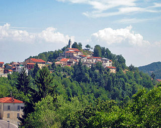
Monastero di Lanzo is a comune (municipality) in the Metropolitan City of Turin in the Italian region Piedmont, located about 35 km northwest of Turin.

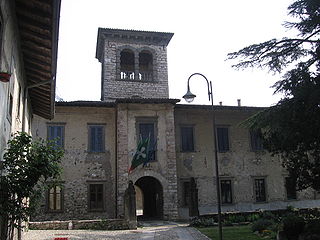
Frabosa Sottana is a comune (municipality) in the Province of Cuneo in the Italian region Piedmont, located about 90 kilometres (56 mi) south of Turin and about 20 kilometres (12 mi) southeast of Cuneo. The economy is based on winter tourism, based on the nearby ski resort of Prato Nevoso.

Margarita is a comune (municipality) in the Province of Cuneo in the Italian region Piedmont, located about 70 kilometres (43 mi) south of Turin and about 11 kilometres (7 mi) east of Cuneo.
Montaldo di Mondovì is a comune (municipality) in the Province of Cuneo in the Italian region Piedmont, located about 80 kilometres (50 mi) south of Turin and about 25 kilometres (16 mi) southeast of Cuneo.
Pianfei is a comune (municipality) in the Province of Cuneo in the Italian region Piedmont, located about 80 kilometres (50 mi) south of Turin and about 13 kilometres (8 mi) east of Cuneo.
Villanova Mondovì is a comune (municipality) in the Province of Cuneo in the Italian region Piedmont, located about 96 kilometres (60 mi) south of Turin and about 20 kilometres (12 mi) east of Cuneo. As of 31 December 2004, it had a population of 5,506 and an area of 28.4 square kilometres (11.0 sq mi).
Pietra Marazzi is a comune (municipality) in the Province of Alessandria in the Italian region Piedmont, located about 80 kilometres (50 mi) east of Turin and about 5 kilometres (3 mi) northeast of Alessandria.

Azzone is a comune (municipality) in the Province of Bergamo in the Italian region of Lombardy, located about 90 kilometres (56 mi) northeast of Milan and about 45 kilometres (28 mi) northeast of Bergamo. As of 31 December 2004, it had a population of 458 and an area of 16.8 square kilometres (6.5 sq mi).

Colzate is a comune (municipality) in the Province of Bergamo in the Italian region of Lombardy, located about 70 kilometres (43 mi) northeast of Milan and about 20 kilometres (12 mi) northeast of Bergamo. As of 31 December 2004, it had a population of 1,638 and an area of 6.7 square kilometres (2.6 sq mi).
Luzzana is a comune (municipality) in the Province of Bergamo in the Italian region of Lombardy, located about 60 kilometres (37 mi) northeast of Milan and about 15 kilometres (9 mi) east of Bergamo. As of 31 December 2004, it had a population of 776 and an area of 3.4 square kilometres (1.3 sq mi).

Misano di Gera d'Adda is a comune (municipality) in the Province of Bergamo in the Italian region of Lombardy, located about 35 kilometres (22 mi) east of Milan and about 25 kilometres (16 mi) south of Bergamo. As of 31 December 2004, it had a population of 2,877 and an area of 6.1 square kilometres (2.4 sq mi).

Villa di Serio is a comune (municipality) in the Province of Bergamo in the Italian region of Lombardy, located about 50 kilometres (31 mi) northeast of Milan and about 6 kilometres (4 mi) northeast of Bergamo. As of 31 December 2004, it had a population of 6,118 and an area of 4.6 square kilometres (1.8 sq mi).

Brallo di Pregola is a comune (municipality) in the Province of Pavia in the Italian region Lombardy, located about 80 km south of Milan and about 50 km south of Pavia. As of 31 December 2004, it had a population of 832 and an area of 46.3 km².
Cergnago is a comune (municipality) in the Province of Pavia in the Italian region Lombardy, located about 45 km southwest of Milan and about 30 km west of Pavia. As of 1 January 2018, it had a population of 719 and an area of 13.6 km².
San Giorgio di Lomellina is a comune (municipality) in the Province of Pavia in the Italian region Lombardy, located about 45 km southwest of Milan and about 30 km west of Pavia. As of 31 December 2004, it had a population of 1,196 and an area of 25.9 km².
Santa Margherita di Staffora is a comune (municipality) in the Province of Pavia in the Italian region Lombardy, located about 80 km south of Milan and about 50 km south of Pavia. As of 31 December 2004, it had a population of 589 and an area of 36.7 km².
Val di Nizza is a comune (municipality) in the Province of Pavia in the Italian region Lombardy, located about 60 km south of Milan and about 35 km south of Pavia. As of 31 December 2004, it had a population of 701 and an area of 29.5 km².
Gorgo al Monticano is a comune (municipality) in the Province of Treviso in the Italian region Veneto, located about 40 kilometres (25 mi) northeast of Venice and about 25 kilometres (16 mi) northeast of Treviso.
Pasian di Prato is a comune (municipality) in the Province of Udine in the Italian region Friuli-Venezia Giulia, located about 70 kilometres (43 mi) northwest of Trieste and about 3 kilometres (2 mi) southwest of Udine.


