Kanpur Nagar district, meaning Urban Kanpur District is one of the districts of the Uttar Pradesh state of India. It is a part of Kanpur division and its district headquarters is Kanpur. Kanpur was formerly spelled Cawnpore.
Goldpan Provincial Park is a provincial park in British Columbia, Canada, on the Trans-Canada Highway between Lytton (W) and Spences Bridge (E), on the Thompson River. The park has camping above the highway and a picnic area and riverfront below.

Lakelse Lake Provincial Park is a provincial park in British Columbia, Canada, located just west of Highway 37 between Terrace and Kitimat. The name is derived from the Coast Tsimshian language word "LaxGyels" - "fresh water mussel", for the mollusk that is found on the bottom of both Lakelse Lake and Lakelse River. Before Lakelse Lake became a provincial park, Hatchery Creek, which runs throughout the park, was the site of a sockeye salmon hatchery operated by the Canadian Government between 1919 and 1936. Lakelse Lake Provincial Park was established on March 16, 1956.
The Okanagan Indian Band is a First Nations government in the Canadian province of British Columbia, located in the city of Vernon in the northern Okanagan Valley. The band is a member government of the Okanagan Nation Alliance.
The Lytton First Nation, a First Nations band government, has its headquarters at Lytton in the Fraser Canyon region of the Canadian province of British Columbia. While it is the largest of all Nlaka'pamux bands, unlike all other governments of the Nlaka'pamux (Thompson) people, it is not a member of any of the three Nlaka'pamux tribal councils, which are the Nicola Tribal Association, the Fraser Canyon Indian Administration and the Nlaka'pamux Nation Tribal Council.
The Kluskus First Nation is the band government of the Lhoosk’uz, a Dakelh people whose main reserve located on the Chilcotin Plateau 130 km west of the city of Quesnel, British Columbia, Canada. The First Nation is a member of the Carrier-Chilcotin Tribal Council, which includes both Tsilhqot'in and Carrier (Dakelh) communities.
The Tlʼesqox First Nation is a Tsilhqotʼin community located west of the Fraser Canyon in the Chilcotin region of the Canadian province of British Columbia. It is a member of the Carrier-Chilcotin Tribal Council, which includes both Tsilhqotʼin and Carrier (Dakelh) communities.
The Tŝideldel First Nation is the band government of the Tsi Del Del subgroup of the Tsilhqot'in people, located in the Chilcotin District in the western Central Interior region of the Canadian province of British Columbia. It is a member of the Tsilhqot'in National Government.
WHKR is a commercial radio station, licensed to Rockledge, Florida, and serving the Space Coast. It is owned by Cumulus Media and broadcasts a country music radio format.
Stoney Demonstration Forest is a state forest located in Aberdeen, Maryland, United States.

Año Nuevo State Marine Conservation Area (SMCA) is one of two adjoining marine protected areas off the coast of San Mateo and Santa Cruz Counties, on California’s central coast. The area is approximately 55 miles south of San Francisco. The SMCA is 11.07 square miles. Except for limited taking of giant kelp, all living marine resources are protected.
N'Dounga is a village and rural commune in Niger. As of 2012, it had a population of 22,341.
Nasrallah, Tunisia is a town and commune in the Kairouan Governorate, Tunisia. As of 2004 it had a population of 5,054.

Pretrešnja is a village in the municipality of Blace, Serbia. According to the 2002 census, the village has a population of 150 people.
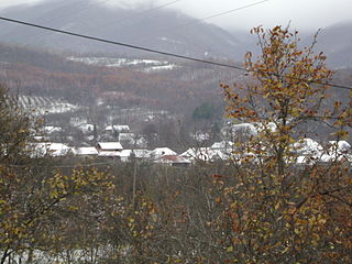
Ravna gora, Haskovo Province is a village in the municipality of Svilengrad, in Haskovo Province, in southern Bulgaria.

Johnsons Glacier is the 1.8 km long and 2.3 km wide glacier on Hurd Peninsula, Livingston Island in the South Shetland Islands, Antarctica bounded by Charrúa Ridge and Charrúa Gap to the north, Napier Peak to the east, Mirador Hill to the southeast, Hurd Ice Cap to the southwest and Mount Reina Sofía to the west. It is draining northwestwards into Johnsons Dock. The glacier provides overland access from the Spanish base Juan Carlos Primero to the interior of the eastern Livingston Island.

Contell Glacier is 1.2 nmi long and 0.4 nautical miles wide glacier on Hurd Peninsula, Livingston Island in the South Shetland Islands, Antarctica bounded by Atlantic Club Ridge to the northwest, Krum Rock to the north, Balkan Snowfield to the northeast, and Charrúa Ridge and Charrúa Gap to the south. It is crescent-shaped, running northwestwards in its upper course, then between Charrúa Ridge and Krum Rock turning west-southwestwards to flow into South Bay north of Johnsons Dock.
Scoresbyøya is an island in the Svalbard archipelago, north of Nordaustlandet. It has an area of about 6 km², and is located in Nordenskiöldbukta, outside the bay of Sabinebukta. The island is named after Arctic explorer William Scoresby. The southern part of the island is dominated by a large lagoon and narrow sand banks.
The Hump is a conspicuous dome-shaped summit on the northern shore of Lapeyrère Bay, northern Anvers Island, in the Palmer Archipelago. The name appears on a chart based on a 1927 survey by Discovery Investigations personnel on the RRS Discovery, but may reflect an earlier naming.

Hossein Abad Metro Station is a metro train station in line 3 of the Tehran Metro. It is located on Mozhdeh Street at Hossein Abad neighbourhood in Northwestern Tehran.


