Don Castro Regional Recreation Area is a regional park located in Hayward, California. It is part of the East Bay Regional Parks system.
Garin Regional Park is a regional park located in Hayward, California, that is part of the East Bay Regional Parks system. It shares a contiguous border with sister park Dry Creek Pioneer Regional Park. The park is the site of the former Garin Ranch, sold by Andrew J. Garin to the district in 1966.

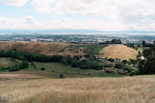
Hayward Regional Shoreline is a regional park located on the shores of the San Francisco Bay in Hayward, California. It is part of the East Bay Regional Parks system. The 1,713 acre park extends to the shores of San Lorenzo. Part of the park is former commercial salt flats purchased in 1996. A former landfill, now capped with soil and plants, is located in the park. The park includes the 250 acre tidal wetland, Cogswell Marsh, and the 364 acre Oro Loma Marsh. Located to the south of the park is the Hayward Shoreline Interpretive Center, which provides information on the Bay shore habitats. The San Francisco Bay Trail runs through the park, which connects the park with San Lorenzo Creek.

Downtown Hayward is the original and current central business district of Hayward, California, United States, and is home to the current Hayward City Hall, along with the two previous city halls, Alex Giualini Plaza and the City Center Building. The Hayward Fault runs through the area, and is the cause of the two previous city halls being taken out of use.

Russell City was an unincorporated community in Alameda County, California, USA, about 10 miles (16 km) south of Oakland in present-day Hayward. The land is at an elevation of 16 feet. The city was named after Frederick James Russell, who laid out the town in 1907. It existed from 1853 until 1964, when the last of the residents were forced out to make way for an industrial park, with such parks dominating the area to this day. During the time the residents fought removal under eminent domain statutes, many of the buildings were destroyed by acts of arson.

Sorenson is an unincorporated community in Alameda County, California. It is located on the Western Pacific Railroad 2 miles (3.2 km) south-southeast of Hayward, at an elevation of 79 feet. The city was named in honor of Harold Sorensen, a landowner who came to Hayward in 1881.
Eden Landing is a former settlement in Alameda County, California. Eden Landing was located west-southwest of Mount Eden. Its site is now located within the corporate limits of Hayward. Eden Landing was established in 1854 by farmers who were dissatisfied with the freight charges at Allen's Landing, which was a quarter of a mile west. The place was bought by Richard Barron in 1855, and renamed Barrons Landing. Henry Louis Petermann and Mary F. Petermann operated their salt works here. Stokes Landing was located east of Eden Landing on Alameda Creek.
Stokes Landing is a ghost town in Alameda County, California, United States. Stokes Landing was located along Alameda Creek east of Eden Landing. The name is in honor of James Johnstone Stokes, who founded the place in 1858. Today the area lies within the city of Hayward, California.

The Hayward Unified School District (HUSD) is a public school district serving the city of Hayward, California, in Alameda County, in the United States. Supervised by the superintendent and the HUSD board of trustees, the district serves about 21,000 students in 30 schools, and employs more than 950 teachers. The current superintendent is Dr. Matt Wayne and the current board of trustees president is Dr. Annette Walker.

The Hayward Area Recreation and Park District (H.A.R.D.) is the park management agency for most of the parks in the city of Hayward, California and environs. It was created in 1944 and is an independent special district under California law. H.A.R.D. is the largest recreation district in California. It manages parks in the bordering city of San Leandro, and the unincorporated regions of Castro Valley and San Lorenzo. It manages the park grounds for numerous schools in the region. Events and classes are scheduled and listed in a quarterly brochure. The parks 2010-2011 budget was $24,383,637.
St. Rose Hospital is an independent, not-for-profit hospital located in Hayward, California. It is a designated cardiac arrest receiving center in the Alameda County emergency medical services system, and provides basic emergency medical services.

Mount Eden Cemetery is a cemetery in Hayward, California, in the former city of Mount Eden. The site was first established in 1860 as a pioneer cemetery. It is still in use. As of 2005, there were 2,821 records (gravesites).

Mount Saint Joseph Cemetery is a cemetery in Hayward, California. The site was first established in 1875. It is operated by the All Saints Catholic Church in Hayward. Many of the historic gravestone inscriptions are in Portuguese. The cemetery borders on Memorial Park.
Kennedy Park is a large, multi-use park in Hayward, California, managed by the Hayward Area Recreation and Park District (HARD). It is the most heavily used park in the district. The park is adjacent to McConaghy Park, which contains McConaghy House, a historic property, built in 1886, and managed as a house museum by HARD and the Hayward Area Historical Society. McConaghy House features Stick/Eastlake architecture. It lies within San Lorenzo. In 2013, plans to renovate the park and combine the park and house into a Victorian-style venue were proposed.

Hayward Area Historical Society (HAHS) is a nonprofit organization dedicated to documenting the history of the city of Hayward, California and adjacent communities. These areas include San Lorenzo, Ashland, Cherryland, Castro Valley, Fairview, the former communities of Russell City, Mount Eden, Schafer Park, and other parts of unincorporated Alameda County. The society was founded in 1956. Their museum in Downtown Hayward closed in 2012. Their new facility opened nearby in 2014.
Mission Hills of Hayward Golf Course is a 9-hole golf course in Hayward, California. It is managed by the Hayward Area Recreation and Park District. It opened in 1999. The course has a pro shop and offers instruction.

Memorial Park, in Hayward, California, is a public park managed by the Hayward Area Recreation and Park District. The park contains an indoor swim center, the Hayward Plunge, which opened in 1936. The park is the access point to the Greenbelt Trails, which follow Ward Creek Canyon adjacent to California State University, East Bay. The park has a small bandstand with musical events offered on major holidays. It borders on Mount Saint Joseph Cemetery.
Leadership Public Schools, Hayward is a charter high school in Hayward, California. Founded in 2005, it is one of four schools in the Leadership Public Schools charter network in the California Bay Area. In 2011, Intel named LPS, Hayward a finalist in mathematics for its Intel Schools of Distinction program.


