Victoria Island is a large island in the Arctic Archipelago that straddles the boundary between Nunavut and the Northwest Territories of Canada. It is the eighth-largest island in the world, and at 217,291 km2 (83,897 sq mi) in area, it is Canada's second-largest island. It is nearly double the size of Newfoundland (111,390 km2 [43,010 sq mi]), and is slightly larger than the island of Great Britain (209,331 km2 [80,823 sq mi]) but smaller than Honshu (225,800 km2 [87,200 sq mi]). The western third of the island lies in the Inuvik Region of the Northwest Territories; the remainder is part of Nunavut's Kitikmeot Region. The population of 2,168 is divided among two settlements, the larger of which is in Nunavut and the other of which is in the Northwest Territories.

Baffin Bay, located between Baffin Island and the west coast of Greenland, is defined by the International Hydrographic Organization as a marginal sea of the Arctic Ocean. It is sometimes considered a sea of the North Atlantic Ocean. It is connected to the Atlantic via Davis Strait and the Labrador Sea. The narrower Nares Strait connects Baffin Bay with the Arctic Ocean. The bay is not navigable most of the year because of the ice cover and high density of floating ice and icebergs in the open areas. However, a polynya of about 80,000 km2 (31,000 sq mi), known as the North Water, opens in summer on the north near Smith Sound. Most of the aquatic life of the bay is concentrated near that region.
The Presidential Range is a mountain range in the Green Mountains of the U.S. state of Vermont. All of the summits of the peaks in the range are located in Addison County but the eastern slopes in the northern part of the range extend into Washington County. The major peaks in the range are named for several U.S. presidents from the period of the American Civil War through World War I.

Peconic County is a proposed new county on Long Island in the U.S. state of New York that would secede the five easternmost towns of Suffolk County: East Hampton, Riverhead, Shelter Island, Southampton and Southold, plus the Shinnecock Indian Reservation.

The North Fork is a 30-mile- (48 km) long peninsula in the northeast part of Suffolk County, New York, U.S., roughly parallel with a longer peninsula known as the South Fork, both on the East End of Long Island. Although the peninsula begins east of Riverhead hamlet, the term North Fork can also refer collectively to the towns of Riverhead and Southold in their entirety.

The Mill River is a river in New Haven County, Connecticut, United States.

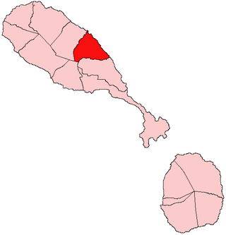
Saint Mary Cayon is one of 14 administrative parishes that make up Saint Kitts and Nevis. It is located on the main island of Saint Kitts and the parish capital is Cayon.

The Westport River lies between Narragansett Bay and Buzzards Bay in Westport, Massachusetts.

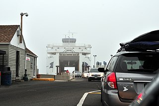
Cross Sound Ferry is a passenger and road vehicle ferry service operating between New London, Connecticut and Orient on the North Fork of Long Island, New York.

Outer Island is a 5-acre island located in Long Island Sound. It is one of the Thimble Islands, a small archipelago just south of Stony Creek, a hamlet of Branford, Connecticut. Outer Island is the southern terminus and most remote island found within this archipelago. It is on the ten units of the Stewart B. McKinney National Wildlife Refuge. The island was transferred to the United States Fish and Wildlife Service in 1995 by Elizabeth Hird. This island provides habitat for marine and avian wildlife.
The Stewart B. McKinney National Wildlife Refuge is a 950-acre (384.5 ha) National Wildlife Refuge in ten units across the U.S. state of Connecticut. Located in the Atlantic Flyway, the refuge spans 70 miles (110 km) of Connecticut coastline and provides important resting, feeding, and nesting habitat for many species of wading birds, shorebirds, songbirds and terns, including the endangered roseate tern. Adjacent waters serve as wintering habitat for brant, scoters, American black duck, and other waterfowl. Overall, the refuge encompasses over 900 acres (364.2 ha) of barrier beach, intertidal wetland and fragile island habitats.

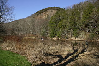
West Rock Ridge State Park is a public recreation area located in New Haven, Hamden, and Woodbridge, Connecticut. The state park is named for the 400-to-700-foot trap rock West Rock Ridge, which is part of the Metacomet Ridge extending from Long Island Sound to the Vermont border. The park's 7 miles (11 km) of open west-facing cliffs offer vistas encompassing Metropolitan New Haven and suburban towns to the west. The park includes Judges Cave, a colonial era historic site; Lake Wintergreen; and the 7-mile (11 km) Regicides Trail, part of the Connecticut Forest and Park Association's Blue Trail system. The park is part of a larger area of protected open space including state, municipal, and non-profit owned land.
The Southeastern New England AVA is an American Viticultural Area that includes portions of thirteen counties in three New England states: Connecticut, Massachusetts, and Rhode Island. The boundaries of the wine appellation include parts of New Haven, New London, and Middlesex counties in Connecticut; Bristol, Newport, Providence, and Washington counties in Rhode Island; and Barnstable, Bristol, Dukes, Nantucket, Norfolk, and Plymouth counties in Massachusetts. The area stretches from just south of Boston, Massachusetts in the east to New London, Connecticut in the west, and includes all of the coastal islands and coastal plain within 15 miles (24 km) of Long Island Sound, Cape Cod, or Massachusetts Bay.

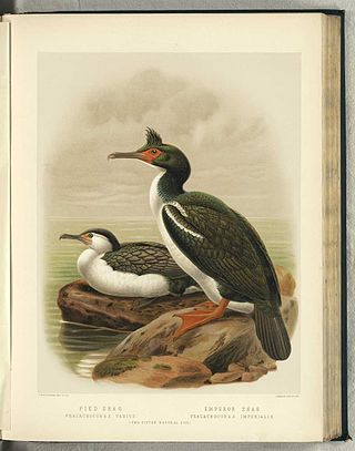
The Marlborough Sounds Important Bird Areas are four distinct sites comprising several small, rocky islets contained within an area with a maximum linear extent of 40 km, in New Zealand. They lie close to Cook Strait in the outer Marlborough Sounds at the northern end of the South Island. The sites are Duffers Reef, Sentinel Rock, White Rocks and the Trio Islands. They have been identified as Important Bird Areas (IBAs) by BirdLife International because they hold the only known colonies, and encompass the entire breeding range, of the vulnerable rough-faced shag.

The Duck River is a short, partly tidal stream in Old Lyme, Connecticut. It joins the Connecticut River in the estuary at Watch Rock Park, just above the point where the Connecticut flows into Long Island Sound.
North Brother Island is a small island in Long Island Sound, part of the town of East Lyme, Connecticut. Its coordinates are 41°17′34″N72°14′41″W, just off the coast. Its companion, South Brother Island is also a part of the town of East Lyme. Its coordinates are 41 degrees, 17 minutes 22 seconds North and 72 degrees, 14 minutes, 22 seconds West.


