Skipanon River

Last updated
Skipanon River
USA Oregon location map.svg
Red pog.svg
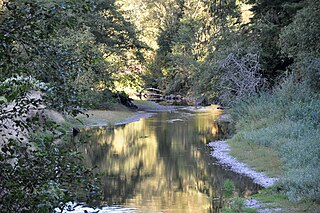
Location of the mouth of Skipanon River in Oregon
EtymologyA Clatsop Indian word, Skippernawin referred to a point at the mouth of the stream [1]
Location
Country United States
State Oregon
County Clatsop County
Physical characteristics
SourceN. Oregon coastal foothills & Cullaby Lake
 - location Clatsop County, Oregon
 - coordinates 46°05′39″N123°54′32″W / 46.09417°N 123.90889°W / 46.09417; -123.90889 [2]
 - elevation50 ft (15 m) [3]
Mouth Columbia River
 - location Warrenton, Clatsop County, Oregon
 - coordinates 46°10′9″N123°55′37″W / 46.16917°N 123.92694°W / 46.16917; -123.92694 Coordinates: 46°10′9″N123°55′37″W / 46.16917°N 123.92694°W / 46.16917; -123.92694 [2]
 - elevation.5 ft (0.15 m) [2]
Length7 mi (11 km)

The Skipanon River is a tributary of the Columbia River, approximately 7 miles (11 km) long, on the Pacific coast of northwest Oregon in the United States. It is the last tributary of the Columbia on the Oregon side, draining an area of coastal bottom land bordered by sand dunes and entering the river from the south at its mouth west of Astoria.

Columbia River river in North America; flows from British Columbia, through Washington, and along the Washington–Oregon border to the Pacific Ocean

The Columbia River is the largest river in the Pacific Northwest region of North America. The river rises in the Rocky Mountains of British Columbia, Canada. It flows northwest and then south into the US state of Washington, then turns west to form most of the border between Washington and the state of Oregon before emptying into the Pacific Ocean. The river is 1,243 miles (2,000 km) long, and its largest tributary is the Snake River. Its drainage basin is roughly the size of France and extends into seven US states and a Canadian province. The fourth-largest river in the United States by volume, the Columbia has the greatest flow of any North American river entering the Pacific.

Pacific Ocean Ocean between Asia and Australia in the west, the Americas in the east and Antarctica or the Southern Ocean in the south.

The Pacific Ocean is the largest and deepest of Earth's oceanic divisions. It extends from the Arctic Ocean in the north to the Southern Ocean in the south and is bounded by Asia and Australia in the west and the Americas in the east.

Oregon State of the United States of America

Oregon is a state in the Pacific Northwest region on the West Coast of the United States. The Columbia River delineates much of Oregon's northern boundary with Washington, while the Snake River delineates much of its eastern boundary with Idaho. The parallel 42° north delineates the southern boundary with California and Nevada. Oregon is one of only three states of the contiguous United States to have a coastline on the Pacific Ocean.

Contents

The Skipanon River issues from Cullaby Lake in western Clatsop County, northeast of Seaside and less than 3 miles (4.8 km) from the ocean. It flows north parallel to the coast and east of U.S. Route 101. It enters the northwest end of Youngs Bay at the mouth of the Columbia approximately 1 mile (1.6 km) northeast of Warrenton. The mouth of the river is at river mile 10.7 miles (17.2 km) of the Columbia upstream from its mouth.

Cullaby Lake lake of the United States of America

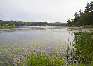
Cullaby Lake is a lake near Warrenton, Oregon, United States. It is the central feature of Cullaby Lake County Park, and one of the major lakes of Clatsop Plains.

Clatsop County, Oregon county in Oregon, USA

Clatsop County is a county in the U.S. state of Oregon. As of the 2010 census, the population was 37,039. The county seat is Astoria. The county is named for the Clatsop tribe of Native Americans, who lived along the coast of the Pacific Ocean prior to European settlement.

Seaside, Oregon City in Oregon, United States

Seaside is a city in Clatsop County, Oregon, United States. The name Seaside is derived from Seaside House, a historic summer resort built in the 1870s by railroad magnate Ben Holladay. The city's population was 6,457 at the 2010 census.

The river's name comes from the Clatsop language, originally referring to a point at the river's mouth rather than the river itself. The charts of the Lewis and Clark Expedition show the stream as Skipanarwin Creek. Another variant spelling, Skeppernawin, was common on maps into the 20th century. [1]

Lewis and Clark Expedition American overland expedition to the Pacific coast

The Lewis and Clark Expedition from May 1804 to September 1806, also known as the Corps of Discovery Expedition, was the first American expedition to cross the western portion of the United States. It began near St. Louis, made its way westward, and passed through the Continental Divide of the Americas to reach the Pacific coast. The Corps of Discovery was a selected group of US Army volunteers under the command of Captain Meriwether Lewis and his close friend Second Lieutenant William Clark.

See also

Related Research Articles

Santiam River river in the United States of America

The Santiam River is a tributary of the Willamette River, about 12 miles (19 km) long, in western Oregon in the United States. Through its two principal tributaries, the North Santiam and the South Santiam rivers, it drains a large area of the Cascade Range at the eastern side of the Willamette Valley east of Salem and Corvallis.

Umpqua River river in the United States of America

The Umpqua River on the Pacific coast of Oregon in the United States is approximately 111 miles (179 km) long. One of the principal rivers of the Oregon Coast and known for bass and shad, the river drains an expansive network of valleys in the mountains west of the Cascade Range and south of the Willamette Valley, from which it is separated by the Calapooya Mountains. From its source northeast of Roseburg, the Umpqua flows northwest through the Oregon Coast Range and empties into the Pacific at Winchester Bay. The river and its tributaries flow entirely within Douglas County, which encompasses most of the watershed of the river from the Cascades to the coast. The "Hundred Valleys of the Umpqua" form the heart of the timber industry of southern Oregon, generally centered on Roseburg.

Luckiamute River watercourse in the United States of America

The Luckiamute River is a tributary of the Willamette River, about 61 miles (98 km) long, in western Oregon in the United States. It drains an area of Central Oregon Coast Range and the western Willamette Valley northwest of Corvallis.

Wallowa River river in the United States of America

The Wallowa River is a tributary of the Grande Ronde River, approximately 55 miles (89 km) long, in northeastern Oregon in the United States. It drains a valley on the Columbia Plateau in the northeast corner of the state north of Wallowa Mountains.

Miami River (Oregon)

The Miami River is a stream, approximately 13 miles (21 km) long, on the coast of northwest Oregon in the United States. It drains a mountainous timbered region of the Northern Oregon Coast Range west of Portland, into Pacific Ocean.

South Santiam River river in the United States of America

The South Santiam River is a tributary of the Santiam River, about 69 miles (111 km) long, in western Oregon in the United States. It drains an area of the Cascade Range into the Willamette Valley east of Corvallis.

Middle Santiam River river in the United States of America

The Middle Santiam River is a tributary of the South Santiam River, 38.5 miles (62.0 km) long, in western Oregon in the United States. It drains a remote area of the Cascade Range east of Sweet Home in the watershed of the Willamette River.

Sprague River (Oregon) river in the United States of America

The Sprague River is a tributary of the Williamson River, approximately 75 miles (121 km) long, in southwestern Oregon in the United States. It drains an arid volcanic plateau region east of the Cascade Range in the watershed of the Klamath River.

Nehalem River river in the United States of America

The Nehalem River is a river on the Pacific coast of northwest Oregon in the United States, approximately 119 miles (192 km) long. It drains part of the Northern Oregon Coast Range northwest of Portland, originating on the east side of the mountains and flowing in a loop around the north end of the range near the mouth of the Columbia River. Its watershed of 855 square miles (2,210 km2) includes an important timber-producing region of Oregon that was the site of the Tillamook Burn. In its upper reaches it flows through a long narrow valley of small mountain communities but is unpopulated along most of its lower reaches inland from the coast. The city where the river flows into the Pacific is also used as the name for CPU manufacturing titan Intel's first-generation line of Core processors.

Lewis and Clark River river in the United States of America

The Lewis and Clark River is a tributary of Youngs River, approximately 20 miles (32 km) long, in northwest Oregon in the United States. It drains 62 square miles (160 km2) of the Northern Oregon Coast Range in the extreme northwest corner of the state, entering Youngs River just above its mouth on the Columbia River at Youngs Bay. Near the river's mouth is the site of former Fort Clatsop of the Lewis and Clark Expedition. The river is named for Meriwether Lewis and William Clark.

Youngs River river in the United States of America

The Youngs River is a tributary of the Columbia River, approximately 27 miles (43 km) long, in northwest Oregon in the United States. It drains part of the Northern Oregon Coast Range in the extreme northwest corner of state, entering the Columbia via Youngs Bay just approximately 10 miles (16 km) from its mouth.

Klaskanine River river in the United States of America

The Klaskanine River is a tributary of the Youngs River, approximately 16 miles (26 km) long, in northwest Oregon in the United States. It drains a small section of the Coast Range in the extreme northwest corner of the state in the watershed of the nearby Columbia River.

Wallooskee River river in the United States of America

The Wallooskee River is a tributary of the Youngs River, about 10 miles (16 km) long, in northwest Oregon in the United States. It drains a small area of the foothills of the Coast Range near the mouth of the Columbia River. The Youngs River is a tributary of the Columbia River.

Clatskanie River river in the United States of America

The Clatskanie River is a tributary of the Columbia River, approximately 25 miles (40 km) long, in northwestern Oregon in the United States. It drains a timber-producing area in the foothills of the Northern Oregon Coast Range north-northwest of Portland.

Necanicum River river in the United States of America

The Necanicum River is a river on the Pacific coast of northwest Oregon in the United States, approximately 21 miles (34 km) long. It drains a timber-producing area of the Northern Oregon Coast Range northwest of Portland. It forms the first estuary south of the mouth of the Columbia River along the Oregon Coast, reaching the Pacific Ocean at Seaside in Clatsop County.

John Day River (northwestern Oregon) river in Clatsop County, Oregon, USA

The John Day River is a tributary of the Columbia River, approximately 6 miles (10 km) long, in northwestern Oregon in the United States. The river rises in the Northern Oregon Coast Range in Clatsop County at 46.138889°N 123.704722°W.

Umatilla River tributary of the Columbia River in Oregon

The Umatilla River is an 89-mile (143 km) tributary of the Columbia River in the U.S. state of Oregon. Draining a basin of 2,450 square miles (6,300 km2), it enters the Columbia near the city of Umatilla in the northeastern part of the state. In downstream order, beginning at the headwaters, major tributaries of the Umatilla River are the North Fork Umatilla River and the South Fork Umatilla River, then Meacham, McKay, Birch, and Butter creeks.

Fifteenmile Creek (Columbia River) river in the United States of America

Fifteenmile Creek is a 54-mile (87 km) long tributary of the Columbia River in the U.S. state of Oregon. It drains 373 square miles (966 km2) of Hood River and Wasco counties. Arising in the Cascade Range near Mount Hood, it flows northeast then west to its confluence with the Columbia near The Dalles.

Scoggins Creek river in the United States of America

Scoggins Creek, formerly known as "Scoggin Creek", is a 19-mile (31 km) tributary of the Tualatin River in Tillamook and Washington counties in the U.S. state of Oregon. It is named for pioneer settler Gustavus Scoggin.

References

  1. 1 2 McArthur, Lewis A.; McArthur, Lewis L. (2003) [1928]. Oregon Geographic Names (7th ed.). Portland, Oregon: Oregon Historical Society Press. p. 773. ISBN   978-0875952772.
  2. 1 2 3 "Skipanon River". Geographic Names Information System (GNIS). United States Geological Survey. November 28, 1980. Retrieved August 16, 2009.
  3. Source elevation derived from Google Earth search using GNIS source coordinates.
Wayback Machine Web archive service

The Wayback Machine is a digital archive of the World Wide Web and other information on the Internet. It was launched in 2001 by the Internet Archive, a nonprofit organization based in San Francisco, California, United States.