
An intelligent transportation system (ITS) is an advanced application which aims to provide innovative services relating to different modes of transport and traffic management and enable users to be better informed and make safer, more coordinated, and 'smarter' use of transport networks.

Traffic engineering is a branch of civil engineering that uses engineering techniques to achieve the safe and efficient movement of people and goods on roadways. It focuses mainly on research for safe and efficient traffic flow, such as road geometry, sidewalks and crosswalks, cycling infrastructure, traffic signs, road surface markings and traffic lights. Traffic engineering deals with the functional part of transportation system, except the infrastructures provided.

A variable-message sign or message board, often abbreviated VMS, VMB, CMS, or DMS, and in the UK known as a matrix sign, is an electronic traffic sign often used on roadways to give travelers information about special events. Such signs warn of traffic congestion, accidents, incidents such as terrorist attacks, AMBER/Silver/Blue Alerts, roadwork zones, or speed limits on a specific highway segment. In urban areas, VMS are used within parking guidance and information systems to guide drivers to available car parking spaces. They may also ask vehicles to take alternative routes, limit travel speed, warn of duration and location of the incidents, inform of the traffic conditions, or display general public safety messages.

An advanced driver-assistance system (ADAS) includes technologies that assist drivers with the safe operation of a vehicle. Through a human-machine interface, ADAS increases car and road safety. ADAS uses automated technology, such as sensors and cameras, to detect nearby obstacles or driver errors, and respond accordingly. ADAS can enable various levels of autonomous driving.
In road-transport terminology, a lane departure warning system (LDWS) is a mechanism designed to warn the driver when the vehicle begins to move out of its lane on freeways and arterial roads. These systems are designed to minimize accidents by addressing the main causes of collisions: driver error, distractions and drowsiness. In 2009 the U.S. National Highway Traffic Safety Administration (NHTSA) began studying whether to mandate lane departure warning systems and frontal collision warning systems on automobiles.

A radar detector is an electronic device used by motorists to detect if their speed is being monitored by police or law enforcement using a radar gun. Most radar detectors are used so the driver can reduce the car's speed before being ticketed for speeding. In general sense, only emitting technologies, like doppler RADAR, or LIDAR can be detected. Visual speed estimating techniques, like ANPR or VASCAR can not be detected in daytime, but technically vulnerable to detection at night, when IR spotlight is used. There are no reports that piezo sensors can be detected. LIDAR devices require an optical-band sensor, although many modern detectors include LIDAR sensors. Most of today's radar detectors detect signals across a variety of wavelength bands: usually X, K, and Ka. In Europe the Ku band is common as well. The past success of radar detectors was based on the fact that radio-wave beams can not be narrow-enough, so the detector usually senses stray and scattered radiation, giving the driver time to slow down. Based on a focused laser-beam, LIDAR technology does not suffer this shortcoming; however it requires precise aiming. Modern police radars incorporate formidable computing power, producing a minimum number of ultra-short pulses, reusing wide beams for multi-target measurement, which renders most detectors useless. But, mobile Internet allows GPS navigation devices to map police radar locations in real-time. These devices are also often called "radar detectors", while not necessary carrying an RF sensor.
Motorway Incident Detection and Automatic Signalling, usually abbreviated to MIDAS, is a UK distributed network of traffic sensors, mainly inductive loops, which are designed to alert the local regional control centre (RCC) to traffic flow and average speeds, and set variable message signs and advisory speed limits with little human intervention. Companies such as RAC, TomTom and Google use this traffic flow data via halogens reporting systems.
In mathematics and transportation engineering, traffic flow is the study of interactions between travellers and infrastructure, with the aim of understanding and developing an optimal transport network with efficient movement of traffic and minimal traffic congestion problems.
The Infra-Red Traffic Logger, more commonly known simply by the acronym TIRTL, is a multi-purpose traffic sensor that can be used as a traffic counter, speed sensor, red light camera sensor, heavy vehicle tracker, overheight vehicle sensor, rail crossing sensor and network management system. The initial development of the device started in 1997 in conjunction with the New South Wales Roads & Traffic Authority and started commercial domestic and international sales in 2002. It is currently in use in sixteen countries.

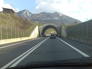
Road traffic control involves directing vehicular and pedestrian traffic around a construction zone, accident or other road disruption, thus ensuring the safety of emergency response teams, construction workers and the general public.

Adaptive cruise control (ACC) is a type of advanced driver-assistance system for road vehicles that automatically adjusts the vehicle speed to maintain a safe distance from vehicles ahead. As of 2019, it is also called by 20 unique names that describe that basic functionality. This is also known as Dynamic cruise control.
Vehicle infrastructure integration (VII) is an initiative fostering research and application development for a series of technologies directly linking road vehicles to their physical surroundings, first and foremost in order to improve road safety. The technology draws on several disciplines, including transport engineering, electrical engineering, automotive engineering, and computer science. VII specifically covers road transport, although similar technologies are in place or under development for other modes of transport. Planes, for example, use ground-based beacons for automated guidance, allowing the autopilot to fly the plane without human intervention. In highway engineering, improving the safety of a roadway can enhance overall efficiency. VII targets improvements in both safety and efficiency.

Active traffic management is a method of increasing peak capacity and smoothing traffic flows on busy major highways. Techniques include variable speed limits, hard-shoulder running and ramp-metering controlled by overhead variable message signs. It has been implemented in several countries, including Germany, the United Kingdom, Canada and the United States.

A radar speed sign is an interactive sign, generally constructed of a series of LEDs, that displays vehicle speed as motorists approach. The purpose of radar speed signs is to slow cars down by making drivers aware when they are driving at speeds above the posted limits. They are used as a traffic calming device in addition to or instead of physical devices such as speed bumps and rumble strips.
A collision avoidance system (CAS), also known as a pre-crash system, forward collision warning system (FCW), or collision mitigation system, is an advanced driver-assistance system designed to prevent or reduce the severity of a collision. In its basic form, a forward collision warning system monitors a vehicle's speed, the speed of the vehicle in front of it, and the distance between the vehicles, so that it can provide a warning to the driver if the vehicles get too close, potentially helping to avoid a crash. Various technologies and sensors that are used include radar (all-weather) and sometimes laser (LIDAR) and cameras to detect an imminent crash. GPS sensors can detect fixed dangers such as approaching stop signs through a location database. Pedestrian detection can also be a feature of these types of systems.

A traffic count is a count of vehicular or pedestrian traffic, which is conducted along a particular road, path, or intersection. A traffic count is commonly undertaken either automatically, or manually by observers who visually count and record traffic on a hand-held electronic device or tally sheet. Traffic counts can be used by local councils to identify which routes are used most, and to either improve that road or provide an alternative if there is an excessive amount of traffic. Also, some geography fieldwork involves a traffic count. Traffic counts provide the source data used to calculate the Annual Average Daily Traffic (AADT), which is the common indicator used to represent traffic volume. Traffic counts are useful for comparing two or more roads, and can also be used alongside other methods to find out where the central business district (CBD) of a settlement is located. Traffic counts that include speeds are used in speed limit enforcement efforts, highlighting peak speeding periods to optimise speed camera use and educational efforts.

IRIS is an open-source Advanced Traffic Management System (ATMS) software project developed by the Minnesota Department of Transportation. It is used by transportation agencies to monitor and manage interstate and highway traffic. IRIS uses the GPL license.
Road traffic control devices are markers, signs and signal devices used to inform, guide and control traffic, including pedestrians, motor vehicle drivers and bicyclists. These devices are usually placed adjacent, over or along the highways, roads, traffic facilities and other public areas that require traffic control.
In traffic engineering, a merge is the point where two streams of traffic travelling in the same direction from multiple roads or in multiple lanes on the same road are required to merge into a single lane.

Terminology related to road transport—the transport of passengers or goods on paved routes between places—is diverse, with variation between dialects of English. There may also be regional differences within a single country, and some terms differ based on the side of the road traffic drives on. This glossary is an alphabetical listing of road transport terms.

