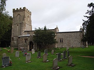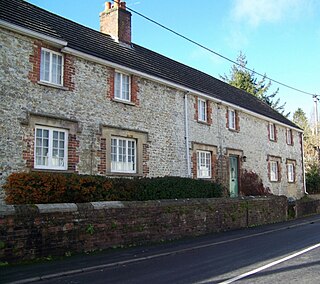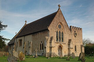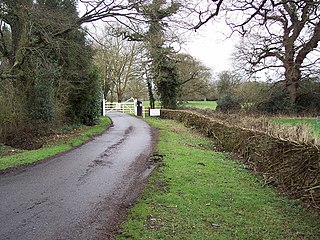
Aldbourne is a village and civil parish about 6 miles (10 km) north-east of Marlborough, Wiltshire, England, in a valley on the south slope of the Lambourn Downs – part of the North Wessex Downs Area of Outstanding Natural Beauty. From here an unnamed winterbourne flows south to join the River Kennet 4 miles (6 km) away near Ramsbury. The 2011 Census recorded the parish population as 1,833. The parish includes the hamlets of Upper Upham and Woodsend and part of the hamlet of Preston, which straddles the boundary with Ramsbury. The village of Snap became deserted in the early 20th century.

Baydon is a village and civil parish in Wiltshire, England about 10 miles (16 km) south-east of Swindon. The eastern boundary of the parish forms part of the county boundary with Berkshire, and the village is about 7 miles (11 km) north-west of the West Berkshire market town of Hungerford.

Ramsbury is a village and civil parish in the English county of Wiltshire. The village is in the Kennet Valley near the Berkshire boundary. The nearest towns are Hungerford about 4.5 miles (7.2 km) east and Marlborough about 5.5 miles (8.9 km) west. The much larger town of Swindon is about 12 miles (19 km) to the north.

Dilton Marsh is a village and civil parish in the far west of the county of Wiltshire, in the southwest of England. The village is about 1.5 miles (2.4 km) southwest of the centre of the town of Westbury; Dilton Marsh remains a distinct settlement with its own character and community, bounded and separated from Westbury Leigh by the Biss Brook.

Wiltshire is a historic county located in the South West England region. Wiltshire is landlocked and is in the east of the region.

Purton is a large village and civil parish in Wiltshire, England, about 4 miles (6 km) northwest of the centre of Swindon. The parish includes the village of Purton Stoke and the hamlets of Bentham, Hayes Knoll, Purton Common, Restrop, The Fox and Widham. The River Key, a tributary of the Thames, crosses the parish near Purton Stoke.

Bishopstone is a village and civil parish in Wiltshire, England, in the Ebble valley about 5.5 miles (9 km) south-west of Salisbury. The parish is on the county boundary with Hampshire and includes the small village of Croucheston and the hamlet of The Pitts.

Bishopstrow is a small village and civil parish in Wiltshire, England, on the southeastern edge of the town of Warminster. The village is about 1.5 miles (2.4 km) from the town centre, south of the old Warminster to Salisbury road, formerly the A36, now the B3414.

Drayton is a village and civil parish about 2 miles (3 km) south of Abingdon, Oxfordshire. It was part of Berkshire until the 1974 boundary changes transferred it to Oxfordshire. The parish includes the hamlet of Sutton Wick. The 2011 Census recorded the parish population as 2,353.

Studley is a small village in the county of Wiltshire, England, belonging to the civil parish of Calne Without.

The Goddard family were a prominent landed family chiefly living in the northern region of the English counties of Wiltshire and Hampshire and the western part of Berkshire, between the Tudor period and the early 20th century.

Britford is a village and civil parish beside the River Avon about 1.5 miles (2.4 km) south-east of Salisbury in Wiltshire, England. The village is just off the A338 Salisbury-Bournemouth road. The 2011 Census recorded a parish population of 592.

Baverstock is a small village and former civil parish in Wiltshire, England, about 7 miles (11 km) west of Salisbury. The village has 10 private dwellings, a church and several farm buildings. The manor of Hurdcott, a hamlet of a few houses, lies to the southwest of the village.

Fringford is a village and civil parish in Oxfordshire, about 4 miles (6.4 km) northeast of Bicester. The parish is bounded to the east by the Roman road that linked Alchester Roman Town with Roman Towcester, to the south by a brook that joins the River Bure, to the north mostly by a brook that is a tributary of the River Great Ouse, and to the west by field boundaries. Fringford village is in the north of the parish, surrounded on two sides by a bend in the tributary of the Great Ouse.

Sutton Veny is a village and civil parish in the Wylye valley, to the southeast of the town of Warminster in Wiltshire, England; the village is about 3 miles (5 km) from Warminster town centre. 'Sutton' means 'south farmstead' in relation to Norton Bavant, one mile (1.6 km) to the north. 'Veny' may be a French family name or may describe the village's fenny situation.

Chilmark is a Wiltshire village and civil parish of some 150 houses straddling the B3089 road, 11 miles (18 km) west of Salisbury, England. The parish includes the hamlets of Mooray and Portash, both close to the south of Chilmark village; and the dispersed hamlet of Ridge, to the southwest.

Upper Upham is a hamlet and deserted medieval village in the civil parish of Aldbourne in the English county of Wiltshire. Its nearest town is Marlborough, which lies approximately 5.6 miles (9.0 km) to the south-west; the hamlet is reached by a narrow lane off the B4192 Aldbourne-Swindon road.

East Challow is a village and civil parish about 1 mile (1.6 km) west of Wantage in the Vale of White Horse, England. Historically it was part of the ecclesiastical parish of Letcombe Regis, but since 1852 East and West Challow have formed their own single ecclesiastical parish. The civil parish was part of Berkshire until the 1974 boundary changes transferred the Vale of White Horse to Oxfordshire.

Clarendon Park is a Grade I listed building, estate and civil parish near Salisbury in Wiltshire, England. At the 2011 census the population of the parish was 246.

Blackland is a hamlet and former civil parish in Calne Without parish, just south-east of the town of Calne in Wiltshire, England. There is a 13th-century church and an 18th-century country house, Blackland House.


