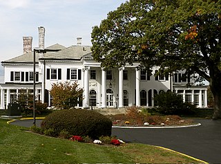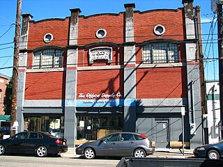
Park Place is a neighborhood in the western half of Norfolk, Virginia. Its boundaries are roughly Granby Street on the east, Colley Avenue on the west, the railroad tracks immediately south of 23rd Street on the south and up to 38th Street to the north. Within these boundaries Park Place is made up of 4 subdivision; Virginia Place, East Kensington, Park Place, and Old Dominion Place.

The South Central Falls Historic District is a historic district in Central Falls, Rhode Island. It is a predominantly residential area, densely populated, which was developed most heavily in the late 19th century. It is bounded roughly by Broad Street to the east, the Pawtucket city line to the south, Dexter Street to the west, and Rand Street and Jenks Park to the north. It has 377 contributing buildings, most of which were built before 1920. The district was added to the National Register of Historic Places in 1991.

The Prospect Hill Historic District is an irregularly-shaped 185-acre (75 ha) historic district in New Haven, Connecticut. The district encompasses most of the residential portion of the Prospect Hill neighborhood.

Highland Heights–Stevens' Subdivision Historic District is a residential historic district located in Highland Park, Michigan along five east-west streets: Farrand Park, McLean Street, Colorado Street, Rhode Island Street, and Massachusetts Street, between Woodward Avenue on the west and Oakland Avenue on the east. The district was listed on the National Register of Historic Places in 1988.

The Medbury's–Grove Lawn Subdivisions Historic District is a residential historic district located in Highland Park, Michigan. It runs along three east-west streets: Eason Street, Moss Street, and Putitan Street, from Hamilton Avenue on the west to Woodward Avenue on the east. The district was listed on the National Register of Historic Places in 1988.

District B is a historic worker housing district located in Manchester, New Hampshire, near the former Amoskeag Manufacturing Company millyard. It is roughly bounded by Canal, Mechanic, Franklin, and Pleasant Streets, and was added to the National Register of Historic Places on November 12, 1982. It contains 32 contributing properties, including seventeen rowhouse tenement blocks built mainly between 1838 and 1850, in an area of approximately 170 acres (69 ha).

There are nine historic districts in Meridian, Mississippi. Each of these districts is listed on the National Register of Historic Places. One district, Meridian Downtown Historic District, is a combination of two older districts, Meridian Urban Center Historic District and Union Station Historic District. Many architectural styles are present in the districts, most from the late 19th century and early 20th century, including Queen Anne, Colonial Revival, Italianate, Art Deco, Late Victorian, and Bungalow.
The Adams Street Historic District in Franklin, Tennessee consists of properties at 1112-1400 Adams, 1251-1327 Adams St., and 304-308 Stewart St. It is a 14-acre (5.7 ha) historic district was listed on the National Register of Historic Places in 2000 and is one of seven local historic districts in the city of Franklin.

Hincheyville Historic District is a 53-acre (21 ha) historic district in Franklin, Tennessee. It is one of seven local historic districts in Franklin and was listed on the National Register of Historic Places in 1982.

The East Portland Grand Avenue Historic District, located in southeast Portland, Oregon, is listed on the National Register of Historic Places. The district includes approximately 20 city blocks on or near Southeast Grand Avenue on the east side of the Willamette River, roughly bounded on the south by SE Main Street, north by SE Ankeny Street, west by SE Martin Luther King Jr. Boulevard, and east by SE Seventh Avenue. Most structures in the district are commercial buildings rising two to three stories. Immediately to the west of the historic district is Portland's east side industrial area, and to the east are industrial and residential areas.

East Wheeling Historic District is a national historic district located at Wheeling, Ohio County, West Virginia. The district encompasses 300 contributing buildings and one contributing site, including the Monroe Street East Historic District. The district is primarily residential, developed in the late-19th and early-20th century. A number of popular architectural styles are represented including Greek Revival and Gothic Revival. Notable non-residential buildings include St. Joseph Cathedral (1926), former Hazel Atlas Company building, Scottish Rite Temple designed by noted Wheeling architect Frederick F. Faris (1870-1927), Elks Building, and YMCA (1906), also designed by Faris. The contributing site is Elk Playground. Also located in the district are the separately listed L. S. Good House, Charles W. Russell House, and Cathedral Parish School.

Palmyra Village Historic District is a national historic district at Palmyra in Wayne County, New York.

The Park-to-Park Residential Historic District in Fort Madison, Iowa, United States, was listed on the National Register of Historic Places in 2014. The historic district is located to the north of the Downtown Commercial Historic District, generally between Central Park on the west and Old Settler's Park on the east. Both parks are contributing sites. For the most part the district is made up of single family homes built in the late 19th and early 20th centuries. Some of these homes were built as rental properties, while others became so in later years. The Albright House and the Chief Justice Joseph M. Beck House are contributing properties, and they are also individually listed on the National Register. There are also duplexes and a few small scale apartment buildings in the district.

The West Pleasant Street Historic District is a nationally recognized historic district located in Maquoketa, Iowa, United States. It was listed on the National Register of Historic Places in 1991. At the time of its nomination it contained 50 resources, which included 29 contributing buildings, 21 non-contributing buildings, and one non-contributing site. The historic district is primarily a residential area that was built during Maquoketa's "Boom Years" (1873-1899) and the "Comfortable Years" (1900-1922). The first house built in the district was in 1863 and the last was in 1914. This is where many of the city's business and professional leaders choose to build their houses. Most of the 28 houses were probably not designed by an architect, but were crafted in the "High Style" of the time by local builders. With the exception of Greek Revival, all the major styles of the period built in Maquoketa are found here. Eight of the houses and one of the three remaining carriage houses are brick structures; the rest are wood.

The Sturdevant Southwest Historic District is a nationally recognized historic district located in Waverly, Iowa, United States. It was listed on the National Register of Historic Places in 2016. At the time of its nomination it contained 183 resources, which included 120 contributing buildings, one contributing structure, and 62 non-contributing buildings. The historic district is a residential area west of the Cedar River and south of a commercial area. It was home to middle-to-working-class families and a few business and professional people. Most of the primary resources in the district are houses, and the secondary resources are either carriage houses, garages, or city barns. The primary resources that are not residential include First Baptist Church (1901), the Farmers Exchange Produce Building, the Farmers Exchange Office Building (1935), and St. Andrew's Episcopal Church (1958). The contributing structure is St. Andrew's bell tower. The Congregational Church was also located here until it was torn down. All but three houses contribute to the historical significance of the district, but a majority of the secondary resources do not.

The Willow–Bluff–3rd Street Historic District is a nationally recognized historic district located in Council Bluffs, Iowa, United States. It was listed on the National Register of Historic Places in 2005. At the time of its nomination the district consisted of 260 resources, including 162 contributing buildings, 56 contributing structures, 36 non-contributing buildings, and six non-contributing structures. The district is primarily a residential area that is adjacent to the central business district to the west. Part of the district is in Jackson's Addition, which is the first addition to the original town of Council Bluffs. It also sits along the base of the loess bluffs to the east.

West Eleventh Street Historic District is a nationally recognized historic district located in Dubuque, Iowa, United States. It was listed on the National Register of Historic Places in 2004. At the time of its nomination it consisted of 288 resources, which included 191 contributing buildings, 32 contributing structures, 61 non-contributing buildings, two contributing sites, and one non-contributing structure. This district is a residential area on top of the bluff above the Jackson Park Historic District, which is in the river valley below. Its name comes from its historical association with the former West Eleventh Street Elevator, a funicular that was similar to the Fenelon Place Elevator to the south. For the most part the historic buildings here are single-family residences with their attendant out-buildings, although the number of out-buildings located here is relatively low. There is one apartment building and 46 duplexes. Some of the single-family houses were converted into multi-family residences, and then some of those were converted back. The various Victorian styles are found along the bluff fronts on the eastern and southern edge of the district, and vernacular structures on the northern and western sections. The Charles T. Hancock House (1890) was individually listed on the National Register. Given the steep bluffs in the district the historic structures are retaining walls and steps that replace the sidewalks.

The Pucker Street Historic District is a nationally recognized historic district located in Marion, Iowa, United States. It was listed on the National Register of Historic Places in 2002. At the time of its nomination it consisted of 84 resources, which included 50 contributing buildings, three contributing structures, two contributing objects, and 29 non-contributing buildings. The historic district is a residential area near Marion's central business district. The people who initially built homes here were the city's pioneer families and then their descendants. It is also where the city's wealthy and influential citizens built their houses along Eighth Avenue and its adjacent streets. The neighborhood was called "Pucker Street" because of the superior attitudes that some of its early residents were said to have possessed.

The Greenwood Park Plats Historic District is a nationally recognized historic district located in Des Moines, Iowa, United States. It was listed on the National Register of Historic Places in 2013. At the time of its nomination the district consisted of 393 resources, including 277 contributing buildings, one contributing site, 109 non-contributing buildings, and six non-contributing structures. Most of this district was originally known as Brown's Park, a private park that was the location of the Iowa State Fair from 1879 to 1885. Founded privately in 1854, the fair was held in several locations in the state making it more of a regional event. It was also not profitable. That changed when the fair moved to this location, and its profitability eventually led to funding from the Iowa General Assembly and a permanent location on the east side of the city. Brown's Park continued for a while longer and the streetcar line from Des Moines opened in 1889.

The Ball Ground Historic District in Ball Ground, Georgia is a 22 acres (8.9 ha) historic district which is roughly bounded by Highway 5 to the west; Commerce Street and Groover Street to the north; Valley Street and Gazaway Lane to the east; and Stripling Street, the southern terminus of Old Canton Road, and Depot Street to the south. It was listed on the National Register of Historic Places October 30, 2009 and included 114 contributing buildings and four contributing sites.


