
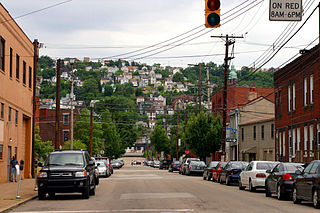
Mount Oliver is a borough in Allegheny County, Pennsylvania, United States. It is a largely residential area situated atop a crest about 3 miles (5 km) west of the Monongahela River. The borough is surrounded entirely by the city of Pittsburgh, having resisted annexations by the city, as it prefers to manage its own local needs and finances.

The Carnegie Library of Pittsburgh is the public library system in Pittsburgh, Pennsylvania. Its main branch is located in the Oakland neighborhood of Pittsburgh, and it has 19 branch locations throughout the city. Like hundreds of other Carnegie libraries, the construction of the main library, which opened in 1895, and several neighborhood branches, was funded by industrialist Andrew Carnegie. The Pittsburgh area holds the distinction of housing the first branches in the United States.

Arlington is a neighborhood in southern Pittsburgh, Pennsylvania. The zip code used by residents is 15210, and the neighborhood has representation on Pittsburgh City Council by the council member for District 3. The Pittsburgh Bureau of Fire houses 22 engine in Arlington. The city has discussed the possibility of closing 22 engine completely. 22 engine is a vital key to second and third alarm firefighting in the city.

The South Side Flats is a neighborhood in Pittsburgh, Pennsylvania's South Side area. It is located just south of the Monongahela River. The neighborhood has one of the City of Pittsburgh's largest concentrations of 19th-century homes, which has prompted outsiders to call the neighborhood the City's Georgetown. It includes many bars and restaurants as well as residences. The main throughway in the South Side Flats is East Carson Street. The street is home to a significant portion of Pittsburgh's nightlife.

Carrick is a south neighborhood of Pittsburgh, Pennsylvania in the United States. It is served by two zip codes, 15210 and 15227, and has representation on Pittsburgh City Council by the council member for District 4 with a part in District 3.

Knoxville is a neighborhood in southern Pittsburgh, Pennsylvania. It is part of zip code 15210, and has representation on Pittsburgh City Council by the council member for District 3.

The Monongahela Incline is a funicular located near the Smithfield Street Bridge in Pittsburgh, Pennsylvania. Built by John Endres in 1870, it is the oldest continuously operating funicular in the United States. It is also one of two surviving inclines from the original 17 passenger-carrying inclines built in Pittsburgh starting in the late 19th century. Its lower station is across the street from the Station Square shopping complex, and is easily accessible from the light rail system at the Station Square station.
The Provincial Party of British Columbia (PROV) was a political party in British Columbia, Canada.

The South Hills is the southern suburbs of Pittsburgh, Pennsylvania, and the neighborhoods in the City of Pittsburgh south of the South Side Slopes. The Pittsburgh neighborhoods include Knoxville, Mt. Oliver, Mt. Washington, Beltzhoover, Allentown, Banksville, Beechview, Brookline, Carrick, and Overbrook. Two suburban municipalities that are included in the South Hills outside of Pittsburgh are Bethel Park and Mt. Lebanon, as well as the boroughs of Castle Shannon, Dormont, and Green Tree. The South Hills also includes the townships of Baldwin, Collier, Peters, Scott, South Park, and Upper St. Clair, plus the boroughs of Baldwin, Brentwood, Bridgeville, Mt. Oliver, Heidelberg, Whitehall, Pleasant Hills, Jefferson Hills, and West Mifflin. Much of the South Hills was originally a land grant to John Ormsby.
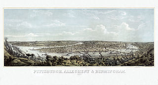
In 1763, King George III provided John Ormsby approximately 2,400 acres (9.7 km2) along the south bank of the Monongahela River as payment for his services during the French and Indian War. The land was then divided into four boroughs: South Pittsburgh, Birmingham, East Birmingham, and Ormsby. The four boroughs were annexed into the City of Pittsburgh in 1872. These areas, collectively, provided for the foundation of the South Side as it is known today.
South Side Slopes is a neighborhood in Pittsburgh, Pennsylvania's South Side area. The neighborhood comprises the hills from the South Side Flats neighborhood along the Monongahela River from the Liberty Bridge (west) to beyond Josephine Street (east).
The Whitehall Branch was a rail line owned and operated by the Pennsylvania Railroad in the U.S. state of Pennsylvania. The line ran from Monongahela Branch near the 30th Street yard to a connection with the Pittsburgh and Lake Erie Railroad and the Allegheny and South Side Railway at 21st Street Yard in the South Side of Pittsburgh. The line was abandoned by Conrail and has been removed.

The Oliver Iron and Steel Corporation was a manufacturer of iron and steel hardware including nuts, bolts, screws, and horseshoes in Pittsburgh, Pennsylvania, USA.
Fort Jones, with its companion, Fort Laughlin were Civil War redoubts, built by the employees of Jones and Laughlin Steel in June and July 1863 for the defense of Pittsburgh from a suspected invasion by Confederate troops. It is named for Benjamin Franklin Jones, a local businessman. Fort Jones occupied the top of a hill in Mount Oliver, Pennsylvania. It was totally destroyed in 1868, and became the site of St. Joseph's Church at 438 Ormsby Street, for which the site was originally purchased. The church is now closed. It was sometimes known as Fort Jackson, in honor of Brig. General Conrad Feger Jackson, killed in the Battle of Fredericksburg, Virginia, in December 1862. 40°24′45″N79°58′50″W
John Ormsby (1720–1805) was a soldier in the French and Indian War, Pontiac's Rebellion, and the American Revolution, and among the first settlers of Pittsburgh, Pennsylvania. The son of the Anglo-Irish landed gentry, he emigrated from Ireland to the Thirteen Colonies in 1752. After Pontiac's Rebellion, he received a land grant from King George III, and established a homestead on the banks of the Monongahela River. He established extensive economic and merchant interests in Bedford, Pennsylvania, and at the head of the Ohio River.

Pittsburgh, Pennsylvania was a thriving and important city during the American Civil War, and provided a significant source of personnel, war materiel, armament, ammunition, and supplies to the Union Army. Situated at the confluence of the Monongahela, Allegheny and Ohio rivers, Pittsburgh was an important transportation hub for both riverine and rail transport, as well as overland via its system of roads.
The Keeling Coal Company (1861-1878) was a 19th-century coal mining company in Allegheny County, Pennsylvania. Its mines were located in the Pittsburgh Coalfield of western Pennsylvania.

Birmingham was a borough in Allegheny County, Pennsylvania, on the South Side of what is now Pittsburgh. Incorporated in 1826 from St. Clair Township, the borough comprised a section of the South Side Flats between what is now South 6th and South 17th Streets.


