
Chester County is a county located in the U.S. state of South Carolina. As of the 2010 census, its population was 33,140. Its county seat is Chester.

Long County is a county located in the U.S. state of Georgia. The county seat is Ludowici. Long County is part of the Hinesvile-Fort Stewart Metropolitan Statistical Area. The constitutional amendment to create the county was proposed August 14, 1920, and ratified November 2, 1920.

Jeff Davis County is a county located in the U.S. state of Georgia. As of the 2010 census, the population was 15,068. The county seat is Hazlehurst. The county was created on August 18, 1905 and named for Jefferson Davis, the only Confederate president.

Candler County is a county located in the U.S. state of Georgia. As of the 2010 census, the population was 10,998. The county seat is Metter. The county was founded in 1914 and named for Allen D. Candler, the 56th governor of Georgia.

Crest is an unincorporated community in San Diego County, California. The Crest census-designated place (CDP) had a population of 2,593 at the 2010 census, down from 2,716 at the 2000 census.

Huxley is a city in Story County, Iowa, United States. The population was 3,317 at the 2010 census. It is part of the Ames, Iowa Metropolitan Statistical Area, which is a part of the larger Ames-Boone, Iowa Combined Statistical Area.

Sloan is a city in Woodbury County, Iowa, United States. It is part of the Sioux City, IA–NE–SD Metropolitan Statistical Area. The population was 973 at the 2010 census.
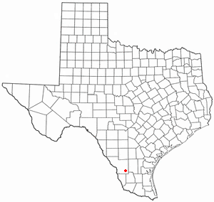
Oilton is a census-designated place (CDP) in Webb County, Texas, United States. The population was 152 at the 2010 census. The community is within the boundary of Webb Consolidated Independent School District and is home to the Oilton Elementary School.

Powellton is a census-designated place (CDP) in Fayette County, West Virginia, United States. The population was 619 at the 2010 census.

Mallory is a census-designated place (CDP) in Logan County, West Virginia, United States. The population was 1,654 at the 2010 census.

Piney View is a census-designated place (CDP) in Raleigh County, West Virginia, United States. The population was 989 at the 2010 census.
Lake Murray Country is a large area of South Carolina, United States; the region includes the counties of Newberry, Saluda, Lexington, and Richland.

Schuler is a hamlet in southern Alberta, Canada within Cypress County, located 4 kilometres (2.5 mi) east of Highway 41, approximately 40 kilometres (25 mi) northeast of Medicine Hat.
Navalcán is a municipality located in the province of Toledo, Castile-La Mancha, Spain. According to the 2006 census (INE), the municipality has a population of 2238 inhabitants.

A seagull intersection or continuous green T-intersection is a type of three-way road intersection, usually used on high traffic volume roads and dual carriageways. This form of intersection is popular in Australia and New Zealand, and sometimes used in the United States and other countries.

Monteagudo is a town and municipality located in the province of Navarre, Spain. According to the 2006 census (INE), the municipality has a population of 1,146 inhabitants.
Queenstown is a hamlet in southern Alberta, Canada within Vulcan County. It is located approximately 26 kilometres (16 mi) south of Highway 1 and 92 kilometres (57 mi) southeast of Calgary.
Kikino Metis Settlement is a Metis settlement in central Alberta, Canada within Smoky Lake County. It is located along Highway 36, approximately 128 km (80 mi) west of Cold Lake.

Klondike is an unincorporated community in Oconto County, Wisconsin, United States. The community is located at the intersection of Oconto County Highways ZZ, B, and Z, in the town of Brazeau, Wisconsin. It is located at latitude 45.068 and longitude -88.16 and elevation 791 feet.


