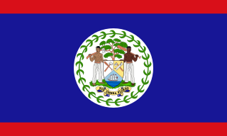
Belize is a Central American country on the north-eastern coast of Central America. It is bordered by Mexico to the north, the Caribbean Sea to the east, and Guatemala to the west and south. It also shares a water boundary with Honduras to the southeast. It has an area of 22,970 square kilometres (8,867 sq mi) and a population of 441,471 (2022). Its mainland is about 290 km (180 mi) long and 110 km (68 mi) wide. It is the least populated and least densely populated country in Central America. Its population growth rate of 1.87% per year is the second-highest in the region and one of the highest in the Western Hemisphere. Its capital is Belmopan, and its largest city is the namesake city of Belize City. Belize is often thought of as a Caribbean country in Central America because it has a history similar to that of English-speaking Caribbean nations. Indeed, Belize's institutions and official language reflect its history as a British colony.

The Belize Defence Force (BDF) is the military of Belize, and is responsible for protecting the sovereignty of the country. The BDF is under the Ministry of National Defence and Border Security, which is currently headed by Hon. Florencio Marin Jr.; the BDF itself is commanded by Brigadier General Azariel Loria. In 2012, the Belizean government spent about $17 million on the military, constituting 1.08% of the country's gross domestic product (GDP).

Placencia is a small village located in the Stann Creek District of Belize.

San Pedro is a town on the southern part of the island of Ambergris Caye in the Belize District of the nation of Belize, in Central America. According to the 2015 mid-year estimates, the town has a population of about 16,444. It is the second-largest town in the Belize District and largest in the Belize Rural South constituency. The once sleepy fishing village was granted the status of a town in 1984.

Ambergris Caye, is the largest island of Belize, located northeast of the country's mainland, in the Caribbean Sea. It is about 40 kilometres (25 mi) long from north to south, and about 1.6 kilometres (1 mi) wide. Where it has not been modified by humans, it is mostly a ring of white sand beach around mangrove swamp in the centre. Though administered as part of the Belize District, the closest point on the mainland is part of the Corozal District.

Caye Caulker is a small limestone coral island off the coast of Belize in the Caribbean Sea measuring about 5 miles (8.0 km) by less than 1 mile (1.6 km). The town on the island is known by the name Caye Caulker Village. The population of Caye Caulker is approximately 2,000 people today and still growing.
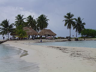
Goff's Caye is a small island off the shore of Belize City, Belize. It sits right on the edge of the Belize Barrier Reef with waters to the south and east being only 0.6 to 3 metres deep. Goff's Caye is registered as an archaeological site due to its Colonial era settlement. During the Colonial times, the island served as a fishing camp, trade center and cemetery. Among those interred in the cemetery are a number of crew members from HMS Blossom, who died of Yellow Fever during a visit to the colony in August 1830.
The Battle of St. George's Caye was a military engagement that lasted from 3 to 10 September 1798, off the coast of British Honduras. However, the name is typically reserved for the final battle that occurred on 10 September.
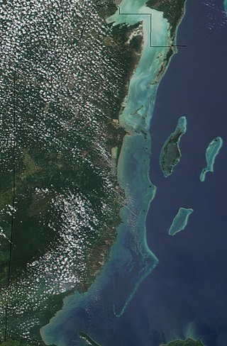
The Belize Barrier Reef is a series of coral reefs straddling the coast of Belize, roughly 300 metres (980 ft) offshore in the north and 40 kilometres (25 mi) in the south within the country limits. The Belize Barrier Reef is a 300-kilometre (190 mi) long section of the 900-kilometre (560 mi) Mesoamerican Barrier Reef System, which is continuous from Cancún on the north-eastern tip of the Yucatán Peninsula through the Riviera Maya and down to Honduras, making it the second largest coral reef system in the world after the Great Barrier Reef in Australia. It is Belize's top tourist destination, popular for scuba diving and snorkeling and attracting almost half of its 260,000 visitors. It is also vital to the country's fishing industry.
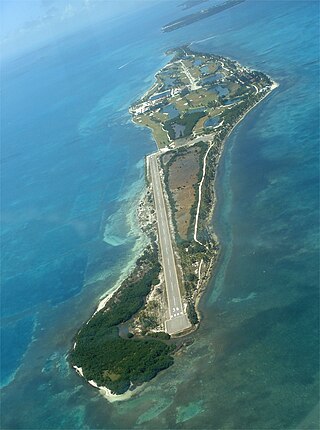
Caye Chapel is a small, private island in Belize, 16 miles (26 km) north-northeast of Belize City and 3 miles (4.8 km) south of Caye Caulker. It was once owned by Isaiah Emmanuel Morter, Belize's first African millionaire.
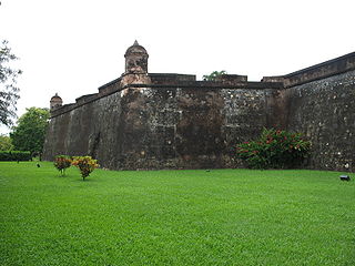
The Battle of San Fernando de Omoa was a short siege and battle between British and Spanish forces fought not long after Spain entered the American Revolutionary War on the American side. On the 16 October 1779, following a brief attempt at siege, a force of 150 British soldiers and seamen assaulted and captured the fortifications at San Fernando de Omoa in the Captaincy General of Guatemala on the Gulf of Honduras.

Hick's Cayes are a group of uninhabited Islands in the South of Chetumal Bay, between St. George's Caye and Caye Chapel, about halfway between Belize City and San Pedro Town.
Blackadore Caye is a small island in Belize, west of Ambergris Caye, in the Caribbean Sea, not far from the Belize Barrier Reef.
The Capture of Cayo Cocina was the result of a Spanish military operation on the 15 September 1779 against a British settlement on Saint George's Caye, just off the coast of present-day Belize, during the Anglo-Spanish War. The settlement was at the time the major British population center in the area, until Spanish forces from the Captaincy General of Guatemala attacked it.
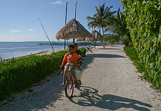
Hispanic and Latin American Belizeans are Belizeans of full or partial Hispanic and Latin American descent. Currently, they comprise around 52.9% of Belize's population.

British Army Training Support Unit Belize (BATSUB), the successor of the former British Forces Belize, is the name given to the current British Army Garrison in Belize. The garrison is used primarily for jungle warfare training, with access to over 5,000 square miles of jungle terrain, provided by the Government of Belize.
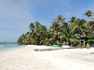
Ranguana Caye is a two-acre private island located roughly 20 miles west of Placencia. Those exploring the caye are required to set up transportation through private boat charters. The island includes a dock and moorings for visiting boats, located just off the Belize Barrier Reef. A day tour to the island is through Belize Ocean Club, a resort located in Maya Beach Village near Placencia and managed by Muy'Ono Properties. Snorkeling the Belize Barrier Reef and reef fishing are also some activities on the island.
Cayo Espanto is an island off the coast of Belize in the Caribbean Sea. It is one of the approximately 450 islands of the Belize Barrier Reef. Administratively it is part of the Belize District. It is private property.

Belize–Spain relations are the bilateral and diplomatic relations between these two countries. Belize has an embassy and honorary consulates in Madrid, Barcelona and Palma de Mallorca. Spain has a non-resident embassy for Belize in Guatemala, and an honorary consulate in Belize City.


