The Upper Derwent Valley is an area of the Peak District National Park in England. It largely lies in Derbyshire, but its north eastern area lies in Sheffield, South Yorkshire. Its most significant features are the Derwent Dams, Ladybower, Derwent and Howden, which form Ladybower Reservoir, Derwent Reservoir and Howden Reservoir respectively.

The Derwent is a river in Derbyshire, England. It is 50 miles (80 km) long and is a tributary of the River Trent, which it joins south of Derby. Throughout its course, the river mostly flows through the Peak District and its foothills.
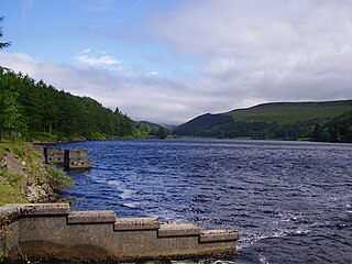
Derwent Reservoir is the middle of three reservoirs in the Upper Derwent Valley in the north of Derbyshire, England. It lies approximately 10 miles (16 km) from Glossop and 10 miles (16 km) from Sheffield. The River Derwent flows first through Howden Reservoir, then Derwent Reservoir and finally through Ladybower Reservoir. Between them they provide practically all of Derbyshire's water, as well as to a large part of South Yorkshire and as far afield as Nottingham and Leicester.

The Howden Reservoir is a Y-shaped reservoir, the uppermost of the three in the Upper Derwent Valley, England. The western half of the reservoir lies in Derbyshire and the eastern half is in Sheffield, South Yorkshire; the county border runs through the middle of the reservoir, following the original path of the River Derwent. The longest arm is around 1.25 miles (2 km) in length. The reservoir is bounded at the southern end by Howden Dam; below this, the Derwent flows immediately into Derwent Reservoir and subsequently the Ladybower Reservoir. Other tributaries include the River Westend, Howden Clough and Linch Clough.

Castleton is a village in the High Peak district of Derbyshire, England, at the western end of the Hope Valley on the Peakshole Water, a tributary of the River Noe, between the Dark Peak to the north and the White Peak to the south. The population was 642 at the 2011 Census.

Hope is a village and civil parish in the Derbyshire Peak District, in England. The population at the 2011 Census was 864. It lies in the Hope Valley, at the point where Peakshole Water flows into the River Noe. To the north, Win Hill and Lose Hill stand either side of the Noe.

Hathersage is a village and civil parish in the Peak District in Derbyshire, England. It lies slightly to the north of the River Derwent, approximately 10 miles (16.1 km) south-west of Sheffield.

St Dunstan's, Stepney, is an Anglican Church which stands on a site that has been used for Christian worship for over a thousand years. It is located in Stepney High Street, in Stepney, London Borough of Tower Hamlets.

Bamford is a village in the Peak District, Derbyshire, England, close to the River Derwent. To the north-east is Bamford Edge, and to the north-west the Ladybower, Derwent and Howden Reservoirs. At the 2011 census, it had a population of 1,241.

The Hope Valley is a rural area centred on the village of Hope, Derbyshire, in the Peak District in the northern Midlands of England.

Bamford railway station serves the village of Bamford in the Derbyshire Peak District, in England and is managed by Northern Trains. It is located 13 miles (21 km) west of Sheffield on the Hope Valley Line.

Derwent was a village 'drowned' in 1944 when the Ladybower Reservoir in Derbyshire, England was created. The village of Ashopton, Derwent Woodlands church and Derwent Hall were also 'drowned' in the construction of the reservoir.

All Saints' Church, Bakewell, is the parish church of Bakewell, Derbyshire. It is a Grade I listed building.

The A6187 is a secondary route in the Peak District, Derbyshire and South Yorkshire, England. It starts in Castleton, runs in an easterly direction past Fox House Inn where it joins the A625 road. It is 13.6 miles long.

The Priory Church of St Mary, Abergavenny is a parish church in the centre of Abergavenny in Monmouthshire, Wales.

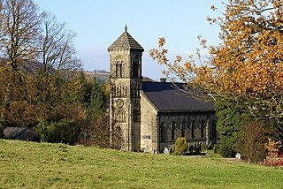
St. Anne’s Church, Baslow, is a Grade II* listed parish church in Baslow, England.
St Mary the Virgin's Church, South Darley is a Grade II listed parish church in the Church of England in South Darley, Derbyshire. At the entrance to the churchyard is a memorial to the men from the parish who died in the two world wars.

St Edmund's Church, Castleton, is a Grade II* listed parish church in the Church of England in Castleton, Derbyshire.

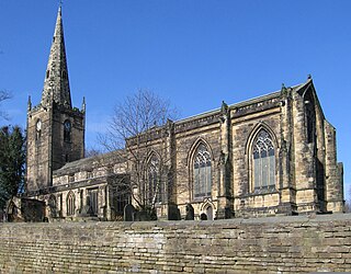
St Michael and All Angels’ Church, Hathersage is a Grade I listed parish church in the Church of England in Hathersage, Derbyshire.
St John the Baptist’s Church, Dronfield is a Grade I listed parish church in the Church of England in Dronfield, Derbyshire.

