
Walton is a village and civil parish in the City of Wakefield in the county of West Yorkshire, England, 3.5 miles south-east of Wakefield. At the time of the 2011 Census, the parish had a population of 3,231. At the time of the 2011 Census the parish was part of the City of Wakefield's ward of Crofton, Ryhill and Walton. The population of this ward at the Census was 15,144.
Coalville is an industrial town in the district of North West Leicestershire, Leicestershire in the East Midlands of England, with a population at the 2011 census of 34,575. It lies on the A511 trunk road between Leicester and Burton upon Trent, close to junction 22 of the M1 motorway where the A511 meets the A50 between Ashby-de-la-Zouch and Leicester. It borders the upland area of Charnwood Forest to the east of the town.

Monk Bretton is a village in the Metropolitan Borough of Barnsley in South Yorkshire, England. It lies approximately two miles north-east from Barnsley town centre.

Blidworth is a village and civil parish approximately five miles east of Mansfield, Nottinghamshire, England. The population of the civil parish at the 2011 census was 4,457. Its history can be traced back to the 10th century, although many of the current houses were built in the first half of the 20th century to provide housing for workers at Blidworth Colliery (1926–1989). These are mainly in estates north of Dale Lane, known as New Blidworth. The area around Main Street, west of Beck Lane and including the church, is Old Blidworth, containing some of the oldest buildings. Blidworth Bottoms is a hamlet about 0.5 km south of Old Blidworth.

Pendlebury is a town in the City of Salford, Greater Manchester, England. The population at the 2011 Census was 13,069. It lies 4.1 miles (6.6 km) northwest of Manchester city centre, 3.4 miles (5.5 km) northwest of Salford, and 5.9 miles (9.5 km) southeast of Bolton.

Gresford is a village and community in Wrexham County Borough, Wales.

Allerton Bywater is a semi-rural village and civil parish in the south-east of the City of Leeds metropolitan borough in West Yorkshire, England. The population of the civil parish as of the 2011 census was 4,717. The village itself is 2 miles (3.2 km) north of Castleford, with neighbouring villages Kippax and Great Preston all providing local amenities. St Aidan's Nature reserve borders the village attracting many visitors with its beauty and charm. Additionally "The Lines Way" bridle path which runs from Garforth through to Allerton following the old train track provides a pleasant route for walkers, joggers and cyclists alike. The River Aire flows through the village to the south-west.

Golborne is a town within the Metropolitan Borough of Wigan, in Greater Manchester, England. It lies 5.4 miles (8.7 km) south-southeast of Wigan, 6.1 miles (9.8 km) northeast of Warrington and 13.8 miles (22.2 km) to the west of the city of Manchester. Combined with the village of Lowton, it has a population of 24,041.
Tyldesley is a town in the Metropolitan Borough of Wigan in Greater Manchester, England. Within the boundaries of the historic county of Lancashire, it is north of Chat Moss near the foothills of the West Pennine Moors, 7.7 miles (12.4 km) southeast of Wigan and 8.9 miles (14.3 km) northwest of Manchester. At the United Kingdom Census 2001, the Tyldesley built-up area, excluding Shakerley, had a population of 16,142.

Aylesham is a village and civil parish in the Dover district of Kent, England. The village is located around 6.5 miles (10.5 km) southeast of the cathedral city of Canterbury, and around 8.5 miles (13.7 km) northwest of the town and port of Dover. According to the 2001 Census, the parish had a population including Drellingore and Snowdown of 3,884, increasing to 3,999 at the 2011 Census.

Pelsall is a large village in the Metropolitan Borough of Walsall, West Midlands, England. Forming part of the borough's border with Staffordshire, Pelsall is located 4 miles north of central Walsall, midway between the towns of Bloxwich and Brownhills and 3.5 miles northwest of Aldridge. The southern edge of Cannock Chase is 5.5 miles to the north. Pelsall is also 7.5 miles southwest of the cathedral city of Lichfield and 8 miles northeast of Wolverhampton.

Hamstead is an area straddling the border of Birmingham and Sandwell, England, between Handsworth Wood and Great Barr, and adjacent to the Sandwell Valley area of West Bromwich. Hamstead Colliery was worked from the 19th century to the 1960s, with much housing built for the miners. Today the area is still referred to as Hamstead Village.

Hanwood is a large village in Shropshire, England.

Norton Canes is an industrial village, civil parish and ward of Cannock Chase District, in Staffordshire, England.
Colwich is a civil parish and village in Staffordshire, England. It is situated off the A51 road, about 3 miles (5 km) north west of Rugeley, and 7 miles (11 km) south east of Stafford. It lies principally on the north east bank of the River Trent near Wolseley Bridge, just north of The Chase. The parish comprises about 2,862 hectares (28.62 km2) of land in the villages and hamlets of Colwich, Great Haywood, Little Haywood, Moreton, Bishton, and Wolseley Bridge.

The Church of St Mary, Ecclesfield, is situated on Church Street in the village of Ecclesfield, now a northern suburb of Sheffield, South Yorkshire, England. It is situated 4.3 miles (7 km) north of the city centre. It is a Grade One listed building, one of only five within the Sheffield city boundary. It was originally the parish church for Hallamshire, one of the largest parishes in England and in the seventeenth century was known as the “Minster of the Moors” due to its then rural situation.

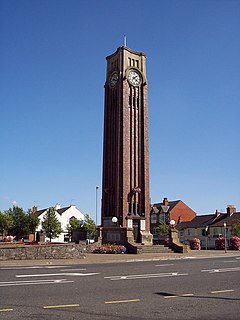
Six Bells Colliery was a colliery located in Six Bells, Abertillery, Gwent, Wales. On 28 June 1960 it was the site of an underground explosion which killed 45 of the 48 miners working in that part of the mine. It is now the site of the artistically acclaimed Guardian memorial to those events, designed by Sebastian Boyesen; although the memorial primarily commemorates those who died at Six Bells, it is dedicated to all mining communities wherever they may be.

St Mary's Priory Church, in Whitecross Street, Monmouth, Monmouthshire, Wales, is an Anglican church founded as a Benedictine priory in 1075. The current church dates mostly from the 18th and 19th centuries. It was designated a Grade II* listed building in 1952. It is one of 24 buildings on the Monmouth Heritage Trail.
Boaz Bloomer JP was a prominent industrialist from Holly Hall in Dudley, Worcestershire, England, who lived between 1801 and 1874. He owned and operated the Pelsall Ironworks, among other ventures, during the 19th Century. He died in Kensington, Middlesex.
The Walsall Silver Thread Tapestries are a set of eleven artworks, in the form of tapestries, designed by the artist Hunt Emerson in conjunction with the various communities of Walsall, England and hand stitched by local people there during 2016. They depict the people, places, history and wildlife of the towns and districts that, since 1974, have formed the Metropolitan Borough of Walsall.

