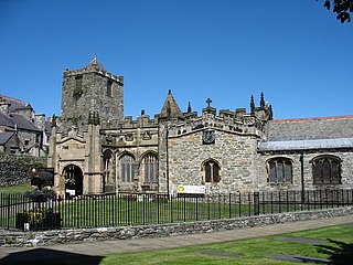
Holyhead is the largest town and a community in the county of Isle of Anglesey, Wales, with a population of 13,659 at the 2011 census. Holyhead is on Holy Island, bounded by the Irish Sea to the north, and is separated from Anglesey island by the narrow Cymyran Strait and was originally connected to Anglesey via the Four Mile Bridge.

Holy Island is an island on the western side of the larger Isle of Anglesey, Wales, from which it is separated by the Cymyran Strait. It is called "Holy" because of the high concentration of standing stones, burial chambers, and other religious sites on the small island. The alternative English name of the island is Holyhead Island. According to the 2011 UK Census, the population was 13,659, of whom 11,431 (84%) lived in the largest town, Holyhead.
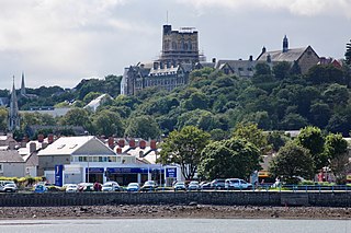
Bangor is a cathedral city and community in Gwynedd, North Wales. It is the oldest city in Wales. Historically part of Caernarfonshire, it had a population of 15,100 at the 2021 census. Landmarks include Bangor Cathedral, Bangor University and Garth Pier. The Britannia and Menai Suspension bridges connect the city to the Isle of Anglesey.

North Wales is a region of Wales, encompassing its northernmost areas. It borders mid Wales to the south, England to the east, and the Irish Sea to the north and west. The area is highly mountainous and rural, with Snowdonia National Park and the Clwydian Range and Dee Valley, known for its mountains, waterfalls and trails, wholly within the region. Its population is concentrated in the north-east and northern coastal areas, with significant Welsh-speaking populations in its western and rural areas. North Wales is imprecisely defined, lacking any exact definition or administrative structure. It is commonly defined administratively as its six most northern principal areas, but other definitions exist, with Montgomeryshire historically considered to be part of the region.

Cledwyn Hughes, Baron Cledwyn of Penrhos, was a Welsh Labour Party politician, usually associated with the moderate wing of the party. He was also regarded, particularly in later years, as a non-political figure of stature in Wales having held posts of importance in bodies such as the University of Wales.

The North Wales Main Line, also known as the North Wales Coast Line, is a major railway line in the north of Wales and Cheshire, England, running from Crewe on the West Coast Main Line to Holyhead on the Isle of Anglesey. The line has 19 stations, with all except two, Chester and Crewe, being in Wales.

Bangor railway station serves the city of Bangor, Gwynedd; it is operated by Transport for Wales. The station, which is 24+3⁄4 miles (40 km) east of Holyhead, is the last mainland station on the North Wales Coast line between Crewe and Holyhead. It is the busiest in terms of passenger numbers in North Wales, as it serves the community around Caernarfon and further west. It is close to the Snowdonia National Park and Bangor University, and has an interchange with bus services to the various towns and villages of north-west Gwynedd and Anglesey.

Rhosneigr is a village in the south-west of Anglesey, north Wales. It is situated on the A4080 road. It is south-east of Holyhead, and is on the Anglesey Coastal Path. From the clock at the centre of the village can be seen RAF Valley and Mynydd Twr. The towns of Holyhead and Llangefni and the city of Bangor are all within easy travelling distance.
Salt Island is joined to Holy Island, Anglesey, in North Wales. It is a natural provider of shelter for the town's Old Harbour from the Irish Sea and is part of the Port of Holyhead.

The Isle of Anglesey County Council is the local authority for the Isle of Anglesey, a principal area with county status in Wales. Since 2022 the council has 35 councillors who represent 11 multi-member electoral wards.

Cardiff Royal Infirmary is a hospital in central Cardiff, Wales. It is managed by the Cardiff and Vale University Health Board.

Anglesey Airport is an airport owned by the Isle of Anglesey County Council on land leased from the Defence Infrastructure Organisation. The airport is situated at Llanfair-yn-Neubwll in Anglesey, Wales. The leased site is part of RAF Valley.

The Isle of Anglesey is a county off the north-west coast of Wales. It is named after the island of Anglesey, which makes up 94% of its area, but also includes Holy Island and some islets and skerries. The county borders Gwynedd across the Menai Strait to the southeast, and is otherwise surrounded by the Irish Sea. Holyhead is the largest town, and the administrative centre is Llangefni. The county is part of the preserved county of Gwynedd.

SS Anglia was a steam ship requisitioned for use as a hospital ship during the First World War. On 17 November 1915 she hit a mine laid by the German U-boat, UC-5.

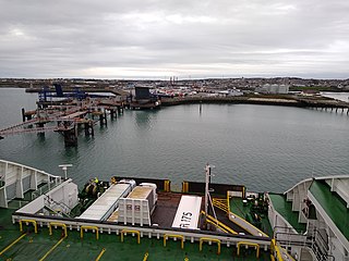
The Port of Holyhead is a commercial and ferry port in Anglesey, United Kingdom, handling more than 2 million passengers each year. It covers an area of 240 hectares, and is operated by Stena Line Ports Ltd. The port is the principal link for crossings from north Wales and central and northern England to Ireland. The port is partly on Holy Island and partly on Salt Island. It is made up of the Inner Harbour, the Outer Harbour and the New Harbour, all sheltered by the Holyhead Breakwater which, at 2.7 kilometres, is the longest in the UK.

Penrhos was a large estate on Holy Island, Anglesey, in north-west Wales.

Betsi Cadwaladr University Health Board (BCUHB) is the local health board of NHS Wales for the north of Wales. It is the largest health organisation in Wales, providing a full range of primary, community, mental health, and acute hospital services for a population of around 694,000 people across the six principal areas of north Wales as well as some parts of Mid Wales, Cheshire and Shropshire. Betsi Cadwaladr University Health Board is the operational name of Betsi Cadwaladr Local Health Board.

Virginia Ann Crosbie is a British Conservative Party politician who has been the Member of Parliament (MP) for Ynys Môn since the 2019 general election. Prior to her political career, she worked as a director at UBS and HSBC before retraining as a mathematics teacher.

Cefni Hospital is a health facility in Llangefni, Anglesey, Wales. It is managed by the Betsi Cadwaladr University Health Board.

Ysbyty Penrhos Stanley is a health facility in Holyhead, Anglesey, Wales. It is managed by the Betsi Cadwaladr University Health Board.

