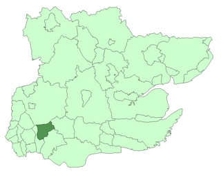
Stansted was a rural district in Essex, England from 1894 to 1934.
Rural districts were a type of local government area – now superseded – established at the end of the 19th century in England, Wales, and Ireland for the administration of predominantly rural areas at a level lower than that of the administrative counties.

Essex is a county in the south-east of England, north-east of London. One of the home counties, it borders Suffolk and Cambridgeshire to the north, Hertfordshire to the west, Kent across the estuary of the River Thames to the south, and London to the south-west. The county town is Chelmsford, the only city in the county. For government statistical purposes Essex is placed in the East of England region.

England is a country that is part of the United Kingdom. It shares land borders with Wales to the west and Scotland to the north-northwest. The Irish Sea lies west of England and the Celtic Sea lies to the southwest. England is separated from continental Europe by the North Sea to the east and the English Channel to the south. The country covers five-eighths of the island of Great Britain, which lies in the North Atlantic, and includes over 100 smaller islands, such as the Isles of Scilly and the Isle of Wight.
It was created under the Local Government Act 1894 from the part of the Bishop's Stortford rural sanitary district which was in Essex (the rest becoming Bishop's Stortford Rural District in Hertfordshire).

The Local Government Act 1894 was an Act of the Parliament of the United Kingdom that reformed local government in England and Wales outside the County of London. The Act followed the reforms carried out at county level under the Local Government Act 1888. The 1894 legislation introduced elected councils at district and parish level.

Bishop's Stortford is a historic English market town and civil parish in Hertfordshire, just west of the M11 motorway on the county boundary with Essex. It is the closest sizeable town to London Stansted Airport, 27 miles (43 km) north-east of Charing Cross in central London, and 35 miles (56 km) by rail from Liverpool Street station, the London terminus of the line to Cambridge that runs through the town. Bishop's Stortford had a population of 38,202 in 2001, easing to 37,838 at the 2011 Census.

Hertfordshire is one of the home counties in England. It is bordered by Bedfordshire to the north, Cambridgeshire to the north-east, Essex to the east, Buckinghamshire to the west and Greater London to the south. For government statistical purposes, it is placed in the East of England region.
It consisted of the following parishes
- Berden
- Birchanger
- Elsenham
- Farnham
- Great Hallingbury
- Henham
- Little Hallingbury
- Manuden
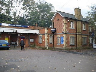
- Stansted Mountfichiet
- Ugley
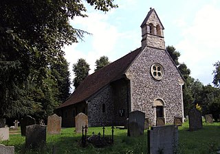
Birchanger is a village, civil parish and electoral ward in Essex, England. It is located 3 km (1.9 mi) northeast from Bishop's Stortford, Hertfordshire and is 25 km (16 mi) northwest from the county town of Chelmsford. The village is in the district of Uttlesford and in the parliamentary constituency of Saffron Walden. There is a Parish Council.

Elsenham is a village and civil parish in north west Essex in southern England. Its neighbouring towns include Bishop's Stortford, Saffron Walden, and Stansted Mountfitchet.
The district was wound up in 1934 under a County Review Order. The Hallingburys became part of Dunmow Rural District with the rest of the district joining Saffron Walden Rural District. Since 1974 it has formed part of the district of Uttlesford.
The Local Government Act 1929 was an Act of the Parliament of the United Kingdom that made changes to the Poor Law and local government in England and Wales.
Saffron Walden Rural District was a rural district in the county of Essex, England. It was created in 1894 and later enlarged by the addition of the parishes of Berden, Birchanger, Elsenham, Farnham, Henham-on-the-Hill, Manuden, Stansted Mountfitchet and Ugley from the disbanded Stansted Rural District. It was named after and administered from Saffron Walden.

Uttlesford is a local government district in Essex, England. Its council is based in the market town of Saffron Walden. At the 2011 Census, the population of the district was 79,443.